Maps of Hol
Odda
1 : 250000 Army map service
Statistikk 43-7-2: Bosettingskart over Odda. Blad 7
1 : 250000 Statistisk Sentralbyrå
Statistikk 43-7- Bosettingskart over Odda. Blad 7
1 : 250000 Statistisk Sentralbyrå
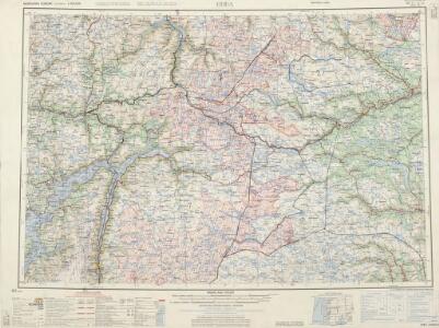
Hardangervidda

Statistikk 40-2: Oversiktskart over Hardangeviddas beiteforhold
Kartblad 136: Situations-Cart over det Nordre Hardangerske Compagnie District
Lauritz Brix Grøn
Hardangervidda
1 : 200000
Hardangervidda
1 : 200000
Statistikk 40- Oversiktskart over Hardangeviddas beiteforhold

C34 nø/4
1 : 100000 Hjalmar Skaar
Geologisk kart 111b: Hardangervidda - Flacheliefs
1 : 200000 P. U. Thomsen | K. Schipull Hamburger Geographische Studien
Spesielle kart 123-2: Kart over Drammensvassdraget
1 : 100000 Toralf à ̃yen
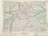
Kartblad 63 vest: Det yttere Hallingdahlske Infanterie Compagnie District

Museumskart 82: Hardangerfjorden
1 : 100000
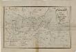
Kroki over en del av Haringvidda
1 : 100000 Finn Qvale
Portefølje nr 29
1 : 100000 W. Næser
Portefølje nr 29
1 : 100000 W. Næser
C33-4; C33-5; C34-10; C34-11
1 : 100000 Johannes Oliver Smith
Spesielle kart 14: Kart over Fjeldovergangen for en Jernbanelinie mellem Vos og Hallingdal
1 : 100000
Portefølje nr 28
1 : 100000 F. Sejersted | E. Lund
Geologisk kart 111a: Hardangervidda - Höhenschichten
1 : 200000 K. Schipull | P. U. Thomsen Hamburger Geographische Studien
Kart over Ulvikfjellene m. m.
1 : 100000 H. K. Hertzberg | Finn Qvale
Portefølje nr 36
1 : 100000 H. Lund
Kart over terrænget Hallingskarvet og Hardangerjøkelen m m
1 : 100000 Finn Qvale
Museumskart 217-42: Specialkart over Hardangerfjorden. Østre del.
1 : 100000 M. T. Kingo | R. M. Petersen | H. N. Bergh Den Geografiske Opmaaling
17D 6; 17D 7; 17D 10; 17D 11
1 : 100000 Carl Christophersen
Portefølje nr 37
1 : 100000 Shie
Kartblad 132-2: Situation af det Urlandske Compagnie District; versjon 2
Leitzner
Portefølje nr 37
1 : 100000 Shie