Maps of Karasjok

W6 Karasjok
1 : 100000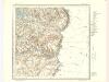
W6 Karasjok
1 : 100000
W6 Karasjok
1 : 100000
W6
1 : 100000 Sigurd Sandvik
W6 Karasjok
1 : 100000
W6 og W5 søndre del
1 : 100000 Bjarne Gjølme | Trygve Frivold Graff-Wang | David Ebbesen | Carl Ludvig Soelberg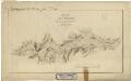
Finmarkens amt 54f(5): Kart over Keldvigs og Kistrands Sogn
1 : 200000 Fredrik Rode, Gerhard Munthe
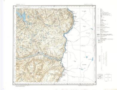
2033-1 Karasjok
1 : 50000 Norges Geografiske Oppmåling
2033-1 Karasjok
1 : 50000 Statens kartverk
2033-1 Kárášjohka
1 : 50000 Statens kartverk
2033-1 Kárášjohka
1 : 50000 Statens kartverk
2034-2 Iddjajav'ri
1 : 50000 Statens kartverk
2034-2 Iddjajav'ri
1 : 50000 Norges Geografiske Oppmåling
2034-2 Idjajávri
1 : 50000 Statens kartverk
2034-2 Idjajávri
1 : 50000 Statens kartverk
2034-2 Nattvatnet
1 : 50000 Norges Geografiske Oppmåling
Spesielle kart 172b-11: Kart over riksgrensen mellom Norge og Finland på grunnlag av luftfotografier
1 : 20000 Gleditsch | Arvo Manner | K. Vaala | Kristian Nissen
Spesielle kart 172b-9: Kart over riksgrensen mellom Norge og Finland på grunnlag av luftfotografier
1 : 20000 Gleditsch | Kristian Nissen | K. Vaala | Arvo Manner
Spesielle kart 172b-10: Kart over riksgrensen mellom Norge og Finland på grunnlag av luftfotografier
1 : 20000 Kristian Nissen | K. Vaala | Arvo Manner | Gleditsch
Spesielle kart 171-foto7: Flyfoto Riksgrensen Norge-Finland i Tanavassdraget, blad 7
1 : 15000
Finmarkens amt nr 55: Croquis over Karasjok
1 : 100000 Andr. Solem
W6 Karasjok
1 : 100000
W6 Karasjok
1 : 100000
W6 vestre del
1 : 100000 Trygve Frivold Graff-Wang
V6 nordøstre del; og V5
1 : 100000 Thorleif Barlag
2033-1 Karasjok
1 : 50000 Norges Geografiske Oppmåling
2134-3 Valjok
1 : 50000 Norges Geografiske Oppmåling
2134-3 Valljåkka
1 : 50000 Statens kartverk
2134-3 Váljohka
1 : 50000 Statens kartverk