Maps of Mo i Rana

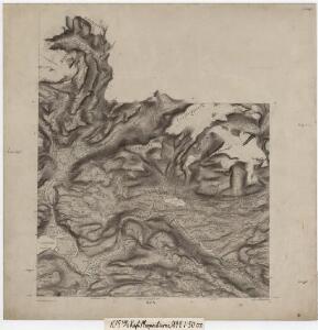
K15 sørvester del
1 : 50000 Vilhelm Herman Ludvig von Munthe af Morgenstierne
K15 nordvestre del
1 : 50000 Vilhelm Herman Ludvig von Munthe af Morgenstierne | Christofer M. N. Havig | Olav Herman Paulsen
2027-4 Nevernes
1 : 50000 Norges Geografiske Oppmåling
2027-4 Storforshei
1 : 50000 Statens kartverk
2027-4 Storforshei
1 : 50000 Norges Geografiske Oppmåling
2027-4 Storforshei
1 : 50000 Statens kartverk
2027-4 Storforshei
1 : 50000 Statens kartverk
K15 Dunderlandsdalen
1 : 100000 Ole Engh | Ole Tolstad
Geologisk kart 57: Geologisk Generalkart; K15, Dunderlandsdalen
1 : 100000 O. Tolstad | John Oxaal | Marstrander | Michelsen Norges geologiske undersøkelse
K15 Dunderlandsdalen
1 : 100000 Ole Engh | Ole Tolstad
K15 Dunderlandsdalen
1 : 100000
K15 Dunderlandsdalen
1 : 100000 Ole Tolstad | Ole Engh
K15 Dunderlandsdalen
1 : 100000 Ole Engh | Ole Tolstad
K15 Dunderlandsdalen
1 : 100000 Ole Engh | Ole Tolstad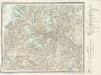
K15 Dunderlandsdalen
1 : 100000
K15 Dunderlandsdalen
1 : 100000 Ole Tolstad | Ole Engh
K15 Dunderlandsdalen
1 : 100000 Ole Engh | Ole Tolstad
K15 Dunderlandsdalen
1 : 100000 Ole Tolstad | Ole Engh
2028-3 Blakkådal
1 : 50000 Norges Geografiske Oppmåling
2028-3 Blakkådal
1 : 50000 Statens kartverk
2028-3 Blakkådalen
1 : 50000 Statens kartverk
2028-3 Blakkådal
1 : 50000 Statens kartverk
2028-3 Blakkådal
1 : 50000 Norges Geografiske Oppmåling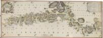
NRA GA 15
Mackuer | Marelius | Holm | Wetterstedt | Thodal | Krogh
Rana
1 : 250000 Bernh. Tolstad | O. Engh
J15 Svartisen
1 : 100000
K16 Umbugten
1 : 100000 Ellef Nilsen | Ole Tolstad
K16 Umbugten
1 : 100000 Ole Engh | Ole Tolstad
J15 Svartisen
1 : 100000 Torgrim Lundtvedt | Ole Engh