Maps of Vågan

J10 sørøstre del
1 : 50000 Carl Oscar Munthe
1131-3 Stamsund
1 : 50000 Statens kartverk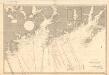
Museumskart 187: Den norske kyst fra Ure til Brettesnes
1 : 50000 M. Skollerud
J10 Vestvaagø
1 : 100000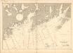
Museumskart 188: Den norske kyst fra Ure til Brettesnes
1 : 50000 M. Skollerud
J10 Vestvågøy
1 : 100000
J10 Vestvaagø
1 : 100000 Johan Gulbrandsen Natrud | C. Pedersen
J10 Vestvaagø
1 : 100000 Johan Gulbrandsen Natrud | C. Pedersen
J10 Vestvaagø
1 : 100000 Johan Gulbrandsen Natrud | C. Pedersen
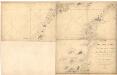
Museumskart 217-47: Fiskekart over den indre del af Vestfjorden i Lofoten
1 : 100000 M. Lyng Den Geografiske Opmaaling
J10 Vestvågøy
1 : 100000
J10 Vestvågøy
1 : 100000
J10 Vestvågøy
1 : 100000
1131-3 Stamsund
1 : 50000 Statens kartverk
1131-3 Stamsund
1 : 50000 Statens kartverk
1131-3 Stamsund
1 : 50000 Norges Geografiske Oppmåling
J10 nordøstre del og J9 sørøstre del
1 : 50000 Carl Oscar Munthe | Carl Olsen | Carl Peter Bruun
1031-2 Leknes
1 : 50000 Statens kartverk
1031-2 Leknes
1 : 50000 Statens kartverk
K10 vestre del
1 : 50000 Hilmar Krogh Borchgrevink
1031-2 Flakstad
1 : 50000 Norges Geografiske Oppmåling
1031-2 Leknes
1 : 50000 Statens kartverk
1031-2 Leknes
1 : 50000 Statens kartverk
Lofoten
1 : 250000 Bernh. Tolstad | O. Engh
Lofoten
1 : 250000 Bernh. Tolstad | O. Engh
Geologiske kart 121-R: Kart med magnetisk totalfelt. Svolvær
1 : 250000 Norges geologiske undersøkelse
Statistikk 43-23-2: Bosettingskart over Svolvær. Blad 23
1 : 250000 Statistisk Sentralbyrå
Lofoten
1 : 250000 Bernh. Tolstad | O. Engh
Lofoten
1 : 250000 Bernh. Tolstad | O. Engh