Maps of Lillehammer

G31-1; G31-2; G31-3; G31-4; G31-8; G31-9; G31-10
1 : 50000 Erling Bjørstad
Kartblad 5 Vey-Cart over det Nordre Hedemarkiske Capt. Von Weyhes Compagnie District
Johan Henrik Ramm
31B 4; 31B 8
1 : 100000 Ramm
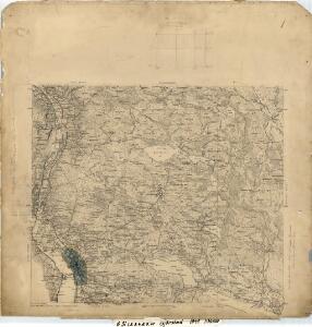
1817-2 Lillehammer
1 : 50000 Statens kartverk
1817-2 Lillehammer
1 : 50000 Norges Geografiske Oppmåling
Spesielle kart 182: Vannressurskart Lillehammer
1 : 50000 Tidemann Klemetsrud | Amund Gaut
1817-2 Lillehammer
1 : 50000 Statens kartverk
1817-2 Lillehammer
1 : 50000 Norges Geografiske Oppmåling
1817-2 Lillehammer
1 : 50000 Norges Geografiske Oppmåling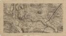
25D 11; 25D 12
1 : 50000
31B 4
1 : 50000 Johan Lauritz Bull
25D 12
1 : 50000 Hans Christian Smith Due
31B 3
1 : 50000 Johan Lauritz Bull
25D 11
1 : 50000 Øvergaard | Hans Christian Smith Due | Johan Ferdinand Normann
25D 11
1 : 50000
Fra Langset til Isakstua
1 : 20000 J. H. Reichborn
Fra Einsby til Gillebu
1 : 20000 J. H. Reichborn
Kartblad nr 4: Kaart over Postveien fra Korsødegaarden til Trondhjem igjennom Gulbrandsdalen over Dovrefjeld
1 : 20000 J. H. Reichborn
25D 12
1 : 50000 Hans Christian Smith Due
G31-8; G31-9
1 : 50000 Erling Bjørstad
Fra Røyne til Gausa
J. H. Reichborn
Kartblad 5: Kart over Veien fra Eidsvold til Gausdal og til Skydsstationen Holmen i Øyer
J. H. Reichborn
26C 9
1 : 50000 Johan Ferdinand Normann
Lillehammer
1 : 50000 Søren Christian Gjessing
Kart over de Mærkesatte Slaatter i Øiers Statsalmenning
1 : 10000 Fr. Matzow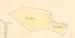
Kart over de Mærkesatte Slaatter i Øiers Statsalmenning
1 : 10000 Fr. Matzow
Kart over de Mærkesatte Slaatter i Øiers Statsalmenning
1 : 10000 Fr. Matzow
1817-2 Lillehammer
1 : 50000 Statens kartverk
1817-2 Lillehammer
1 : 50000 Statens kartverk