Maps of Modum

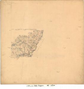
F34-6 e, F34-6 f
1 : 25000 Carl Gustav Fleischer
19B 5
1 : 50000 Rynning
F34-6c
1 : 25000 Johan Gulbrandsen Natrud
F34-5, F34-6
1 : 50000 Nicolay Caspary Ræder | Hans Knagenhjelm Hertzberg | Toralf Øyen | Johan Gulbrandsen Natrud | Erling Bjørstad | Marius Widerøe | Even Olsen Daarstad | Thorleif Barlag | David Ebbesen | Carl Gustav Fleischer
Ekserserplasskart; Helgelandsmoen og Hvalsmoen med omgivelser
1 : 50000 E. Daarstad | B. Tolstad
Ekserserplasskart; Helgelandsmoen og Hvalsmoen med omgivelser
1 : 50000 E. Daarstad | B. Tolstad
1815-3 Hønefoss
1 : 50000 Statens kartverk
1815-3 Hønefoss
1 : 50000 Statens kartverk
1815-3 Hønefoss
1 : 50000 Norges Geografiske Oppmåling
1815-3 Hønefoss
1 : 50000 Statens kartverk
Ekserserplasskart; Umgebungskarte von Helgelandsmoen og Hvalsmoen
1 : 50000
19B 1
1 : 50000 Carl Aksel Sigurd Sissener
F34-6
1 : 50000 Thorleif Barlag | Toralf Øyen
19B 2
1 : 50000 Kaare Kvisgaard | Oscar Thue | Hjalmar Skaar
19B 2; 19B 6
1 : 50000 Kaare Kvisgaard
1815-3 Hønefoss
1 : 50000 Norges Geografiske Oppmåling
F34-4
1 : 50000 Einar Fredrik Hafslund
F34 aust Tyristrand
1 : 100000
F34 aust Tyristrand
1 : 100000
G34-7
1 : 50000 Toralf Øyen
1815-3 Hønefoss
1 : 50000 Statens kartverk
1815-3 Hønefoss
1 : 50000 Statens kartverk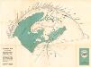
Panokart over Kongens utsikt
1 : 25000 Carl Martin Vendelboe
19B Hønefoss
1 : 100000 H. N. Bergh | Johan Nordhagen
19B Hønefoss
1 : 100000
19B Hønefoss
1 : 100000 C. Pedersen | H. N. Bergh
19B Hønefoss
1 : 100000 H. N. Bergh
Geologiske kart 60: Norges Geologiske Undersøkelse, Hønefoss
1 : 100000 H. N. Bergh | W. C. Brøgger | J. Schetelig | Johan Nordhagen Norges geologiske undersøkelse
19B Hønefoss
1 : 100000