Maps of Nord-Aurdal

F31-1, F31-2
1 : 50000 Gunvald Hagene | Thorolv Ingar Ween
1717-3 Fullsenn
1 : 50000 Norges Geografiske Oppmåling
Geologisk kart 75: Nordre Etnedal
1 : 100000 Trygve Strand Norges geologiske undersøkelse
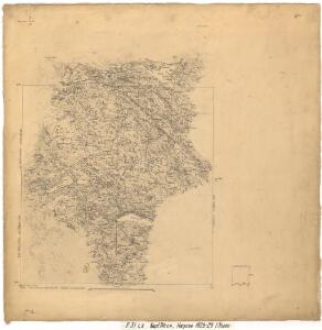
F31 vest Nordre Etnedal
1 : 100000
F31-2
1 : 50000 Adler Gleditsch
1717-3 Fullsenn
1 : 50000 Statens kartverk
1717-3 Fullsenn
1 : 50000 Norges Geografiske Oppmåling
1717-3 Fullsenn
1 : 50000 Statens kartverk
1717-3 Fullsenn
1 : 50000 Statens kartverk
25C 7; 25C 11
1 : 100000 Lund
25C 6; 25C 9; 25C 10; 31A 1; 31A 2
1 : 100000 Lund
F31-3
1 : 50000 Axel P. Printz
Skrutvold anneks til Nordre Aurdal Pgd
1 : 5000 A. T. Roll | J. Sejersted
F32-8
1 : 50000 Anders I. Elnæs
F31 vest Nordre Etnedal
1 : 100000
F31 vest Nordre Etnedal
1 : 100000
F31-1
1 : 50000 Hans Knagenhjelm Hertzberg
31A 2; 31A 3
1 : 50000 Albert Hansen | Kjeld Andreas Bugge
31A 1; 31A 2
1 : 50000 Thorleif Barlag | Even Olsen Daarstad
1717-2 Synnfjell
1 : 50000 Statens kartverk
E31-5, E31-6
1 : 50000 Thorolf Ingar Ween
F32-8
1 : 50000 Johannes Oliver Smith
1717-2 Synnfjell
1 : 50000 Norges Geografiske Oppmåling
1717-2 Synnfjell
1 : 50000 Statens kartverk
1717-2 Synnfjell
1 : 50000 Norges Geografiske Oppmåling
1717-2 Synnfjell
1 : 50000 Statens kartverk
Spesielle kart 123-3: Kart over Drammensvassdraget
1 : 100000 Toralf à ̃yen
Kartblad 68: Wey-Cart over det Yttre Valderske Compagnie District
Lauritz Nagel
Portefølje nr 46
1 : 100000 F. Akrell