Maps of Fyresdal

D37-4, D37-5
1 : 50000 Alf Hattestad | Gunvald Hagene
D37-4, D37-5
1 : 50000 Alf Hattestad | Gunvald Hagene
D37-4, D37-5
1 : 50000 Gunvald Hagene | Alf Hattestad
1513-3 Grøssæ
1 : 50000 Statens kartverk
1513-3 Grøssæ
1 : 50000 Statens kartverk
1513-3 Grøssæ
1 : 50000 Statens kartverk
1513-3 Grøssæ
1 : 50000 Norges Geografiske Oppmåling
D37 aust Fyresdal
1 : 100000
8C 2 8C 3 8C 6 8C 7
1 : 50000 Christoffer Fredrik von Lowzow
Kartblad 144: Chart over det 1ste Westfieldske Compagnie District
Petter Møller
5224-18 Moland
1 : 100000
D38-10, D38-11, D38-12
1 : 50000 Erik Christensen
7D 4 7D 8 8C 1 8C 5
1 : 50000 Birger Hielm
D37-5, D37-6
1 : 50000 Gunvald Hagene
D38-10, D38-11
1 : 50000 Olav Dahle | Logstein
D37-10, D37-11
1 : 50000 Roald Aanrud
D37-10, D37-11
1 : 50000 Alf Hattestad
7B 8 7B 12 8A 5 8A 9
1 : 50000 Johannes Falkenberg
D37-5, D37-6, D37-11, D37-12
1 : 50000 Axel P. Printz
8A 6 8A 7 8A 10 8A 11
1 : 50000 Christoffer Fredrik von Lowzow
1512-4 Bygland
1 : 50000 Norges Geografiske Oppmåling
D38-11, D38-12
1 : 50000 Gustav Adolf Tajet | Axel P. Printz | Gunvald Hagene
D37-10, D37-11
1 : 50000 Axel P. Printz
Spesielle kart 80: Oversiktskart vedkommende Rensdyrsaken i Valle
F. Flate
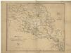
Kart over Lister og Mandals amt
1 : 200000 Norsko Gjessing, Soren Christian Geografiske opmaaling
Geologisk kart over det Söndenfjeldske Norge
1 : 400000 Südwest-Blatt Kjerulf, Theodor ; Dahll, Tellef Carl Schwenzens
Trigonometrisk grunnlag, Squelet-Cart 45: Kart for 1849
F. Næser
V
1 : 400000 L. Arentz
Spesielle kart 52-1: Flaadnings-Kart over Langesundsfjordens Vasdrag
1 : 200000 Halck J. Finnes lith. Offiscin i Christiania