Maps of Kvinnherad

B34-5; B34-6
1 : 25000 Adler Gleditsch
1215-2 Varaldsøy
1 : 50000 Statens kartverk
1215-2 Varaldsöyna
1 : 50000 Statens kartverk
1215-2 Varaldsöyna
1 : 50000 Statens kartverk
1215-2 Varaldsöy
1 : 50000 Norges Geografiske Oppmåling
1215-2 Varaldsøy
1 : 50000
B34 aust Standebarm
1 : 100000
B34 aust Standebarm
1 : 100000
B34 aust Standebarm
1 : 100000
B34 aust Standebarm
1 : 100000
B34 aust Standebarm
1 : 100000
B34-4
1 : 50000 Kjeld Andreas Bugge
B34-4
1 : 50000 Adler Gleditsch
B34-11
1 : 50000 Kjeld Andreas Bugge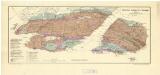
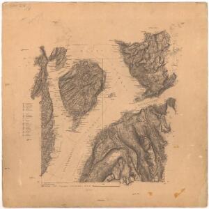
Geologisk kart 106: Kisdistriktet Varaldsøy-Ølve i Hardanger
1 : 40000 Steinar Foslie Norges geologiske undersøkelse
16B 8; 16B 12; 17A 5; 17A 9
1 : 50000
C34-1; C34-2; C34-7; C34-8
1 : 50000 Sigurd L. N. Hauge | Kaare Kvisgaard
B34-12-2
1 : 50000 Erling Bjørstad
B34-12-1
1 : 50000 Adler Gleditsch
B34-11
1 : 50000 Hjalmar Skaar
Portefølje nr 27
1 : 100000 E. Lund
Museumskart 217-4 Specialkart over Hardangerfjorden. Vestre del.
1 : 100000 M. T. Kingo | H. N. Bergh | R. M. Petersen Den Geografiske Opmaaling
Museumskart 82: Hardangerfjorden
1 : 100000
Kartblad 129: Situations Cart over det Nordre Sündhordlehnske Compagnie District
Severin Wincentz Segelcke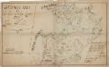
Kartblad 128: Citustions Cart over det Søndre Nordhordlehnske Compagnie District
Christian Frost Nicoll
Museumskart 85b: Speciel kaart over en Deel af den Norske Søe-Kyst strækkende fra Samnanger-Fjorden
1 : 140000 Carl Frederik Grove
17A 2; 17A 3; 17A 4; 17A 8; 17A 12 (geometrisk hovednet)
1 : 100000 Fr. Sejersted
17A 6; 17A 7; 17A 10; 17A 11
1 : 100000 Fougner
17A 2; 17A 3; 17A 4; 17A 8; 17A 12
1 : 100000 Fr. Sejersted