Maps of Tysnes

B34-1; B34-2
1 : 50000 Axel P. Printz
16B 6; 16B 10
1 : 50000 Hans Paasche Schreuder
1115-2 Austevoll
1 : 50000 Norges Geografiske Oppmåling
B34-1
1 : 50000 Niels Sire
B34-2
1 : 50000 Knud Maartmann Søyland
1115-2 Austevoll
1 : 50000 Statens kartverk
1115-2 Austevoll
1 : 50000 Statens kartverk
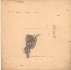
B34 vest Fana
1 : 100000
B34 vest Fana
1 : 100000
B34 vest Fana
1 : 100000
B34 vest Fana
1 : 100000
B34 vest Fana
1 : 100000
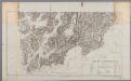
Museumskart 217-65: Specialkart over Den Norske Kyst fra Stolmen til Lyngø og Raugnene
1 : 50000 H. T. Bjørnstad Den Geografiske Opmaaling
1115-2 Austevoll
1 : 50000 Norges Geografiske Oppmåling
1115-2 Austevoll
1 : 50000 Statens kartverk
A35-11; A35-12
1 : 50000 Finn Qvale | Eivind A. N. Riiber
B35-8
1 : 50000 Rasmus Larsen Hatledal | Einar Liljedahl
B35-8
1 : 50000 Einar Liljedahl
B35-9
1 : 50000 Sverre Spjeldnæs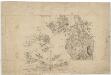
16A 12; 16B 9
1 : 50000 J. Hertzberg
B34 vest Fana
1 : 100000
B34 vest Fana
1 : 100000
Portefølje nr 26
1 : 100000 E. Lund
Museumskart 84b: Speciel kaart over en Deel af den Norske Søe-Kyst, Bømmel-Øe.
1 : 140000 Carl Frederik Grove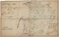
Kartblad 128: Citustions Cart over det Søndre Nordhordlehnske Compagnie District
Christian Frost Nicoll
Museumskart 85b: Speciel kaart over en Deel af den Norske Søe-Kyst strækkende fra Samnanger-Fjorden
1 : 140000 Carl Frederik Grove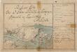
Kartblad 130-2: Situations Carte over det Søndre Sundhordlehnske Compagnie District; versjon 2
Lorentz Henrik Møller Segelcke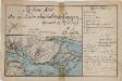
Kartblad 130- Situations Carte over det Søndre Sundhordlehnske Compagnie District; versjon 1
Lorentz Henrik Møller Segelcke
Museumskart 217-3 Kart over Den Norske Kyst fra Espevær til Korsfjord
1 : 50000 H. Wille | A. Heimburger Den Geografiske Opmaaling