Maps of Lillehammer

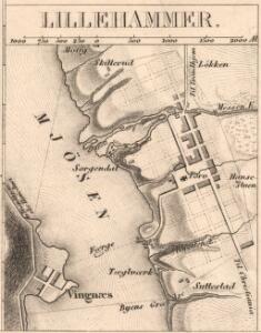
Lillehammer
1 : 50000 Søren Christian Gjessing
Kartblad 5: Kart over Veien fra Eidsvold til Gausdal og til Skydsstationen Holmen i Øyer
J. H. Reichborn
Fra Langset til Isakstua
1 : 20000 J. H. Reichborn
Fra Røyne til Gausa
J. H. Reichborn
25D 11
1 : 50000
25D 11
1 : 50000 Øvergaard | Hans Christian Smith Due | Johan Ferdinand Normann
1817-2 Lillehammer
1 : 50000 Norges Geografiske Oppmåling
1817-2 Lillehammer
1 : 50000 Norges Geografiske Oppmåling
1817-2 Lillehammer
1 : 50000 Statens kartverk
Spesielle kart 182: Vannressurskart Lillehammer
1 : 50000 Tidemann Klemetsrud | Amund Gaut
1817-2 Lillehammer
1 : 50000 Norges Geografiske Oppmåling
1817-2 Lillehammer
1 : 50000 Statens kartverk
G31-1; G31-2; G31-3; G31-4; G31-8; G31-9; G31-10
1 : 50000 Erling Bjørstad
1817-2 Lillehammer
1 : 50000 Norges Geografiske Oppmåling
25D Lillehammer
1 : 100000
1817-2 Lillehammer
1 : 50000 Statens kartverk
Kartblad 5 Vey-Cart over det Nordre Hedemarkiske Capt. Von Weyhes Compagnie District
Johan Henrik Ramm
1817-2 Lillehammer
1 : 50000 Statens kartverk
1817-2 Lillehammer
1 : 50000 Statens kartverk
25D Lillehammer
1 : 100000
G31-7; G31-8
1 : 50000 A. H.
Kartblad 62: Charte over det Faabergske Compagnie District

25D Lillehammer
1 : 100000 Johan Ferdinand Normann | Ole Engh
25D Lillehammer
1 : 100000 Johan Ferdinand Normann
25D Lillehammer
1 : 100000 Einar Sigurd Ween | Johan Ferdinand Normann
25D Lillehammer
1 : 100000 Johan Ferdinand Normann
Kartblad 52: Militært Cart over det Gusdalske Compagnies District
Keilhau
25D Lillehammer
1 : 100000 Einar Sigurd Ween | Johan Ferdinand Normann
Portefølje nr 47
1 : 100000 Duncker | Munthe