Maps of Oslo

Maps of Oslo

$title$

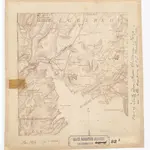
Kristiania nr 82b: Karta à ̧fver Staden Christiania i Norrige och Trakten der omkring

1 : 10000 O. J. Hagelstam
$title$

Kristiania amt nr 60: Kart over Agershus Fæstning med Plan til dens fremtidige Bebyggelse

1 : 2000 C. Schwenzens Lit. Officin
$title$

Gatorne i Christiania

1 : 50000 O. J. Hagelstam
$title$

Kristiania amt nr 60: Kart over Agershus Fæstning med Plan til dens fremtidige Bebyggelse

1 : 2000 C. Schwenzens Lit. Officin
$title$

Kristiania amt nr 58: Detailkart over Christiania efter Kommunebestyrelsens Foranstaltning trigonometrisk og geometrisk opmaalt

1 : 1000 J. W. G. Næser
$title$

Kristiania amt nr 58: Detailkart over Christiania efter Kommunebestyrelsens Foranstaltning trigonometrisk og geometrisk opmaalt

1 : 1000 J. W. G. Næser
$title$

Kristiania amt nr 58: Detailkart over Christiania efter Kommunebestyrelsens Foranstaltning trigonometrisk og geometrisk opmaalt

1 : 1000 J. W. G. Næser
$title$

Kristiania amt nr 58: Detailkart over Christiania efter Kommunebestyrelsens Foranstaltning trigonometrisk og geometrisk opmaalt

1 : 1000 J. W. G. Næser
$title$

Kristiania amt nr 58: Detailkart over Christiania efter Kommunebestyrelsens Foranstaltning trigonometrisk og geometrisk opmaalt

1 : 1000 J. W. G. Næser
$title$

Kristiania amt nr 58: Detailkart over Christiania efter Kommunebestyrelsens Foranstaltning trigonometrisk og geometrisk opmaalt

1 : 1000 J. W. G. Næser
$title$

Kristiania amt nr 58: Detailkart over Christiania efter Kommunebestyrelsens Foranstaltning trigonometrisk og geometrisk opmaalt

1 : 1000 J. W. G. Næser
$title$

Kristiania amt nr 58: Detailkart over Christiania efter Kommunebestyrelsens Foranstaltning trigonometrisk og geometrisk opmaalt

1 : 1000 J. W. G. Næser
$title$

Bysten No 77

1 : 1000 Schwenzens lit. Officin.
$title$

Kristiania amt nr 58: Detailkart over Christiania efter Kommunebestyrelsens Foranstaltning trigonometrisk og geometrisk opmaalt

1 : 1000 J. W. G. Næser
$title$

Kristiania amt nr 58: Detailkart over Christiania efter Kommunebestyrelsens Foranstaltning trigonometrisk og geometrisk opmaalt

1 : 1000 J. W. G. Næser
$title$

Grønlibryggen

1 : 1000 J. W. G. Næser
$title$

Geologiske kart Ladegaardsøens Jordbund. Snit over Wigwam og Oscarshal

1 : 25000 Kjerulf
$title$

Kristiania nr 82-1: Karta à ̧fver Staden Christiania i Norrige och Trakten der omkring

1 : 100000 O. J. Hagelstam
$title$

14D 12 sø

1 : 25000 Johannes Solem
$title$

Oversiktskart over Kristiania amt nr 58

1 : 50000 J. W. G. Næser
$title$

14D 12 nv

1 : 10000 Ditlev Vibe
$title$

14D 12 sv

1 : 25000 Johannes Solem
$title$

Trigonometrisk grunnlag, Squelet-Cart 52: Trigonometrisk kart over Christiania og omegn

F. Næser
$title$

14D 12 nv

1 : 10000 W. Næser
$title$

Kristiania

1 : 43000 Oslo (Norsko) F.A. Brockhaus' geogr.-artist. Anstalt
$title$

Kristiania amt nr 63: Kart over Kristiania

1 : 5000 H. N. Bergh | J. W. G. Næser
$title$

Kristiania amt nr 97

1 : 10000
$title$

14D 12 sv

1 : 10000 Ditlev Vibe
$title$

14D 12 sv

1 : 10000 Ditlev Vibe
$title$

Christiania

1 : 50000 Gerhard Munthe | Niels Arentz Ramm
© MapTiler © OpenStreetMap contributors
How does it work?
These instructions will show you how to find historical maps online.
Getting started
Type the place name in the search box to find the exact location. You can further adjust the search by zooming in and out.
Zoom
Zoom in and out with the buttons or use your mouse or touchpad natively.
Exact Area tool
Click here and draw a rectangle over the map to precisely define the search area.
Set filters
Narrow your search with advanced settings, such as Years (from/to), Fulltext, Publisher, etc.
Results
See the results of your search on the right side. You can scroll down to find more maps of this location.
?

Download OldMapsOnline Mobile