Maps of Oslo

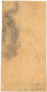
Finmarkens amt 54-2: HÃ¥ndtegnet kopi av kart over Ã...rdalstangen
1 : 200000 Fredrik Rode, Gerhard Munthe
Geologisk kart 59: Den geologiske Undersøgelse, Kristianiafeltet-Fet
1 : 100000 W. C. Brøgger | J. Schetelig Norges geologiske undersøkelse
Spesielle kart 108: à ̃versigtsprofil. Nordbanen-Lillestrà ̧m-Smaalensbanen
1 : 100000
Kartblad 23: Kart over det Aggerske Compagnie District
Fridrich Helle Grønvold
Kartblad 24: Wei-Kaart over det Schijedsmoiske Compagnie District
Lihme senior
1914-4 Oslo
1 : 50000 Statens kartverk
1914-4 Oslo
1 : 50000 Norges Geografiske Oppmåling
1914-4 Oslo
1 : 50000 Statens kartverk
1914-4 Oslo
1 : 50000 Statens kartverk
G35-11
1 : 50000 N. Houge
G35-5
1 : 50000 Andreas Theodor Walle
Kartblad 36: Militairisk Chart over det Enebakske Compagnie District
N. F. Lihme
15C 5 (geometrisk hovednet)
1 : 50000
Kristiania omegn / Heliogravure efter Tegning af Karttegner J. Natrud ; Fjeldtonen af O. Engh
1 : 25000 J. Natrud; O. Engh [S.l. : Norges geografiske Opmaaling]
1915-3 Nannestad
1 : 50000 Statens kartverk
1915-3 Nannestad
1 : 50000 Statens kartverk
1915-3 Nannestad
1 : 50000 Statens kartverk
15C 5; 15C 6 (geometrisk hovednet)
1 : 25000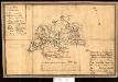
Kartblad 34: Militairt Cart over Nordrefollaugske Compagnie District
L. Rein | Petter Prydz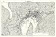
Geologisk kart 118: The Aker Moraines
1 : 50000 J. Gjessing Norsk geografisk tidsskrift
Geologiske kart 50: Geologisk kart over Christiania omegn
1 : 100000 Theodor Kjerulf
G34-6; H35-7; G35-12
1 : 50000 Andreas Theodor Walle
1914-4 Oslo
1 : 50000 Norges Geografiske Oppmåling
1914-4 Oslo
1 : 50000 Norges Geografiske Oppmåling
1914-4 Oslo
1 : 50000 Statens kartverk
G35-11
1 : 50000 Niels Sire | Andreas Theodor Walle
1915-3 Nannestad
1 : 50000 Norges Geografiske Oppmåling
1915-3 Nannestad
1 : 50000 Norges Geografiske Oppmåling
1915-3 Nannestad
1 : 50000 Norges Geografiske Oppmåling