Maps of Tinn
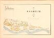
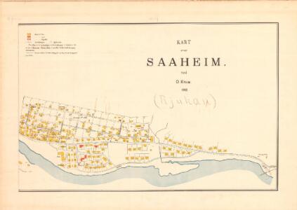
Bratsberg amt nr 37b: Saaheim (Rjukan aust)
1 : 2500 Nicolai Solner Krum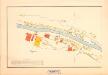
Bratsberg amt nr 37a: Saaheim (Rjukan vest)
1 : 2500 Nicolai Solner Krum
E35-7
1 : 50000 Hans Knagenhjelm Hertzberg | Toralf Øyen
13D 6; 13D 7; 13D 10; 13D 11
1 : 50000 Ludvig Andreas Riis
1614-4 Rjukan
1 : 50000 Statens kartverk
1614-4 Rjukan
1 : 50000 Statens kartverk
1614-4 Rjukan
1 : 50000 Norges Geografiske Oppmåling
1614-4 Rjukan
1 : 50000 Statens kartverk
1614-4 Rjukan
1 : 50000 Norges Geografiske Oppmåling
13C 8; 13C 12; 13D 5; 13D 9
1 : 50000 Christoffer Fredrik von Lowzow
E35-9
1 : 50000 Berthold Dahl
E35-4
1 : 50000 Toralf Øyen
1614-4 Rjukan
1 : 50000
E35 vest Rjukan
1 : 100000
Geologisk kart 9 Rjukan
1 : 100000 Johannes A. Dons Norges geologiske undersøkelse
E35 vest Rjukan
1 : 100000
E35 vest Rjukan
1 : 100000
E35 vest Rjukan
1 : 100000
E35 vest Rjukan
1 : 100000
Kartblad 21 øst-2: Geographisk Kart over det Hjerdalske Compagnie District; østre del versjon 1
Mathias Andreas Rye
Kartblad 21-2: Geographisk Kart over det Hjerdalske Compagnie District; versjon 2
Mathias Andreas Rye
Portefølje nr 21
1 : 100000 H. Lassen
Portefølje nr 21
1 : 100000 H. Lassen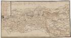
Kartblad 31- Chart over det Numedahlsche Compagnie District
S. Selboe
Geologiske kart 45: Geologisk kart over Østtelemarken
1 : 300000 Kjerulf | W. Werenskiold | Tellef Dahll
Kartblad 32: Vej-Cart over det Nummedahlske Compagnie District
V. Dietrichs | Bruenech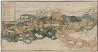
Kartblad 31-2: Chart over det Numedahlsche Compagnie District
S. Selboe
Spesielle kart 58-5: Kart over Drammenselvens Flødningsdistrikt
1 : 100000 Thurmann | Seip
Kartblad 22 vest: Vei-Kart over det Tindske Compagnie District; vestre del
J. Dop