Maps of Germany

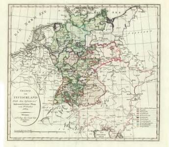
Charte von Teutschland: Nach dem definitiven Indemnisations-Plane vom 8ten October 1802
1 : 4100000 Landes-Industrie-Comptoir
Mappa Geographica indicans, quibus in locis per totam Germaniam bello tricennali Rex Sueciae Gustavus Adolphus, ejusque Confoederati felicia ut plurimum praelia comiserint, quas urbes tenuerint et A. 1648 amore Pacis vi tractatum Westphalicarum restituere promiserint
1 : 2500000 Mollova mapová sbírka Seutter, Matthäus Seutter, Matthäus
Mappa geographica exhibens postas omnes tam vehiculares quam veredarias totius Germaniae
Evropa střední Lotter, Tobias Conrad Tobias Conrad Lotter
Mappa geographica exhibens postas omnes tam vehiculares quam veredarias totius Germaniae
Evropa střední Lotter, Tobias Conrad Tobias Conrad Lotter
Mappa geographica exhibens postas omnes tam vehiculares quam veredarias totius Germaniae
Evropa střední Lotter, Tobias Conrad Tobias Conrad Lotter
Germany.
1 : 6000000 Bowen, Frances
L'Empire d'Allemagne
1 : 2400000 Mollova mapová sbírka Jaillot, Alexis-Hubert Broen, Gerrit de Jaillot, Alexis Hubert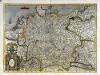
Germania
1 Karte : Kupferdruck ; 34 x 47 cm Mercator; Hondius Henricus Hondius
Germania
1 Karte : Kupferdruck ; 34 x 47 cm Mercator s.n.
L'Allemagne.
1 : 3700000 Clouet, J. B. L. (Jean-Baptiste Louis), b. 1730
(L'Allemagne)
1 : 12000000 Bruyset, Jean-Marie; Schneider, J. H.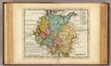
Germany.
1 : 5500000 Moll, Herman, d. 1732
General-Charte von Teutschland nach den besten Quellen bearbeitet und den neuesten politischen Veraenderungen begrenzt
1 : 2027520
Karte von Central-Europa bis Paris, Mailand, Triest, Pesth, Krakau, Königsberg, Schleswig
1 : 1800000 Budapešť (Maďarsko) Justus Perthes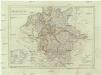
Deutschland nach den letzten Friedenschlüssen
1 : 3600000 Evropa střední Mollo, Tranquillo bey Tranquillo Mollo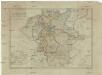
Deutschland nach den letzten Friedenschlüssen
1 : 3600000 Evropa střední Mollo, Tranquillo Tranquillo Mollo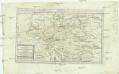
Karte von Deutschland, oder, dem Heilligen Römischen Reiche überhaupt und dem Östreichischen Kreise insbesondere
Německo Reilly, Franz Johann Josef von F. I. I. von Reilly
Post Karte durch ganz Deutschland
1 : 2100000 Evropa střední Walch, Johann bey Joh. Walch
Carte exacte des Postes et Routes de l'Empire d'Allemagne
1 : 2500000 Mollova mapová sbírka Delisle, Guillaume Covens, Johannes I
Imperium Romano-Germanicum in suos circulos electorat. et status accurate distinctum
1 : 2500000 Evropa střední Homann, Johann Baptist J. B. Homann
IMPERIUM ROMANO-GERMANICUM IN SUOS CIRCULOS DIVISUM Geographice exhibitum
1 : 2450000 Evropa střední Homann, Johann Baptist Hübner, Johann a Ioh. Baptista Homanno

(Teutschland, Pohlen, Ungarn, Turcken, Russland)
Hubner, Johann, 1688-1731
S[anctum] Imperium Romano-Germanicum oder Teutschland Mit Seinen Angräntzenden Königreichen Und Provincien
Reichelt, Julius; Visscher, Nicolaes; Hogeboom, Andries
Germania in Circulos Divisa
1 : 4300000 Mollova mapová sbírka Weigel, Christoph Weigel, Christoph I.
Germania secundum observationes recentissimas in suos circulos divisa
1 : 2313000 Německo Walch, Johann Ioanes Walch
Germania secundum observationes recentissimas in suos circulos divisa
1 : 2313000 Německo Walch, Johann Ioanes Walch
Neu vermehrte Post Charte durch gantz Teutschland nach Italien, Franckreich, Niederland, Preußen, Polen, und Ungarn &c.

[Recto], uit: Post- und Eisenbahn-Karte von Deutschland, den Niederlanden, Belgien und der Schweiz / bearb. nach L. Friedrich's Post-, Eisenbahn- & Reisekarte von Mittel-Europa
1 : 1800000 Annotatie: Ondertitel op omslag: Bis Calais & Paris, Rügen & Königsberg, Krakau & Pesth, Venedig & Grenoble Gotha : Perthes