Maps of Hoboken

Maps of Hoboken

$title$

Firemen's guide and map of the city of New-York shewing the boundaries of the proposed new fire districts / enlered according to Act of Congress in the year 1840 by George Hayward
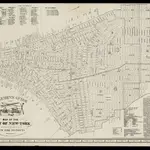
1 Mapa, b/n. Dins (?): Valentine's manual of New York city, 1841-1870 Hayward, George G. Hayward's Lith. G. Hayward's Lith.
$title$

Plan von New-York, 1844.

from Manhattan
$title$

City of New-York / by David H. Burr.

from Manhattan
$title$

The Firemen's guide : a map of the City of New-York, showing the fire districts, fire limits, hydrants, public cisterns, stations of engines, hooks & ladders, hose carts, &c.

from Manhattan
$title$

City of New-York / W. Kemble.

from Manhattan
$title$

Strangers guide through the city of New York : with the latest improvements / by H. Phelps.

from Manhattan
$title$

Map of the lower section of the city of New York : showing high and low water lines.

From Manhattan
$title$

Map Of The City Of New York

1 : 12500 Ensign, Bridgman & Fanning
$title$

City of New-York

1 : 12500 Burr, David H., 1803-1875 Edward Walker
$title$

Map of the city of New-York extending northward to Fiftieth St. / surveyed and drawn by John F. Harrison, C.E.

from Manhattan
$title$

Map of the city of New York, shewing the original high water line and the location of the different farms and estates

Common Council
$title$

Map of New York City, south of 46th St. : showing new arrangement of docks, piers, and water frontage, also soundings and former high water line

1 : 7200 Dripps, M. (Matthew) Matthew Dripps
$title$

Outline and Index Map of Atlas of New York City.

from Atlas of the borough of Manhattan, city of New York.
$title$

Map of the City of New-York with part of Brooklyn and Williamsburgh : population in the year 1850: 450,000 inhabitants.

from Manhattan
$title$

This actual map and comparative plans showing 88 years growth of the City of New York : is inscribed to the citizens by the proprietor, David Longworth / G.B. King sc. N.Y. 1817 ; engraved by Jas. D. Stout.

from Manhattan
$title$

Map of the City of New York.

from Manhattan
$title$

New map of the city of New York with part of Brooklyn & Williamsburg / by J. Calvin Smith ; engraved on steel by Stiles, Sherman & Smith.

from Manhattan
$title$

New-York.

from The American traveller ; or, Guide through the United States, containing brief notices of the several states, cities, principal towns, canals and rail roads, etc. ; with tables of distances by stage, canal and steam boat routes ... by H.S. Tanner.
$title$

Hooker's new pocket plan of the city of New York / compiled & surveyed by William Hooker, engraver, No. 179 Water Street, New York, house, Willoughby St., Brooklyn.

from Manhattan
$title$

Map of the city of New York with the adjacent cities of Brooklyn and Jersey City, and the village of Williamsburg

1 : 14000 Story & Atwood H. Phelps
$title$

Outline & Index Map of Volume One, Atlas of New York City, Borough of Manhattan: Battery to Fourteenth Street.

from Atlas of the city of New York, borough of Manhattan. From actual surveys and official plans / by George W. and Walter S. Bromley.
$title$

Map of New York City from Battery to 60th Street.

From Manhattan
$title$

Map of the city of New York.

from Manhattan
$title$

A new map of the city of New York : comprising all the late improvements, compiled and corrected from authentic documents.

from Manhattan
$title$

Area District Map Section No. 12

From Area district map.
$title$

New York S.

1 : 21120 Letts, Son & Co.
$title$

Topographical Atlas Of The City Of New York

1 : 12000 Viele, Egbert L.
$title$

Plan von der Stadt New York

1 : 68500 New York (New York)
$title$

Hooker's new pocket plan of the city of New York / compiled & surveyed by William Hooker, engraver, No. 179 Water Street, New York, house, Willoughby St., Brooklyn.

From Manhattan
$title$

Plan of the city of New-York : the greater part from actual survey made expressly for the purpose (the rest from authentic documents)

1 : 7300 Poppleton, Thomas H Prior & Dunning
© MapTiler © OpenStreetMap contributors
How does it work?
These instructions will show you how to find historical maps online.
Getting started
Type the place name in the search box to find the exact location. You can further adjust the search by zooming in and out.
Zoom
Zoom in and out with the buttons or use your mouse or touchpad natively.
Exact Area tool
Click here and draw a rectangle over the map to precisely define the search area.
Set filters
Narrow your search with advanced settings, such as Years (from/to), Fulltext, Publisher, etc.
Results
See the results of your search on the right side. You can scroll down to find more maps of this location.
?

Download OldMapsOnline Mobile