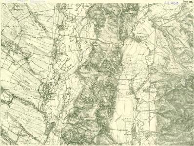
Maps of Ipolytölgyes

III. vojenské mapování 4861/2
1 : 25000
III. vojenské mapování 4861
1 : 75000
Mgy. Szölgyén und Gran
1 : 75000 Svodin, Esztergom Schrift und Gerippe v. Oberlt. Charlemont. Terrainschraffirung v. Lieut. Sied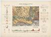
Zone 14, Kol. XIX, Umgebung von Magyarszölgyén und Párkány-Nána, uit: [Geologische Specialkarte der im Reichsrathe vertretenen Königreiche und Länder der österreichisch-ungarischen Monarchie] / geologische Aufnahmen der königl. ung. Geologischen Anstalt
1 : 75000 Annotatie: Verantwoordelijkheidsvermelding in 1909 veranderd in: Königliche Ungarische Geologische Reichsanstalt; Sommige bladen in het Frans; Annotatie geografische gegevens: Coördinaten gebaseerd op nulmeridiaan van Ferro (Hierro) Königliche Ungarische Geologische Reichsanstalt; Königliche Ungarische Geologische Anstalt Budapest : [Königliche Ungarische Geologische Anstalt]
Mgy. Szolgyen und Gran.
from Spezialkarte der osterreichisch-ungarischen Monarchie.
Parkan
1 : 75000 Maďarsko Vojenský zeměpisný ústav
Parkan
1 : 75000 Maďarsko Vojenský zeměpisný ústav
Leva und Sallo. (Ungarn)
from Spezialkarte der osterreichisch-ungarischen Monarchie.
Hont vármegye
1 : 288000 Hont (Slovensko a Maďarsko) Biller, Bernhard Görög
C. Hontensis
Slowakei Komitat Hont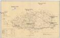
Komorner Comitat
1 : 290000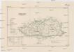
Komorner Comitat
1 : 288000 Komárno (Slovensko)
Generální mapa ČSR

C. Barsensis
Slowakei Komitat Bars
Barser und Honther Comitat
1 : 290000 Levice (Slovensko : oblast)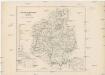
Barser und Honther Comitat
1 : 288000 Levice-oblast (Slovensko)
Komorn 148, uit: Special-Karte von Mittel-Europa / nach amtlichen Quellen bearbeitet von W. Liebenow
1 : 300000 titelvariant: W. Liebenow's Mittel-Europa; Annotatie: Titel boven de bladen: W. Liebenow's Mittel-Europa Johannes Wilhelm Liebenow 1822-1897 Frankfurt a. M. : Ludwig Ravenstein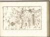

Stolice Tekov. Stolice Hont
Komitat Hont, Komitat Bars, ethnische Gruppe
C. Strigontensis
Ungarn Komitat Gran (Ungarn)
Komárom Vármegye
1 : 340000 Slovensko jižní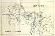
Stolice Pešť-Pilišská. Stolice Komárno a Ostřihom
Komitat Komárom-Esztergom, Komitat Pest-Pilis-Solt-Kiskun, ethnische Gruppe
Serben im Komitat Pest 1980
Komitat Pest Serben, Siedlung Bottlik, Zsolt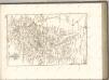

Serben im Komitat Pest 1880
Komitat Pest Serben, Siedlung Bottlik, Zsolt
Serben im Komitat Pest 1941
Komitat Pest Serben, Siedlung Bottlik, Zsolt
A szerbek aránya és száma Pest megyében 1880-ban
Komitat Pest Serben, Siedlung Bottlik, Zsolt
A szerbek aránya és száma Pest megyében 1941-ben
Komitat Pest Serben, Siedlung Bottlik, Zsolt
A szerbek aránya és száma Pest megyében 1980-ban
Komitat Pest Serben, Siedlung Bottlik, Zsolt