Maps of Podhájska
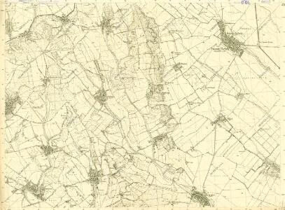
III. vojenské mapování 4761/3
1 : 25000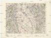
Levice
1 : 75000 Levice (Slovensko : oblast) Vojenský zeměpisný ústav
Levice
1 : 75000 Levice-oblast (Slovensko) Vojenský zeměpisný ústav
Levice
1 : 75000 Levice (Slovensko : oblast) Vojenský zeměpisný ústav
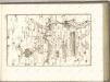
A nagysallói csata vázlata (1849 april 19-én)
Ungarn Schlacht bei Nagy-Sarlo Ungarn / Revolution <1848-1849>
III. vojenské mapování 4760/4
1 : 25000
Leva und Sallo. (Ungarn)
from Spezialkarte der osterreichisch-ungarischen Monarchie.
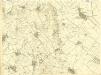
III. vojenské mapování 4761
1 : 75000
Léva und Salló
1 : 75000 Levice, Umland Schrift und Gerippe v. Feldw. König. Terrainschraffirung v. Adolf Hertl
Sellye und Nagy-Surany.
from Spezialkarte der osterreichisch-ungarischen Monarchie.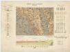
Zone 13, Kol. XVIII, Umgebung von Vágsellye und Nagysurány, uit: [Geologische Specialkarte der im Reichsrathe vertretenen Königreiche und Länder der österreichisch-ungarischen Monarchie] / geologische Aufnahmen der königl. ung. Geologischen Anstalt
1 : 75000 Annotatie: Verantwoordelijkheidsvermelding in 1909 veranderd in: Königliche Ungarische Geologische Reichsanstalt; Sommige bladen in het Frans; Annotatie geografische gegevens: Coördinaten gebaseerd op nulmeridiaan van Ferro (Hierro) Königliche Ungarische Geologische Reichsanstalt; Königliche Ungarische Geologische Anstalt Budapest : [Königliche Ungarische Geologische Anstalt]
III. vojenské mapování 4760
1 : 75000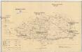
Komorner Comitat
1 : 290000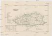
Komorner Comitat
1 : 288000 Komárno (Slovensko)
Komárom vármegye térképe
1 : 360000 Kogutowicz, Manó Magyar Földrajzi Intézet
Generální mapa ČSR

Mappa Comitatvs Hontensis Methodo Astronomico-Geometrica concinnata.
1 : 160000 Mollova mapová sbírka Mikoviny, Sámuel Nicolaï, Georg David Christoph
Mappa Comitatvs Barsiensis Methodo Astronomico-Geometrica concinnata.
1 : 160000 Mollova mapová sbírka Mikoviny, Sámuel Nicolaï, Georg David Christoph
Mappa Comitatis Hontensis Methodo Astronomico-Geometrica concinnata, opera ...
1 : 162000 Mollova mapová sbírka Mikoviny, Sámuel
C. Barsensis
Slowakei Komitat Bars
C. Nitriensis. Tab. I
Slowakei Komitat Neutra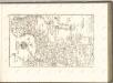

Barser und Honther Comitat
1 : 290000 Levice (Slovensko : oblast)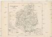
Barser und Honther Comitat
1 : 288000 Levice-oblast (Slovensko)
Schemnitz 134, uit: Special-Karte von Mittel-Europa / nach amtlichen Quellen bearbeitet von W. Liebenow
1 : 300000 titelvariant: W. Liebenow's Mittel-Europa; Annotatie: Titel boven de bladen: W. Liebenow's Mittel-Europa Johannes Wilhelm Liebenow 1822-1897 Frankfurt a. M. : Ludwig Ravenstein
Unter Neutraer-Comitat
1 : 280000 Nitra-oblast (Slovensko)
Unter Neutraer-Comitat
1 : 290000 Nitra (Slovensko : oblast)
Komorn 148, uit: Special-Karte von Mittel-Europa / nach amtlichen Quellen bearbeitet von W. Liebenow
1 : 300000 titelvariant: W. Liebenow's Mittel-Europa; Annotatie: Titel boven de bladen: W. Liebenow's Mittel-Europa Johannes Wilhelm Liebenow 1822-1897 Frankfurt a. M. : Ludwig Ravenstein