Maps of Šaľa

III. vojenské mapování 4760/1
1 : 25000
Šurany
1 : 75000 Slovensko Vojenský zeměpisný ústav
Šurany
1 : 75000 Slovensko Vojenský zeměpisný ústav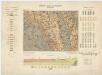
Zone 13, Kol. XVIII, Umgebung von Vágsellye und Nagysurány, uit: [Geologische Specialkarte der im Reichsrathe vertretenen Königreiche und Länder der österreichisch-ungarischen Monarchie] / geologische Aufnahmen der königl. ung. Geologischen Anstalt
1 : 75000 Annotatie: Verantwoordelijkheidsvermelding in 1909 veranderd in: Königliche Ungarische Geologische Reichsanstalt; Sommige bladen in het Frans; Annotatie geografische gegevens: Coördinaten gebaseerd op nulmeridiaan van Ferro (Hierro) Königliche Ungarische Geologische Reichsanstalt; Königliche Ungarische Geologische Anstalt Budapest : [Königliche Ungarische Geologische Anstalt]
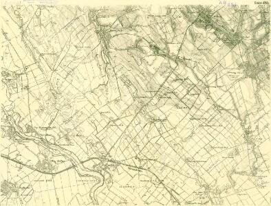
III. vojenské mapování 4760
1 : 75000
III. vojenské mapování 4759/2
1 : 25000
Sellye und Nagy-Surany.
from Spezialkarte der osterreichisch-ungarischen Monarchie.
Manöver-Terrain bei Freystadtl [sic] (Galgóc)
1 : 75000 Nitra (Slovensko : oblast) K. u. k. militär-geographisches Institut
Neutra.
from Spezialkarte der osterreichisch-ungarischen Monarchie.
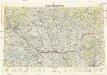
Nitra a okolí
1 : 75000 Nitra (Slovensko : oblast) Vojenský zeměpisný ústav
Wartberg und Tallos (Ungarn).
from Spezialkarte der osterreichisch-ungarischen Monarchie.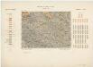
Zone 13, Kol. XVII, Umgebung von Szempcz und Tallós, uit: [Geologische Specialkarte der im Reichsrathe vertretenen Königreiche und Länder der österreichisch-ungarischen Monarchie] / geologische Aufnahmen der königl. ung. Geologischen Anstalt
1 : 75000 Annotatie: Verantwoordelijkheidsvermelding in 1909 veranderd in: Königliche Ungarische Geologische Reichsanstalt; Sommige bladen in het Frans; Annotatie geografische gegevens: Coördinaten gebaseerd op nulmeridiaan van Ferro (Hierro) Königliche Ungarische Geologische Reichsanstalt; Königliche Ungarische Geologische Anstalt Budapest : [Königliche Ungarische Geologische Anstalt]
Wartberg und Tallós
1 : 75000 Senec, Tomášikovo Geripp: Oberjgr. Spaczek. Terrain: J. Le Gay Edler v. Lierfels
III. vojenské mapování 4759
1 : 75000
III. vojenské mapování 4660/3
1 : 25000
III. vojenské mapování 4760/2
1 : 25000
C. Nitriensis. Tab. I
Slowakei Komitat Neutra

Schemnitz 134, uit: Special-Karte von Mittel-Europa / nach amtlichen Quellen bearbeitet von W. Liebenow
1 : 300000 titelvariant: W. Liebenow's Mittel-Europa; Annotatie: Titel boven de bladen: W. Liebenow's Mittel-Europa Johannes Wilhelm Liebenow 1822-1897 Frankfurt a. M. : Ludwig Ravenstein
Unter Neutraer-Comitat
1 : 280000 Nitra-oblast (Slovensko)
Unter Neutraer-Comitat
1 : 290000 Nitra (Slovensko : oblast)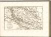

Comitat Pressburg
1 : 280000 Bratislava-oblast (Slovensko)
Comitat Pressburg
1 : 300000 Bratislava (Slovensko : oblast)
Stolice Prešpurk a Nitra
Bratislava, Nitra, ethnische Gruppe
Mappa Comitatvs Nitriensis :
1 : 170000 Mollova mapová sbírka Mikoviny, Sámuel Nicolaï, Georg David Christoph
Generalkarte von Zentraleuropa

Bez titulu: mapy slovenských krajů
Neubertova generální automapa Republiky československé
1 : 200000 Bratislava (Slovensko : oblast) Soukup, Jan V. Neubert a synové