Maps of Dolné Obdokovce

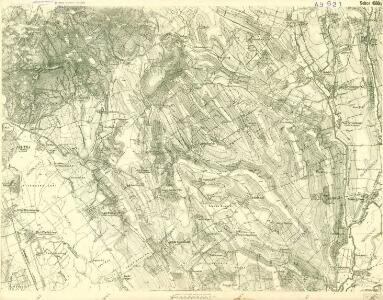
III. vojenské mapování 4660/4
1 : 25000
Nitra
1 : 75000 Nitra (Slovensko : oblast) Kartografické odd. při Min. nár. obrany
Nitra
1 : 75000 Nitra (Slovensko : oblast) Kartografické odd. při Min. nár. obrany
Nitra a okolí
1 : 75000 Nitra (Slovensko : oblast) Vojenský zeměpisný ústav
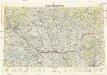
III. vojenské mapování 4660
1 : 75000
Nitra
1 : 75000 Nitra-oblast (Slovensko) Vojenský zeměpisný ústav
Nitra
1 : 75000 Nitra (Slovensko : oblast) Vojenský zeměpisný ústav
Neutra.
from Spezialkarte der osterreichisch-ungarischen Monarchie.
Manöver-Terrain bei Freystadtl [sic] (Galgóc)
1 : 75000 Nitra (Slovensko : oblast) K. u. k. militär-geographisches Institut
Generální mapa ČSR

C. Nitriensis. Tab. I
Slowakei Komitat Neutra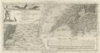
Vestigium Operationis Astronomico-Geometricae :
1 : 533000 Mollova mapová sbírka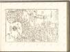

Barser und Honther Comitat
1 : 290000 Levice (Slovensko : oblast)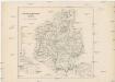
Barser und Honther Comitat
1 : 288000 Levice-oblast (Slovensko)
Schemnitz 134, uit: Special-Karte von Mittel-Europa / nach amtlichen Quellen bearbeitet von W. Liebenow
1 : 300000 titelvariant: W. Liebenow's Mittel-Europa; Annotatie: Titel boven de bladen: W. Liebenow's Mittel-Europa Johannes Wilhelm Liebenow 1822-1897 Frankfurt a. M. : Ludwig Ravenstein
Unter Neutraer-Comitat
1 : 280000 Nitra-oblast (Slovensko)
Unter Neutraer-Comitat
1 : 290000 Nitra (Slovensko : oblast)
Stolice Tekov. Stolice Hont
Komitat Hont, Komitat Bars, ethnische Gruppe
C. Strigontensis
Ungarn Komitat Gran (Ungarn)
Stolice Prešpurk a Nitra
Bratislava, Nitra, ethnische Gruppe
Mappa Comitatvs Nitriensis :
1 : 170000 Mollova mapová sbírka Mikoviny, Sámuel Nicolaï, Georg David Christoph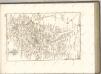

Generalkarte von Zentraleuropa
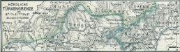
Nördliche Türkengrenze im 16ten u. 17ten Jhdt.
1 : 1850000 Osmanisches Reich / Europäischer Teil Grenze
Bez titulu: mapy slovenských krajů
Neubertova generální automapa Republiky československé
1 : 200000 Bratislava (Slovensko : oblast) Soukup, Jan V. Neubert a synové
Die Donau, der Fürst aller Europaeischen Flüsse :
Mollova mapová sbírka Hoffmann, Johannes Hoffmann, Johann
Vermehrte und Verbesserte Landkarten des Königreichs Ungarn :
1 : 500000 Mollova mapová sbírka Stier, Martin Böner, Johann-Alexander Endter, Martin