Maps of Úhorná

III. vojenské mapování 4565/2
1 : 25000
[Mapový list]
1 : 25000 Slovensko Vojenský zeměpisný ústav
Rožňava
1 : 75000 Maďarsko Vojenský zeměpisný ústav
Rožňava
1 : 75000 Maďarsko Vojenský zeměpisný ústav
Rožňava
1 : 75000 Maďarsko Vojenský zeměpisný ústav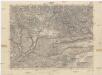
Rožňava
1 : 75000 Maďarsko Vojenský zeměpisný ústav
Rosenau und Szilas
1 : 75000 Rožňava, Umland Geripp: Führ. Karger. Terrain: Hauptm. A. Pitron
III. vojenské mapování 4565
1 : 75000
Rosenau und Szilas.
from Spezialkarte der osterreichisch-ungarischen Monarchie.
Slovenský Kras

Iglo und Mereny.
from Spezialkarte der osterreichisch-ungarischen Monarchie.
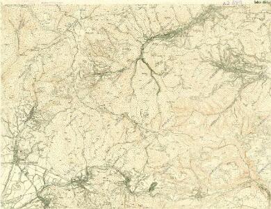
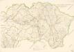
III. vojenské mapování 4566/1
1 : 25000
Slovenský raj

[Mapový list]
1 : 25000 Slovensko Vojenský zeměpisný ústav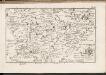
C. Tornensis
Ungarn Komitat Torna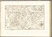

Leutschau 121, uit: Special-Karte von Mittel-Europa / nach amtlichen Quellen bearbeitet von W. Liebenow
1 : 300000 titelvariant: W. Liebenow's Mittel-Europa; Annotatie: Titel boven de bladen: W. Liebenow's Mittel-Europa Johannes Wilhelm Liebenow 1822-1897 Frankfurt a. M. : Ludwig Ravenstein
Stolice Abauj-Torna a Boršod
Abaúj-Torna, Komitat Borsod, ethnische Gruppe
C. Scepusiensis
Slowakei Komitat Zips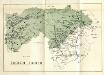
Stolice Zvolen a Gemer
Komitat Altsohl, Komitat Gemer, ethnische Gruppe
Zipser Comitat
1 : 280000 Spiš (Slovensko)
Comitat Abaúj-Torna
1 : 290000 Košice (Slovensko : oblast)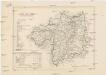
Comitat Abaúj-Torna
1 : 288000 Košice-oblast jižní (Slovensko)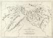
Appendix ad Mappam Mineralographicam
Mollova mapová sbírka Marsili, Luigi Ferdinando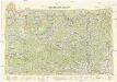
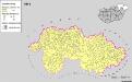
Neubertova generální automapa Republiky československé
1 : 200000 Košice (Slovensko : oblast) Soukup, Jan V. Neubert a synové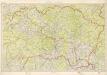
Kraj Košický a Prešovský
Bez titulu: mapy slovenských krajů
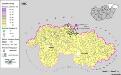
Siedlungsgebiet der Slowaken nach dem Nachbarschaftsindex für Nordost-Ungarn 1941
Ungarn (Nordost) Slowaken, Siedlung Bottlik, Zsolt
Siedlungsgebiet der Slowaken nach dem Nachbarschaftsindex für Nordost-Ungarn 1980
Ungarn (Nordost) Slowaken, Siedlung Bottlik, Zsolt