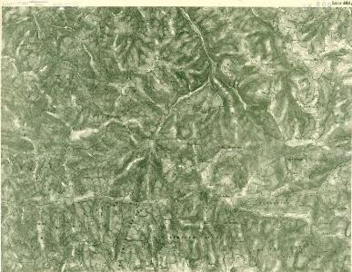
Maps of Heľpa

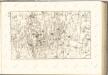
III. vojenské mapování 4464/1
1 : 25000
[Gradkartenblatt]
1 : 25000 Nízké Tatry (Slovensko) Vojenský zeměpisný ústav
[Gradkartenblatt]
1 : 25000 Nízké Tatry (Slovensko)
III. vojenské mapování 4464
1 : 75000
Quellencebiet Der Cran.; Spezialkarte der osterreichisch-ungarischen Monarchie.
from Spezialkarte der osterreichisch-ungarischen Monarchie. Austro-Hungarian Monarchy. Militärgeographisches Institut.,
Quellengebiet der Gran (Garam)
1 : 75000 Hron (Slovensko : řeka : oblast) Kartografické odd. při Min. nár. obrany
Nízké Tatry východná časť

Nízké Tatry – Východná časť

Pohorelá
1 : 75000 Slovensko Vojenský zeměpisný ústav
Pohorelá
1 : 75000 Slovensko Vojenský zeměpisný ústav
Quellencebiet Der Cran.
from Spezialkarte der osterreichisch-ungarischen Monarchie.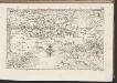
C. Liptoviensis
Slowakei Komitat Liptau
Comitat-Liptau
1 : 288000 Liptov (Slovensko)
Comitat-Liptau
1 : 288000 Liptov (Slovensko)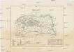
Comitat-Liptau
1 : 288000 Liptov (Slovensko)
Hohe Tatra.
from Spezialkarte der osterreichisch-ungarischen Monarchie.
[Gradkartenblatt]
1 : 25000 Nízké Tatry (Slovensko) Vojenský zeměpisný ústav
[Gradkartenblatt]
1 : 25000 Nízké Tatry (Slovensko)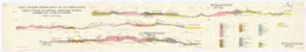
Profily Centrálními Západními Karpaty na listu Báňská Bystrica
1 : 50000 Banská Bystrica (Slovensko : oblast) V. Neubert a synové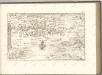


Stolice Orava a Liptov
Komitat Arva, Komitat Liptau, ethnische Gruppe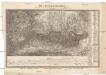
Die Central-Karpaten
1 : 200000 Karpaty Sydow, A. von Wolff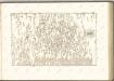

Leutschau 121, uit: Special-Karte von Mittel-Europa / nach amtlichen Quellen bearbeitet von W. Liebenow
1 : 300000 titelvariant: W. Liebenow's Mittel-Europa; Annotatie: Titel boven de bladen: W. Liebenow's Mittel-Europa Johannes Wilhelm Liebenow 1822-1897 Frankfurt a. M. : Ludwig Ravenstein
C. Gömöriensis
Slowakei Komitat Gemer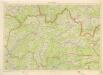
Kraj Žilinský

Zipser Comitat
1 : 280000 Spiš (Slovensko)