Maps of Smerek

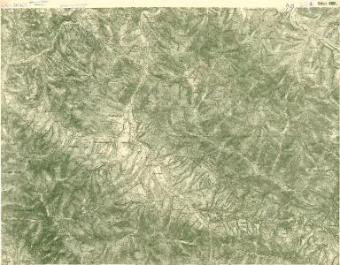
III. vojenské mapování 4369/1
1 : 25000
[Gradkartenblatt]
1 : 25000 Národní park Poloniny (Slovensko) Vojenský zeměpisný ústav
[Gradkartenblatt]
1 : 25000 Národní park Poloniny (Slovensko)
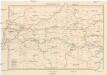
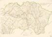
Zemplénoroszi und Dydiowa
1 : 75000 Chlum K. u. k. Militärgeographisches Institut
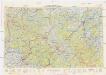
Ruské
1 : 75000 Polsko Vojenský zeměpisný ústav

Zemplénoroszi und Dydiowa
1 : 75000 Bieszczady Geripp: Feuerwkr. Sorè u. Aspr. Chlum. Terrain: Oberlt. Sachs u. Offiz. Hanusch
III. vojenské mapování 4369
1 : 75000
Zemplenoroszi und Dydiowa.; Spezialkarte der osterreichisch-ungarischen Monarchie.
from Spezialkarte der osterreichisch-ungarischen Monarchie. Austro-Hungarian Monarchy. Militärgeographisches Institut.,
Ruská a Dydiowa
1 : 75000 Polsko Vojenský zeměpisný ústav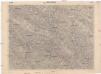
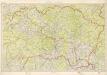
Ruská a Dydiowa
1 : 75000 Slovensko Vojenský zeměpisný ústav
[Gradkartenblatt]
1 : 25000 Národní park Poloniny (Slovensko) Vojenský zeměpisný ústav
[Gradkartenblatt]
1 : 25000 Národní park Poloniny (Slovensko)
Normální mezinárodní letecká mapa.
Neubertova generální automapa Republiky československé
1 : 200000 Soukup, Jan V. Neubert a synové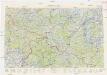
Neubertova generální automapa Republiky československé
1 : 200000 Soukup, Jan V. Neubert a synové
Stolice Zemplín a Užhorod
Komitat Zemplín, Komitat Uschgorod, ethnische Gruppe
Stolice Zemplín a Užhorod
Užhorod (Ukrajina)
Generalkarte von Zentraleuropa
Kraj Košický a Prešovský
Bez titulu: mapy slovenských krajů
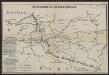
Übersichtskarte des Kampfgeländes
1 : 650000 Polen Tarnów Weltkrieg <1914-1918> Verl. Gerhard Stalling, Oldenburg
Podkarpatská Rus
1 : 500000 Berehove (Ukrajina) Fastr Eduard
Slovensko

Podkarpatská Rus
1 : 300000 Berehove (Ukrajina) Fastr Eduard
Ost-Galizien
Halič (Polsko a Ukrajina) Liesganig, Joseph im Verlage des Kunst und Industrie Comptoirs
Ober Ungern
Slovensko východní Kipferling, Karl Joseph Müller, Karl im Verlage des Kunst und Industrie Comptoir's
Ober Ungern
Slovensko východní Kipferling, Karl Joseph Müller, Karl im Verlage des Kunst und Industrie Comptoir's