Maps of Nordrhein-Westfalen

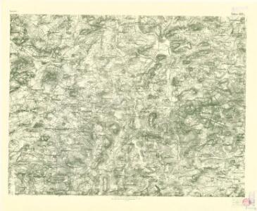
III. vojenské mapování 4251/1
1 : 25000
Germany No.4.
1 : 1375000 Colton, G.W.
Empire of Germany (southern portion).
1 : 1050000 Johnston, W. & A.K.
Germaniae, Galliae & Rhaetiae pars
1 : 2850000 Galie Heimburger, August Bibliographisches Institut
West Deutschland
Neuer Handatlas über alle Theile der Erde Kiepert, Heinrich Verlag von Dietrich Reimer
Western Germany.
1 : 1340000 Arrowsmith, John
German Empire 1.
1 : 1774080 Letts, Son & Co.
Northern and Central Germany.
1 : 2154240 Fullarton, A. & Co.
Germany north.
1 : 2800000 Arrowsmith, Aaron; Lewis, Samuel
Germany north.
1 : 2800000 Arrowsmith, Aaron; Lewis, Samuel
Weiland ́s Specialkarte der west-norddeutschen Bundesstaaten

Special-Karte der west-norddeutschen Bundesstaaten

Germany (Deutschland)
1 : 1776000 Hannover (Německo) Walker, C. Baldwin & Cradock
Germany.
1 : 1500000 Colton, G.W.
Radfahrer-übersichstkarte von Deutschland

Germany No. 2.
1 : 1393920 Colton, G.W.
Germany.
1 : 1500000 Colton, G.W.
Germany.
1 : 1500000 Colton, G.W.
Possessions du roi de Prusse a l'ouest du Weser
1 : 1730000 Neuchâtel (Švýcarsko) Mentelle, Edme Tardieu, Pierre François
Eisenbahnkarte von Nordwest-Deutschland
1 : 2000000 Německo severozápadní Geograph. Anstalt von Wagner & Debes
Germany Central.
1 : 1100000 Hall, S. (Sidney)
Laender zwischen der Maas und der Elbe
1 : 1442000 Labe-oblast (Česko a Německo) Tranquillo Mollo
Germany No. 2.
1 : 1500000 Colton, G.W.
Germany No.3.
1 : 1375000 Colton, G.W.
Saxoniae superioris circulus
1 : 620000 Anhaltsko (Německo) Seutter, Matthäus per Matth. Seutter
Saxoniae superioris circulus
1 : 620000 Anhaltsko (Německo) Seutter, Matthäus M. Seutter
Weiland's Specialkarte der west-norddeutschen Bundesstaaten
Bavorsko (Německo) Weiland, Karl Ferdinand Beck'schen Univ. Buchh. (A. Hölder)
Westdeutsches Mittelgebirge
Plastischer Schul-Atlas über alle Theile der Erde : in 24 Karten Woldermann, G Verlag von P. Eckerlein
Karte über die Circulation der böhmischen Braunkohle während des Jahres 1870
Německo Pechar, Johann C.H. Hunger