Maps of Stříbrná
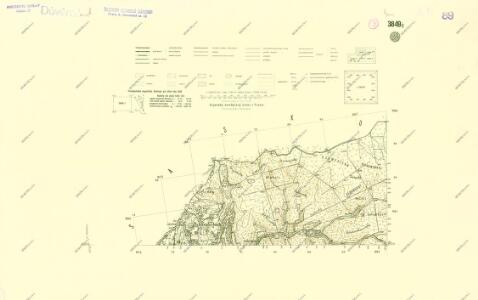
III. vojenské mapování 3849/1
1 : 25000
III. vojenské mapování 3849/1
1 : 25000
Silberbach - c7464-2-010 - Kaiserpflichtexemplar der Landkarten des stabilen Katasters
1 : 2880
Silberbach - c7464-2-005 - Kaiserpflichtexemplar der Landkarten des stabilen Katasters
1 : 2880
Silberbach - c7464-2-002 - Kaiserpflichtexemplar der Landkarten des stabilen Katasters
1 : 2880
Silberbach - c7464-2-003 - Kaiserpflichtexemplar der Landkarten des stabilen Katasters
1 : 2880
Silberbach - c7464-2-007 - Kaiserpflichtexemplar der Landkarten des stabilen Katasters
1 : 2880
Silberbach - c7464-2-009 - Kaiserpflichtexemplar der Landkarten des stabilen Katasters
1 : 2880
Silberbach - c7464-2-001 - Kaiserpflichtexemplar der Landkarten des stabilen Katasters
1 : 2880
Silberbach - c7464-2-004 - Kaiserpflichtexemplar der Landkarten des stabilen Katasters
1 : 2880
Silberbach - c7464-2-011 - Kaiserpflichtexemplar der Landkarten des stabilen Katasters
1 : 2880
Silberbach - c7464-2-008 - Kaiserpflichtexemplar der Landkarten des stabilen Katasters
1 : 2880
Silberbach - c7464-2-006 - Kaiserpflichtexemplar der Landkarten des stabilen Katasters
1 : 2880
Schwaderbach - c0621-2-001 - Kaiserpflichtexemplar der Landkarten des stabilen Katasters
1 : 2880
Schwaderbach - c0621-2-002 - Kaiserpflichtexemplar der Landkarten des stabilen Katasters
1 : 2880
Schwaderbach - c0621-2-004 - Kaiserpflichtexemplar der Landkarten des stabilen Katasters
1 : 2880
Schwaderbach - c0621-2-003 - Kaiserpflichtexemplar der Landkarten des stabilen Katasters
1 : 2880
Schwaderbach - c0621-2-005 - Kaiserpflichtexemplar der Landkarten des stabilen Katasters
1 : 2880
[Kartenblatt]
1 : 25000 Bublava (Česko) Reichsamt für Landesaufnahme
Bezirk Graslitz

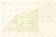
Soubor přehledných map pro plánování a statistiku: 3849 – Kraslice
Mapy plánování ČSR

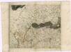
Müllerova mapa Čech
1 : 132000
III. vojenské mapování 3849
1 : 75000
Graslitz und Johanngeorgenstadt
1 : 75000 Johanngeorgenstadt (Německo : oblast) Höller, K. K. u. k. militär-geographisches Institut
Graslitz und Johanngeorgenstadt
1 : 75000 Johanngeorgenstadt (Německo : oblast) Höller, K. K. u. k. Militärgeographisches Institut
Graslitz und Johanngeorgenstadt
1 : 75000 Johanngeorgenstadt (Německo : oblast) K. u. k. Militärgeographisches Institut
Kraslice
1 : 75000 Kraslice-oblast (Česko) Vojenský zeměpisný ústav