Maps of Yasinia

III. vojenské mapování 4773
1 : 75000
13 zóna, XXXI rovat, Bogdán Vidéke, uit: [Geologische Specialkarte der im Reichsrathe vertretenen Königreiche und Länder der österreichisch-ungarischen Monarchie] / geologische Aufnahmen der königl. ung. Geologischen Anstalt
1 : 75000 Annotatie: Verantwoordelijkheidsvermelding in 1909 veranderd in: Königliche Ungarische Geologische Reichsanstalt; Sommige bladen in het Frans; Annotatie geografische gegevens: Coördinaten gebaseerd op nulmeridiaan van Ferro (Hierro) Königliche Ungarische Geologische Reichsanstalt; Königliche Ungarische Geologische Anstalt Budapest : [Königliche Ungarische Geologische Anstalt]
Bogdán
1 : 75000 Bogdan Vodă, Marmarosch, Umland Schrift und Gerippe v. Assistent Leitner. Terrainschraffirung v. Lieut. R. Meschede
Bogdan.; Spezialkarte der osterreichisch-ungarischen Monarchie.
from Spezialkarte der osterreichisch-ungarischen Monarchie. Austro-Hungarian Monarchy. Militärgeographisches Institut.,
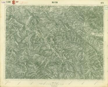
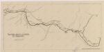
Bila Tisa
1 : 75000 Ukrajina Vojenský zeměpisný ústav
Řiditelství [sic] státních lesů Rachovo
1 : 75000 Voj. zeměpisný ústav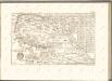

Brustury
1 : 75000 Ukrajina Vojenský zeměpisný ústav

Korosmezo und Mikuliczyn.
from Spezialkarte der osterreichisch-ungarischen Monarchie.
Mapa turistických cest značkovaných odb. K.Č.S.T. Rachov
1 : 200000 Československo Odbor klubu čsl. turistů
Körösmezö und Mikuliczyn
1 : 75000 Jasinja-oblast (Ukrajina) Jonak, Edl. Freyenwald von K. u. k. Militärgeographisches Institut
Generalkarte von Zentraleuropa

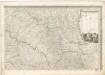
Máramaros vármegye térképe
1 : 500000 Maramureş (Rumunsko) Kogutowicz, Manó Magyar Földrajzi Intézet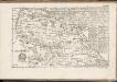
C. Marmarus
Rumänien Komitat Marmarosch
Comitat Marmaros
1 : 288000 Maramureş (Rumunsko)
Comitat Marmaros
1 : 280000 Marmarošská Sihoť (Rumunsko : oblast)
Generalkarte von Zentraleuropa
Sbírka map a diagramů použitých na mírových konferencích v Paříži v letech 1919 - 1920

Podkarpatská Rus
1 : 500000 Berehove (Ukrajina) Fastr Eduard
[Bukowina, Galizien]
1 Karte : Kupferdruck ; 18 x 13 cm [Trattner]
Podkarpatská Rus
1 : 300000 Berehove (Ukrajina) Fastr Eduard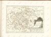

Russia
Mollova mapová sbírka Hoffmann, Johannes Hoffmann, Johann
Ober Ungern
Rumunsko severní im Verlage des Kunst und Industrie Comptoirs
Ober Ungern
Rumunsko severní Ossenbrug, J. von Müller, Franz im Verlage des Kunst und Industrie Comptoirs
Vermehrte und Verbesserte Landkarten des Königreichs Ungarn :
1 : 500000 Mollova mapová sbírka Stier, Martin Böner, Johann-Alexander Endter, Martin
Carte de la Roumanie et pays limitrophes. Lemberg
1 : 500000 France. Service géographique de l'armée [Paris] : Service géographique de l'armée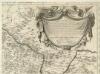
Augustissimo Romanor. Imperatori Iosepho I. Hungaria Regi Invictissimo Mappam Hanc Regni Hungariae
1 : 540000 Mollova mapová sbírka Müller, Johann Christoph