Maps of Putnoki járás

III. vojenské mapování 4665
1 : 75000
Szendrő
1 : 75000 Szendrő, Szendrő (Region)
Bretka
1 : 75000 Maďarsko Vojenský zeměpisný ústav
Szendrö und Putnok
1 : 75000 Maďarsko Bloschitz, R. K. u. k. Militärgeographisches Institut
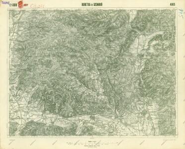
Beretka a Szendrö
1 : 75000 Maďarsko Vojenský zeměpisný ústav
Szendrö a Putnok
1 : 75000 Maďarsko Kartografické odd. při Min. nár. obrany
[Mapový list]
1 : 25000 Slovensko Vojenský zeměpisný ústav
III. vojenské mapování 4665/1
1 : 25000
III. vojenské mapování 4665/3
1 : 25000
[Mapový list]
1 : 25000 Slovensko Vojenský zeměpisný ústav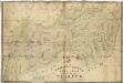
Gömörpanyit helysége határának Terképe

Szendro und Putnok (Ungarn).
from Spezialkarte der osterreichisch-ungarischen Monarchie.
Tornal'a a okolí
1 : 75000 Vojenský zeměpisný ústav
C. Tornensis
Ungarn Komitat Torna

Borsod vármegye
1 : 410000 Görög, Demeter Biller, Bernhard Görög
Borsoder Comitat
1 : 288000
Borsoder Comitat
1 : 288000
C. Borsodiensis
Ungarn Komitat Borsod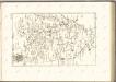

Stolice Abauj-Torna a Boršod
Abaúj-Torna, Komitat Borsod, ethnische Gruppe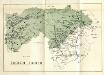
Stolice Zvolen a Gemer
Komitat Altsohl, Komitat Gemer, ethnische Gruppe
C. Gömöriensis
Slowakei Komitat Gemer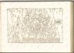

Rima-Szombat 135, uit: Special-Karte von Mittel-Europa / nach amtlichen Quellen bearbeitet von W. Liebenow
1 : 300000 titelvariant: W. Liebenow's Mittel-Europa; Annotatie: Titel boven de bladen: W. Liebenow's Mittel-Europa Johannes Wilhelm Liebenow 1822-1897 Frankfurt a. M. : Ludwig Ravenstein
Rimavská Sobota, Číž – Domica

Rosenau und Szilas.
from Spezialkarte der osterreichisch-ungarischen Monarchie.
Miskolcz.
from Spezialkarte der osterreichisch-ungarischen Monarchie.
Goncz und Csobad (Ungarn).
from Spezialkarte der osterreichisch-ungarischen Monarchie.