Mappa catalogata
Philadelphia and vicinity : Pennsylvania and New Jersey


Titolo completo:Philadelphia and vicinity : Pennsylvania and New Jersey
Anno di illustrazione:1896
Data di pubblicazione:1896
Editore:U.S. Geological Survey
Dimensione fisica:20 x 30 cm
Scala della mappa:1:62 500
Philadelphia County, Pennsylvania
1983
Geological Survey (U.S.)
1:50k
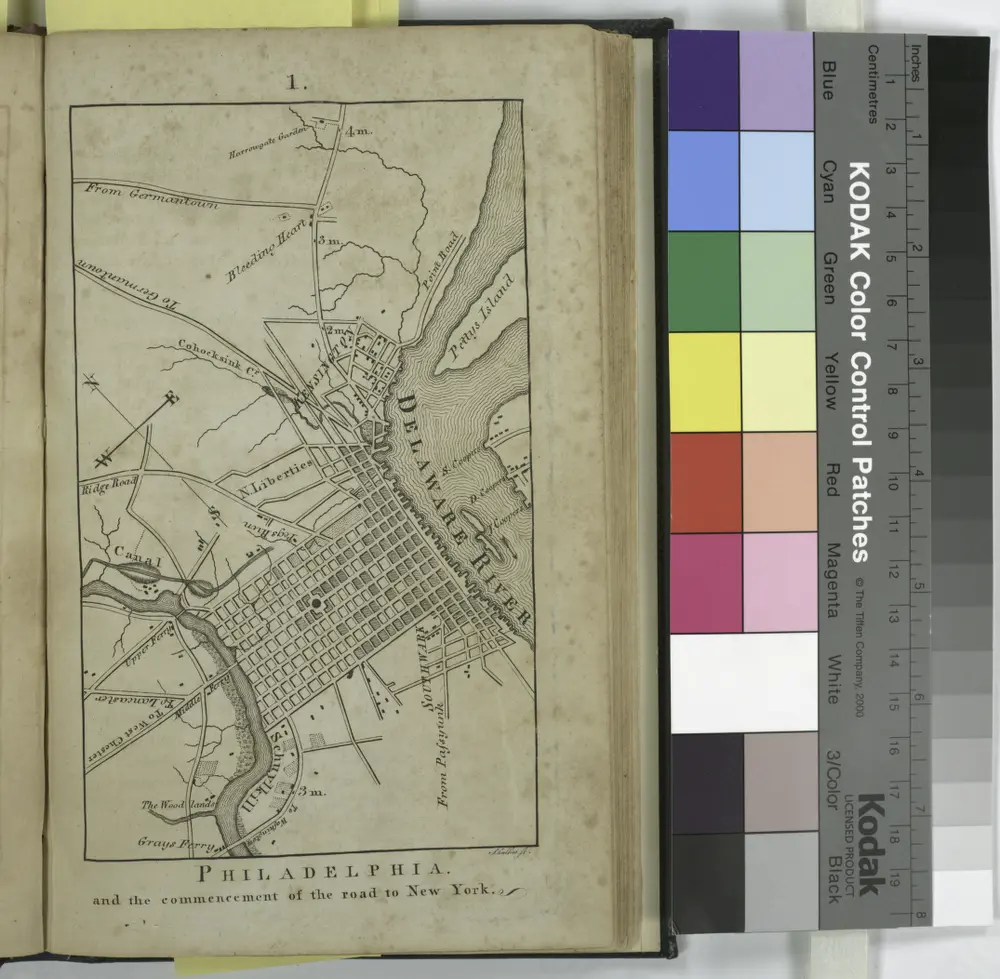
Philadelphia and the commencement of the road to New York / Shallus sc.
1802
New map of the city of Philadelphia, 1900 : from the latest city surveys : prepared for Gopsill's directories 1900
1900
Smith, John L., b. 1846
1:22k
New map of the city of Philadelphia : from the latest city surveys : prepared for Gopsill's directories 1893
1893
Smith, J. L
1:22k
Fac simile of Reed's map : to the honourable House of Representatives of the freemen of Pennsylvania this map of the city and liberties of Philadelphia with the catalogue of purchasers is humbly dedicated by their most obedient humble servant, Iohn Reed
1774
Reed, John, 1738-1776
1:24k
Map of Philadelphia, Camden and vicinity : compiled from city plans & personal surveys
1921
Smith, Elvino V., 1870-1932
1:35k
New map of Philadelphia
1882
Pickwick & Co
A map of Philadelphia and parts adjacent : with a perspective view of the State-House
1750
Scull, Nicholas, 1686?-1761?
1:65k
Plan of the city of Philadelphia and Camden
1874
Gamble, W. H. (William H.)
1:25k
Rand McNally new commercial atlas map of Philadelphia
1916
Rand McNally and Company
1:20k