Mapa catalogado
A topographical map of the northn. part of New York Island : exhibiting the plan of Fort Washington, now Fort Knyphausen, with the rebels lines to the southward, which were forced by the troops under the command of the Rt. Honble. Earl Percy on the 16th. Novr. 1776, and survey'd immediately after by order of His Lordship


Título completo:A topographical map of the northn. part of New York Island : exhibiting the plan of Fort Washington, now Fort Knyphausen, with the rebels lines to the southward, which were forced by the troops under the command of the Rt. Honble. Earl Percy on the 16th. Novr. 1776, and survey'd immediately after by order of His Lordship
Año de ilustración:1777
Fecha de publicación:1777
Editorial:Wm. Faden
Tamaño físico:20 x 30 cm
Escala del mapa:1:20 000
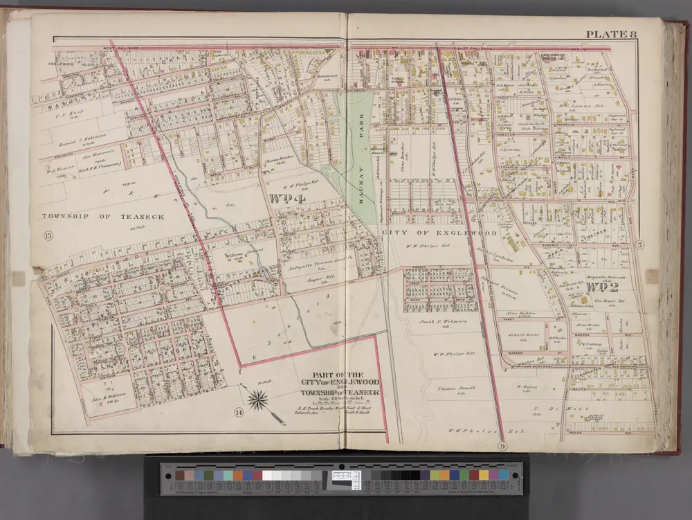
Bergen County, V. 1, Double Page Plate No. 8 [Map bounded by W. Palisade Ave., Dana Pl., Broad Ave., Teaneck Rd.] / by George W. and Walter S. Bromley.
1912
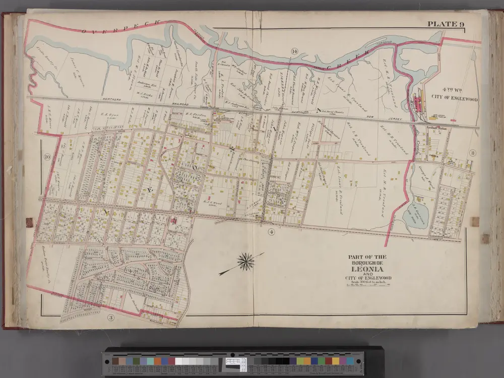
Bergen County, V. 1, Double Page Plate No. 9 [Map bounded by Overpeck Creek, Cedar Lane, Phelps Ave., Broad Ave., Borough Blvd., Oakdene Ave.] / by George W. and Walter S. Bromley.
1912
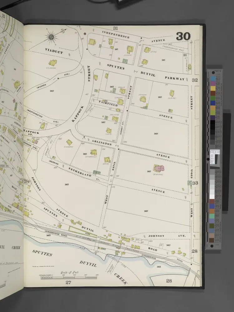
Manhattan, V. 12, Plate No. 30 [Map bounded by Independence Ave., W. 230th St., Spuyten Duyvil Creek]
1900

1C - N.Y. City (Aerial Set).
1924
A topographical map of the northn. part of New York Island : exhibiting the plan of Fort Washington, now Fort Knyphausen, with the rebels lines to the southward, which were forced by the troops under the command of the Rt. Honble. Earl Percy on the 16th. Novr. 1776, and survey'd immediately after by order of His Lordship
1777
Sauthier, Claude Joseph
1:20k
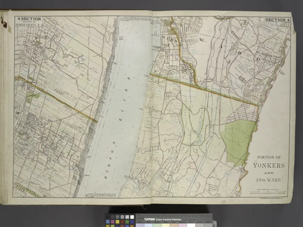
Portion of Bergen County, N.J.; Portion of Yonkers and 24th Ward.
1891
Yonkers
1998
1:24k
Yonkers
1966
1:24k
Yonkers
1966
1:24k
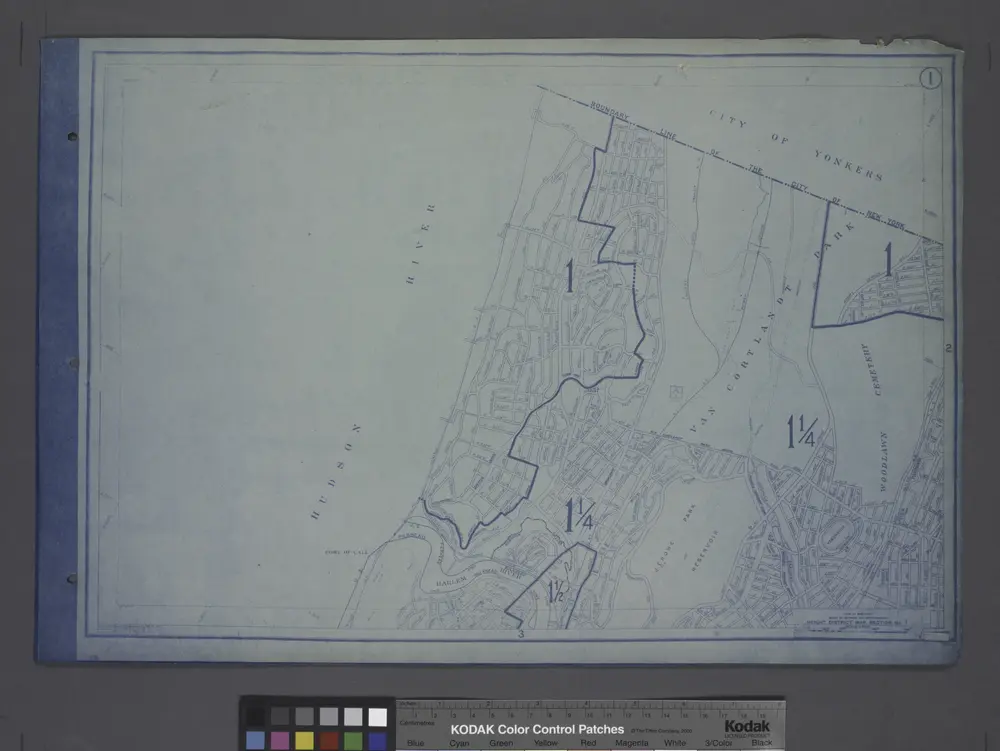
Height District Map Section No. 1
1916