Maps of Cambridge

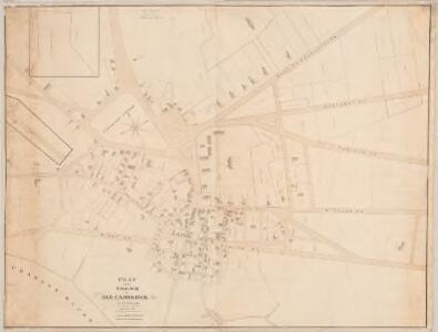
Plan of the village in old Cambridge
1 : 1200 Wadsworth, Alexander, 1806-1898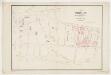
Plan of building lots belonging to Mrs. Washington Allston, on the estate of the late Chief Justice Dana in Cambridge
1 : 1200 McKean, Henry S Ephm. W. Bouvé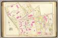
18. Ward 8.
1 : 1200 Bromley, George Washington; Bromley, Walter Scott
A plan of a part of the land belonging to the honorable Frances Dana, Esqr. lying in Cambridge
1 : 1980 Tufts, Peter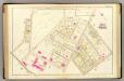
19. Ward 8.
1 : 1200 Bromley, George Washington; Bromley, Walter Scott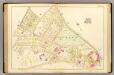
21. Ward 9.
1 : 1200 Bromley, George Washington; Bromley, Walter Scott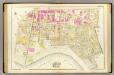
17. Wards 8-9.
1 : 1200 Bromley, George Washington; Bromley, Walter Scott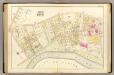
22. Ward 9.
1 : 1200 Bromley, George Washington; Bromley, Walter Scott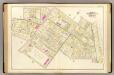
20. Wards 8-10.
1 : 1200 Bromley, George Washington; Bromley, Walter Scott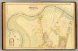
33. Ward 25 Brighton.
1 : 2400 Richards, L. J.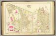
14. Wards 5, 8.
1 : 1200 Bromley, George Washington; Bromley, Walter Scott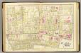
15. Wards 5, 7-8.
1 : 1200 Bromley, George Washington; Bromley, Walter Scott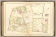
24. Ward 9-10.
1 : 1200 Bromley, George Washington; Bromley, Walter Scott
Map of the city of Cambridge, Middlesex County, Massachusetts
1 : 6000 Walling, Henry Francis, 1825-1888 Geo. L. Dix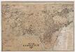
City of Cambridge, Mass
[s.n.]
Plan of the town of Brighton : made by order of the selectmen from actual surveys : Eastern sheet
1 : 3600 Wightman, H. M A. Meisel
Plan of the town of Brighton : made by order of the selectmen from actual surveys : Western sheet
1 : 3600 Wightman, H. M A. Meisel
A plan of those parts of Boston, and the towns in its vicinity, with the waters and flats adjacent, which are immediately or remotely connected with the contemplated design of erecting perpetual tide-mills

This plan drawn from a scale of 200 ft. to an in. : [Cambridgeport, Massachusetts]
1 : 2400 Tufts, Peter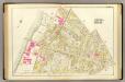
16. Wards 7-8.
1 : 1200 Bromley, George Washington; Bromley, Walter Scott
A plan of those parts of Boston and the towns in its vicinity : with the waters and flats adjacent which are immediately or remotely connected with the contemplated design of erecting perpetual tide-mills
1 : 15840 Dearborn, Benjamin, 1754-1838 Benjamin Dearborn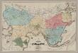
Plan of Cambridge
1 : 10560 W.A. Mason & Son Greenough & Co.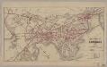
Map of the city of Cambridge for 1865
1 : 12672 Chase, J. G J.H. Bufford's Lith.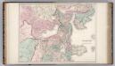
Boston and Vicinity.
1 : 19400 Gray, Ormando Willis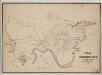
A map of Cambridge, Mass
1 : 12000 Hayward, James, 1786-1866 Eddy's Lithography
Map of the city of Boston and immediate neighborhood : from original surveys
1 : 5400 McIntyre, H. (Henry) H. McIntyre
Proposed Charles River park
1 : 21100 Davenport, Charles J.H. Bufford's Sons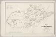
Map of Somerville, Mass
1 : 9600 Draper, Martin J.T. Powers & Co.'s Lith.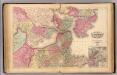
Boston.
1 : 19800 Walling, H. F.