Maps of Cambridge
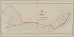
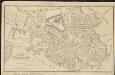
Plan of the city of Charlestown : made by order of the City Council from actual survey
1 : 4800 Felton & Parker J.H. Bufford's Lithogy.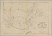
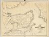
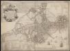
Rail-road crossings and termini in the vicinity of Boston : compiled under the direction of the commissioner appointed by the governor to report upon a plan or plans for avoiding said crossings
1 : 7200 Perkins, Charles E., 1951- Tappan & Bradford's Lithogy.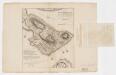
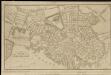
A plan of the action at Bunkers Hill on the 17th of June 1775 between His Majesty's troops, under the command of Major General Howe, and the American forces (without overlay)
1 : 4800 Page, Thomas Hyde, Sir, 1746-1821 Published by the author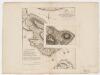
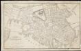
A plan of the action at Bunkers Hill on the 17th of June 1775 between His Majesty's troops, under the command of Major General Howe, and the American forces (with overlay)
1 : 4800 Page, Thomas Hyde, Sir, 1746-1821 Published by the author
Boston and Adjacent Cities.
1 : 20000 Colton, G.W.
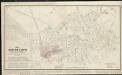
Plan of East Boston : shewing the location of a mill dam and other improvements
1 : 4800 Eddy, R. H. (Robert Henry), 1812-1887 Pendleton's Lithography
Boston with Charlestown and Roxbury

Sketch of the Action on the Heights of Charlestown.
Melish, John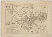
The town of Boston in New England
1 : 5600 Bonner, John, ca. 1643-1726 George G. Smith
Boston, Birthplace of the Telephone : A Pictorial Map of the Down Town Area
Chase, Ernest Dudley, 1878-1966
A rough and innacurate sketch of the streets of Boston as they are supposed to have been first laid out & the owners of the soil, from 1630 to 1650 or thereabouts
A new plan of ye great town of Boston in New England in America, with the many additionall buildings & new streets to the year 1743

Map of Boston proper

Plan of Boston showing existing ways and owners on December 25, 1635
1 : 7200 Lamb, George
Plan of Boston showing existing ways and owners on December 25, 1645

Plan of Boston showing existing ways and owners on December 25, 1640

Plan of Boston showing existing ways and owners on December 25, 1635

Plan of Boston

A new and correct plan of the town of Boston

Boston

Map of Boston in the state of Massachusetts
The South Cove territory, comprising every part which is coloured on this map
Plan of the city of Boston
Plan of the city of Boston
Plan of the city of Boston

Plan of Boston, 1828

A plan of Boston, from actual survey

Plan of Boston

Plan of Boston
1 : 9320 Edward Cotton