Mapa catalogado
Map showing route of marches of the army of Genl. W.T. Sherman, from Atlanta, Ga. to Goldsboro, N.C. : to accompany the report of operations from Savannah, Ga. to Goldsboro, N.C


Título completo:Map showing route of marches of the army of Genl. W.T. Sherman, from Atlanta, Ga. to Goldsboro, N.C. : to accompany the report of operations from Savannah, Ga. to Goldsboro, N.C
Año de ilustración:1865
Fecha de publicación:1865
Editorial:Lith. of P.S. Duval & Son
Tamaño físico:20 x 30 cm
Escala del mapa:1:1 950 000

Atlas Ameriquain Septentrional Contenant, mapa ze strany: [22]
1778
Chez le Rouge, Ingenieur Géographe du Roi, Rue des grands Augustins
To David Stone and Peter Brown, Esq. : this first actual survey of the state of North Carolina taken by the subscribers is respectfully dedicated
1808
Price, Jonathan, d. 1822
1:507k
A new and accurate map of North Carolina in North America
1779
1:1m
Virginiae item et Floridae Americae provinciarum, nova descriptio
1633
Hondius, Jodocus
1:3m
Frank Leslie's war maps
1861
Leslie, Frank
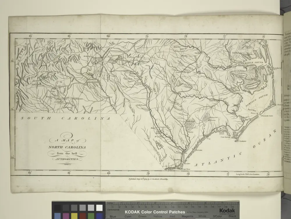
A map of North Carolina, from the best authorities.
1794
Carte des deux Carolines et de la Géorgie
1782
Hilliard d'Auberteuil, Michel René
1:3m
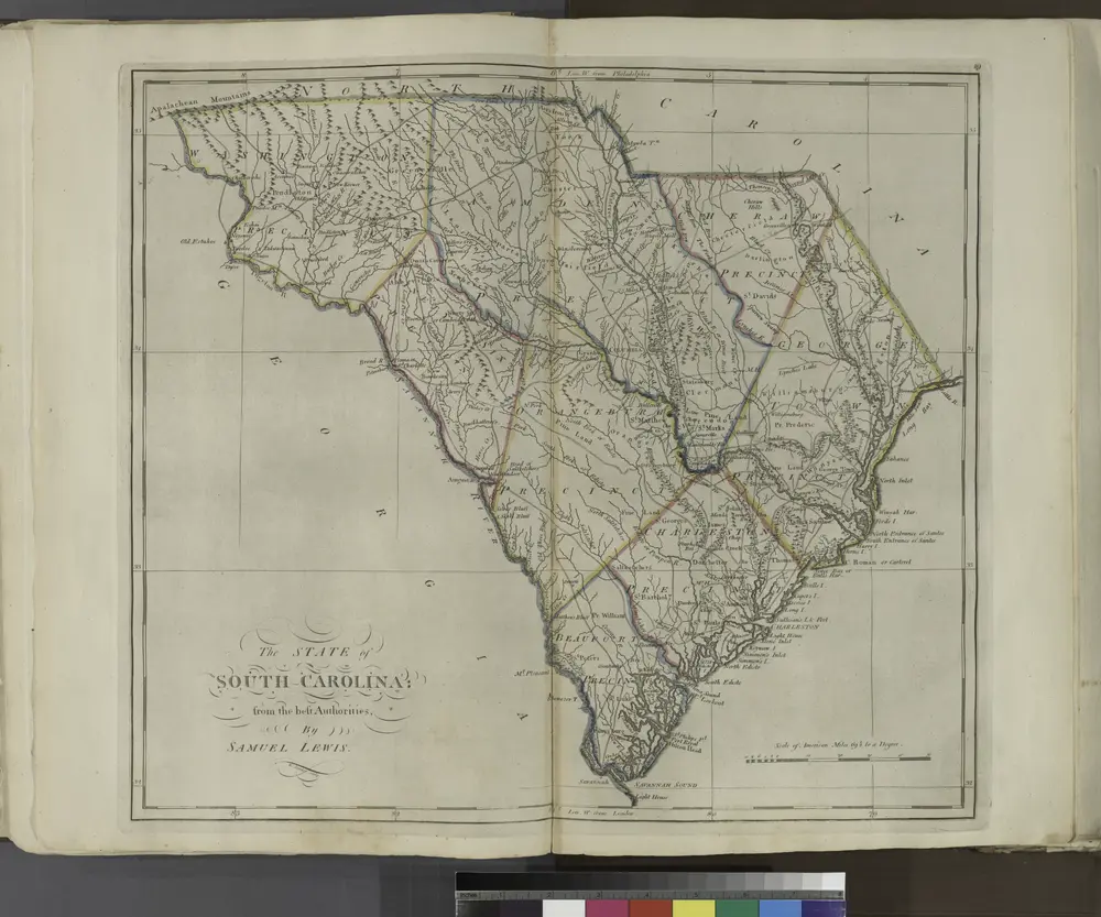
The State of South Carolina, from the bests authorities.
1814

Atlas minor, mapa ze strany: 655
1610
Mercator Gerhard
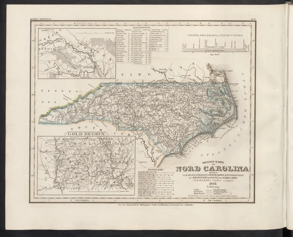
Neueste Karte von Nord Carolina mit seinen Canaelen, Strassen, Eisenbahnen, Entfernungen der Hauptpunkte und Routen für Dampfschiffe
1860
Meyer, J.