Mappa catalogata
Die Balkan-Halbinsel in 4 Blättern : Türkei, Rumänien, Griechenland, Serbien, Montenegro, Bulgarien


Titolo completo:Die Balkan-Halbinsel in 4 Blättern : Türkei, Rumänien, Griechenland, Serbien, Montenegro, Bulgarien
Anno di illustrazione:1908
Data di pubblicazione:1908
Editore:Justus Perthes
Dimensione fisica:20 x 30 cm
Scala della mappa:1:1 500 000
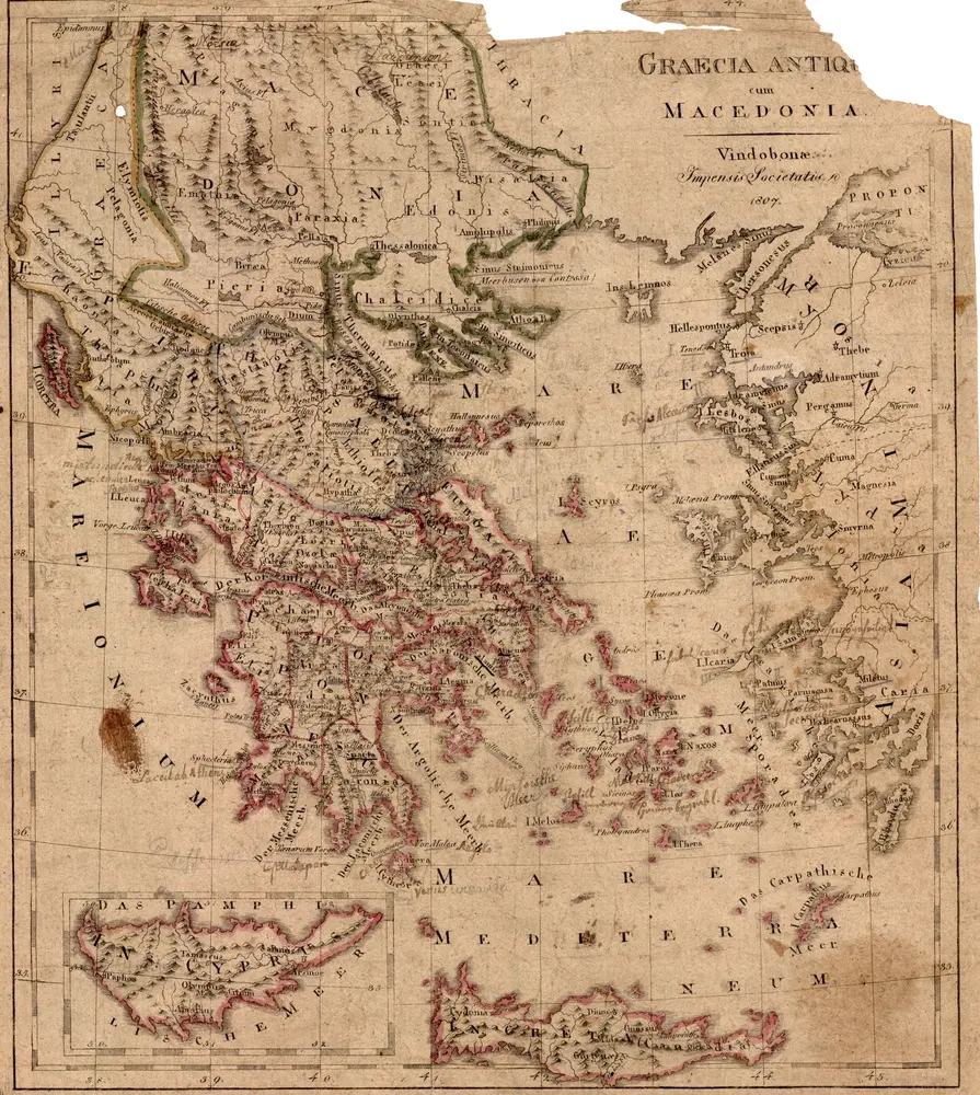
Graecia antiq[ua] cum Macedonia
1807
Impensis Societatis
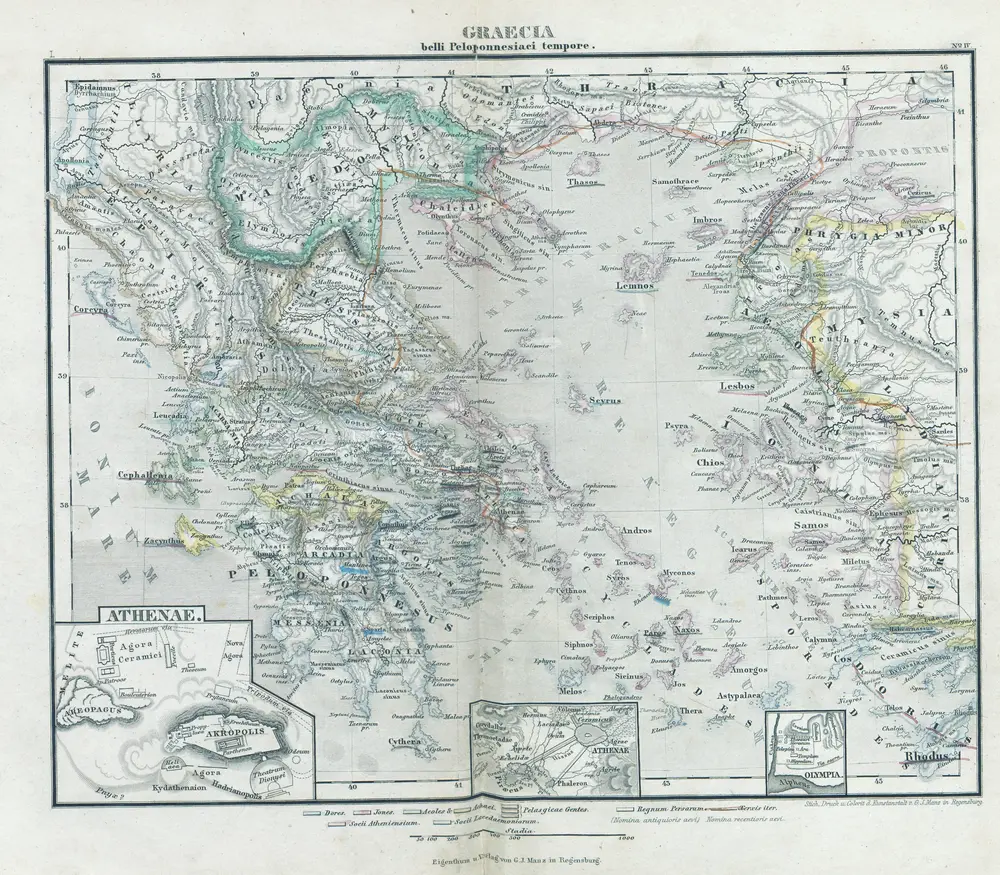
Graecia belli Peloponnesiaci tempore
1877
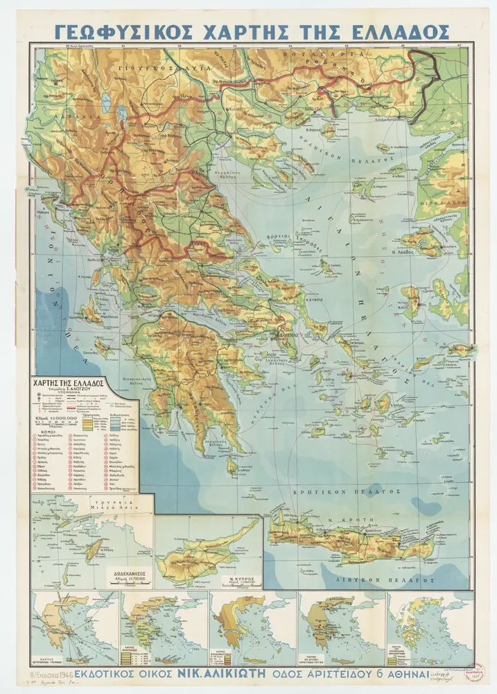
[Kaart], uit: Geofusikos chartēs tēs Ellados
1946
Athēnai : Nik. Alikiotē
1:1m

Dějiny lidstva od pravěku k dnešku. Díl 1. Světla východu a HelladySvětla východu a Hellady, mapa ze strany: 393
1940
Melantrich
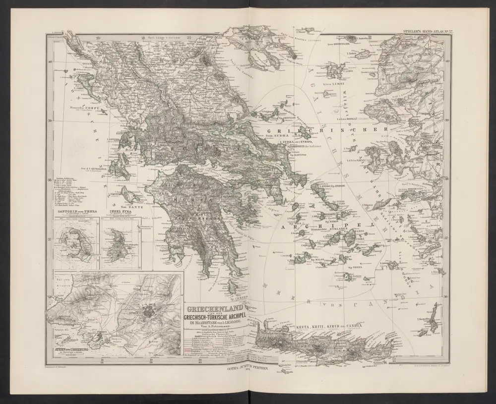
Griechenland und der Griechisch-Türkische Archipel
1876
Stieler, Adolf
Griechenland
1870
Eduard Hölzel
1:3m
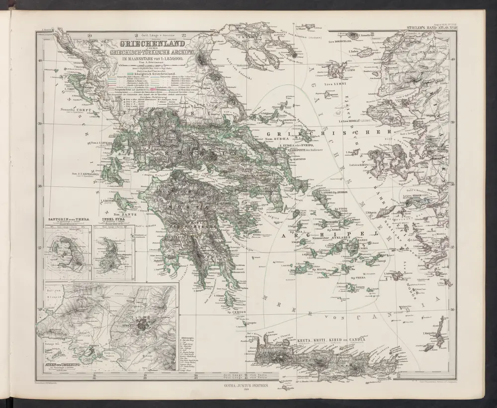
Griechenland und der Griechisch-Türkische Archipel
1869
Stieler, Adolf
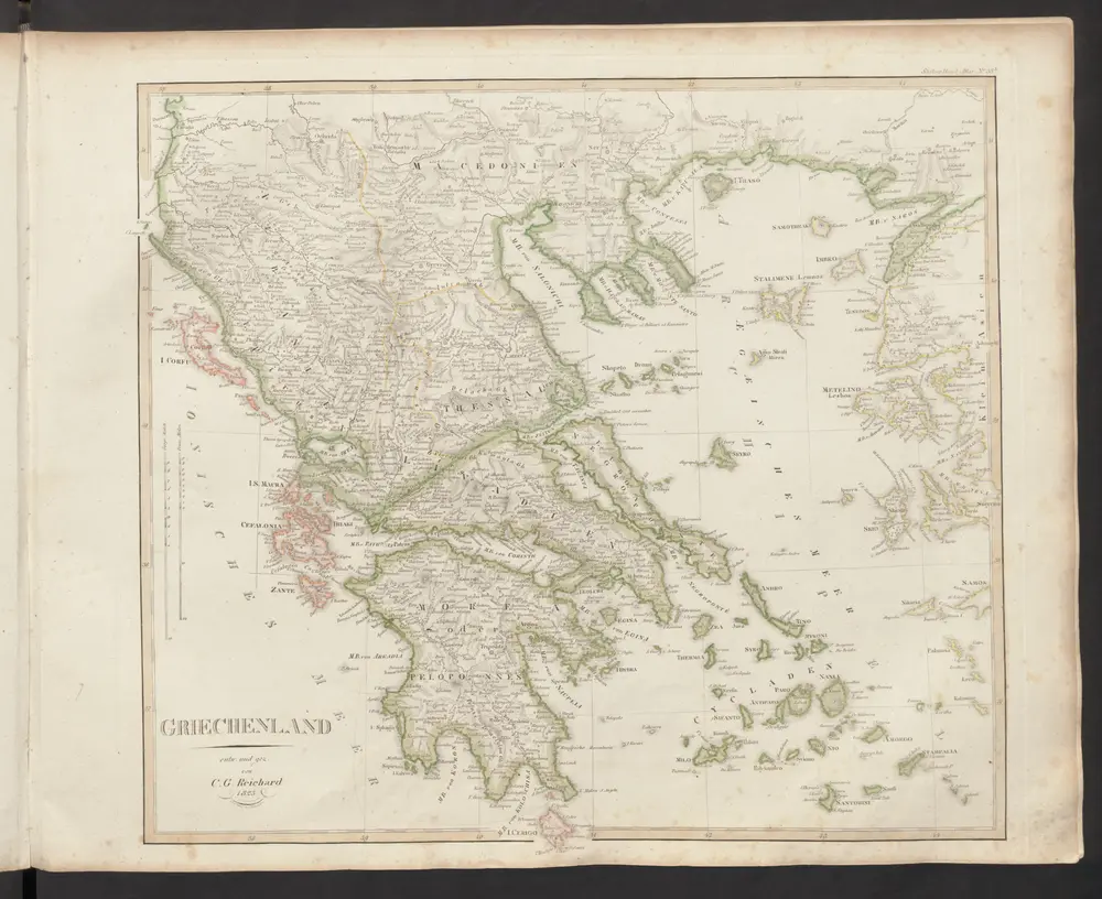
Griechenland
1833
Stieler, Adolf
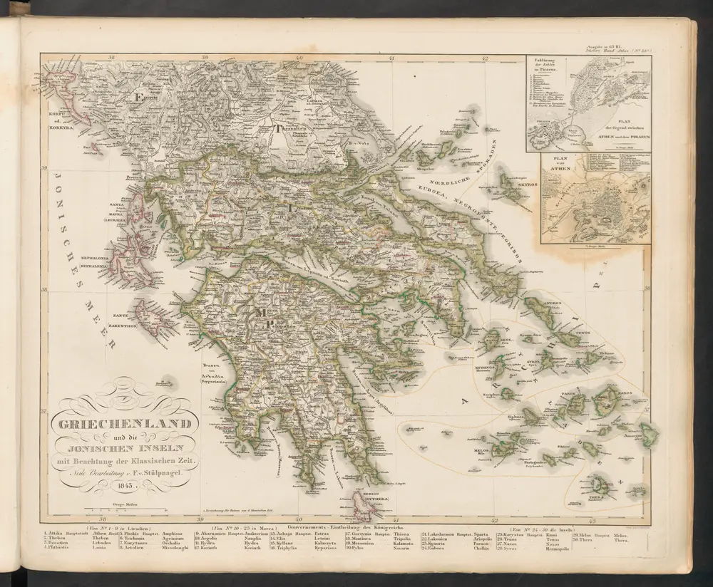
Griechenland und die Jonischen Inseln mit Beachtung der Klassischen Zeit
1845
Stieler, Adolf
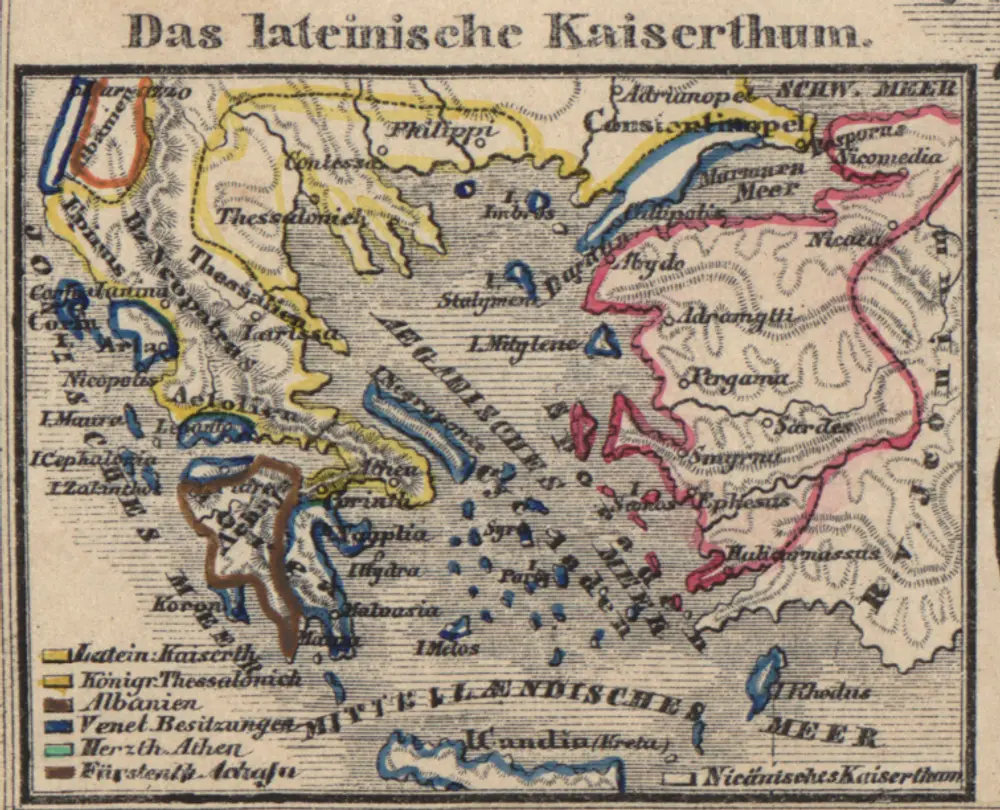
Das lateinische Kaiserthum
1261