Maps of Asia
Allgemeine Weltkarte auf welcher alle neue Entdeckungen eines Pérouse, Wilson, Vancouver, Mungo-Park, Brown etc. dargestellt sind : nach Marcators Projection undden zuverlässigsten Astronomishcen Bestimungen entworsen
Simon Schropp'sche Hof-Landkartenhandlung bei Simon Schropp et Comp.
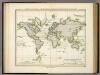
Welt-Karte, Globular-Proj.
1 : 150000000 Radefeld, Carl Christian Franz, 1788-1874
Planiglob zur Ubersicht der Verbreitung der Indo-Germanen .
1 : 140000000 Berghaus, Heinrich
Welt-Karte, Mercators Proj.
1 : 125000000 Radefeld, Carl Christian Franz, 1788-1874
World on Mercators Projection.
1 : 80000000 Tanner, Henry S.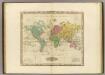
The World On Mercators Projection.
1 : 80000000 Tanner, Henry S.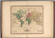
World on Mercators Projection.
1 : 80000000 Tanner, Henry S.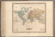
World on Mercators Projection.
1 : 80000000 Tanner, Henry S.
World on Mercators Projection.
1 : 80000000 Tanner, Henry S.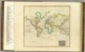
Hydrographical chart of the World.
1 : 82000000 Thomson, John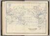
World Mercators proj.
1 : 70000000 Johnston, Alexander Keith, 1804-1871
World.
1 : 45000000 Robert Laurie & James Whittle
Mapa que demuestra el derrotero q[ue] : hizo M. Cook en 1776, 1777, 1778, y 1779 en su tercero y ultimo viaje
1 : 600000 Libreria de Copin Libreria de Copin
[Recto], uit: Noord- en Zuid-Amerika / [aardrijksk. medew. G.J. de Vries]
1 : 76000000 titelvariant: Landen van Amerika met de hoofdsteden; Amerika; Annotatie: Titel boven krt.: Landen van Amerika met de hoofdsteden; Titel op keerzijde: Amerika; Verso: statistische gegevens betreffende de voornaamste staatkundige gebieden; Annotatie geografische gegevens: Inzet: Aruba; Curaçao; Willemstad; Suriname Gerben Johannes de Vries 1886-1968 Sneek : Tonnema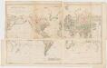
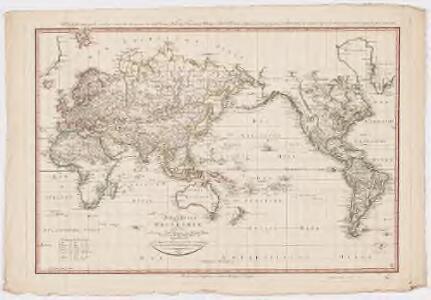
Chart of the world on Mercators projection : exhibiting all the new discoveries to the present time, with the tracks of the most distinguished navigators since the year 1700 carefully collected from the best charts, maps, voyages, &c. extant and regulated from the accurate astronomical observations made in three voyages performed under the command of Captn. James Cook in the years 1768, 69, 70, 71, 72, 73, 74, 75, 76, 77, 78, 79 & 80
1 : 20000000 Arrowsmith, Aaron, 1750-1823 A. Arrowsmith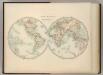
World in Hemispheres.
1 : 72000000 Johnston, W. & A.K.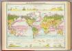
World - vegetation & ocean currents.
1 : 92000000 John Bartholomew and Son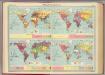
World - population &c.
1 : 153000000 John Bartholomew and Son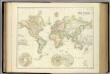
World On Mercator's Projection.
1 : 84000000 Fullarton, A. & Co.
Map of The World Illustrating ... Meteorology ... And Limits of Cultivation.
1 : 200000000 Colton, G.W.
Map of The World Illustrating..Land...Co-Tidal Lines...Ocean Currents...River Systems.
1 : 200000000 Colton, G.W.
Map of The World Showing ... The Animal Kingdom ... Commerce And Navigation.
1 : 200000000 Colton, G.W.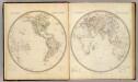
W., E. Hemispheres.
1 : 64000000 Society for the Diffusion of Useful Knowledge (Great Britain)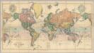
Map Of The World.
1 : 20000000 Stanford, Edward
An accurate chart of the world with the new discoveries : also a view of the general &c coasting trade winds, monsoons or shifting trade winds & the variations of the compass ; from the latest and best authorities
1 : 90000000 Kitchin, Thomas, d. 1784 s.n.
Geographische Verbreitung und Vertheilung der Raubthiere, Carnivora
Zweiter Band, enthaltend in vier Abtheilungen die Vertheilung der Organismen: 5. Pflanzen-Geographie, 6. Thier-Geographie, 7. Anthropographie, 8. Ethnographie Humboldt, Alexander von Verlag von Justus Perthes
Nova Totius Terrarum Orbis Geographica Ac Hydrographica Tabula [Karte], in: Novus Atlas, das ist, Weltbeschreibung, Bd. 1, S. 16.
1 Karte aus Atlas Blaeu, Joan Blaeu, Willem Janszoon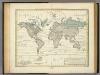
Alexander von Humboldt's System Der Isotherm-Kurven.
1 : 110000000 Humboldt, Alexander von, 1769-1859
Geographische Verbreitung und Vertheilung der Raubthiere, Carnivora.
1 : 115000000 Berghaus, Heinrich