Maps of Nyalam County

Tingri Dzong
1 : 2500000 United States. Army Map Service. Army Map Service
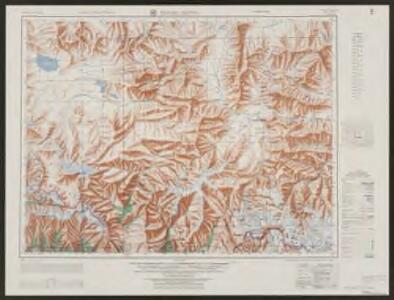
Mount Everest and environs
1 : 126720 Himálaj (pohoří : oblast) Survey of India offices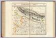
Nepaul. Asie 83.
1 : 1641836 Vandermaelen, Philippe, 1795-1869
India 10.
1 : 2217600 Letts, Son & Co.
India X.
1 : 2200000 Society for the Diffusion of Useful Knowledge (Great Britain)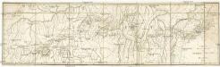
Carte de la route de Tchhing Tou Fou a H'lassa
Lhasa (Čína) Berthe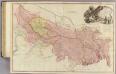
Bengal, Bahar, Oude, Allahabad.
1 : 1480000 Rennell, James, 1742-1830
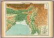
Gangetic Hindoostan or the countries occupied by the Ganges and the branches
1 : 7000000 Cary, John, ca. 1754-1835 J. Cary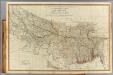
N. Hindostan.
1 : 1480000 Robert Laurie & James Whittle
India - north-eastern section.
1 : 4000000 John Bartholomew & Co.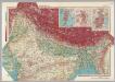
India - North. Pergamon World Atlas.
1 : 5000000 Polish Army Topography Service
Northern India Including The Presidency of Calcutta.
1 : 9000000 Tallis, J. & F.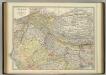
India (northern sheet).
1 : 4457000 Johnston, W. & A.K.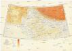
Karte von Europa und Westasien
1 : 4000000 Asie západní Ravensteins Geographische Verlagsanstalt und Druckerei
N. Hindostan.
1 : 4400000 Thomson, John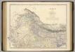
India N.
1 : 4457000 Johnston, Alexander Keith, 1804-1871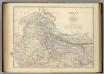
India (northern sheet).
1 : 4457000 Johnston, Alexander Keith
137-138. North India, Nepal, East Pakistan. The World Atlas.
1 : 5000000 USSR (Union of Soviet Socialist Republics).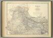
India (northern sheet).
1 : 4457000 Johnston, Alexander Keith
Inde N.-E. et Tibet.
1 : 5000000 Vivien St Martin, L.
Undecima Asie Tabula [Karte], in: [Clavdii Ptholomei Cosmographi ...], S. 332.
1 Karte aus Atlas Nicolaus Germanus [und Ptolemaeus, Claudius]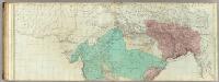
The East Indies, with the roads (northern section).
1 : 2600000 Jefferys, Thomas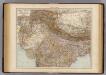
India North.
1 : 6000000 Andree, Richard; Times (London, England)
General Karte von VORDERINDIEN
1 : 4000000 Indie Berghaus, Heinrich Karl Wilhelm Rennell, James Justus Perthes
Nord-Indien
1 : 4000000 Indie severní War Office
120-121. China, West. The World Atlas.
1 : 5000000 USSR (Union of Soviet Socialist Republics).
Imperia antiqua
1 : 13530000 Indie Bonne, Rigobert André
Charte von Ost Indien
Indie Sotzmann, Daniel Friedrich Rennell, James Haude u. Spener
Das Himálaja Gebirg in Bissahir, Gherwal & Kemaun, von Südrande des Plateaus von Mittel-Tibet bis zum Tieflande von Hindostan
1 : 900000 Himálaj Grimm, J. L. Etzel, Franz August von C. Ritter und F.A. O'etzel