Maps of Carpathian Mountains

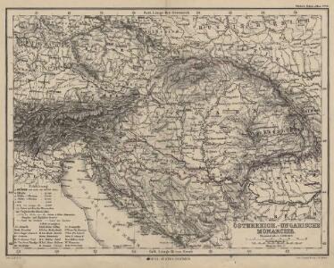
Österreich.-Ungarische Monarchie
1 : 5000000 Österreich-Ungarn
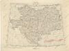
Oesterreichisch-Ungarische Monarchie
1 : 820000 Rakousko-Uhersko Waldermann, G. Kellner
Bez titulu: Östereich
Oesterreich-Ungarische Monarchie.
1 : 2750000 Andree, Richard
Austria.
1 : 4815360 Tallis, J. & F.
Empire Of Austria.
1 : 4300000 Greenleaf, Jeremiah
Empire Of Austria.
1 : 4435200 Greenleaf, Jeremiah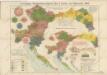
G.Freytag ́s Reichsrathswahlkarte aller 5 Curien von Österreich, 1897

Karte III: Nationalitätenkarte von Österreich-Ungarn
Österreich Ungarn Tschechische Republik Polen Österreich-Ungarn Ethnische Gruppe
Tatsächliche Zu- und Abnahme der anwesenden Bevölkerung in den politischen Bezirken der Reichsratsländer im Jahrzehnt 1901 – 1910
Österreich Bevölkerungsentwicklung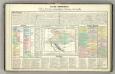
Tableau l'historie de l'Empire d'Autriche.
1 : 7200000 Duval, Henri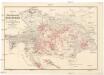
Oesterreichs Weinbau
1 : 2000000 Doležal k.k. Landwirtschafts-Gesellschaft
Übersichts-Karte der gewerblichen Unterrichts-Anstalten in Österreich
1 : 1700000 Rakousko-Uhersko Peucker, Karl Müller, Adolf Artaria
Mocnářství Rakousko-Uherské
1 : 5000000 Rakousko-Uhersko Wagner, Jan Eduard A. Mikolášek
Mineralien
Österreich-Ungarn Mineralischer Rohstoff
Bez titulu: Östereich
Übersichtblatt der Spezialkarte 1:75 000

Říše rakousko-uherská
Rakousko-Uhersko Wagner, Jan Eduard Le Rouge, Georges-Louis knihkupectví Jaroslava Pospíšila
Jährliche Regenmenge
Österreich-Ungarn Gebietsniederschlag
Gewebe- und Glasindustrie
Österreich-Ungarn Textilindustrie, Glasindustrie
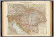
Österreichisch-Ungarische Monarchie
Volksschul-Atlas über alle Teile der Erde Lange, Henry Druck und Verlag von Georg Westermann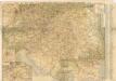
Neue verkehrskarte von Österreich-Ungarn...

Übersichtskarte der Oesterreichisch-Ungarischen Monarchie
1 : 3000000 Rakousko-Uhersko Haardt von Hartenthurn, Vinzenz von Ed. Hölzel
Osterreichischer Kaiserstaat.
1 : 3900000 Flemming, Carl
Völkerkarte
Österreich-Ungarn Ethnische Gruppe
Osterreich – Ungarn

Karte der zu Ende Juni 1857 thätigen Stationen für phänologische Beobachtungen in Oesterreich
Rakousko-Uhersko
Österreich-Ungarn, Bevölkerungsdichtigkeit
Österreich-Ungarn Bevölkerungsdichte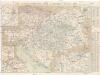
G. Freytags Verkehrs-Karte von Österreich-Ungarn
1 : 1400000 Evropa jihovýchodní Freytag, Gustav G. Freytag und Berndt