Maps of Balkan Pen.

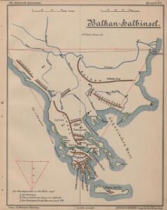
Balkan-Halbinsel
Balkanhalbinsel
Türkei und Griechenland
1 : 6660000 Osmanisches Reich / Europäischer Teil, Griechenland
Turquie d'Europe, Grece, Roumanie, Servie, Montenegro.
1 : 3600000 Levasseur, E.
Die Europaeische Türkey und das Königreich Griechenland
Osmanisches Reich / Europäischer Teil, Griechenland
Turquie d'Europe, Grece &c.
1 : 3900000 Garnier, F. A., 1803-1863
Europaeische Türkey und Griechenland
Geographischer Atlas über alle Theile der Erde Ziegler, Jakob Melchior Verlag von Dietrich Reimer
Turquie d'Europe.
1 : 3500000 Picquet, C.
Das Osmanische Europa oder die Europaeische Türkey nebst dem Koenigr. Griechenland und den Jonischen Inseln
1 : 2850000 entworfen und gezeichnet von C.F. Weiland Weimar : im Verlage des Geograph: Instituts
Země jihoslovanské
balkánské země Fáborský, Jan B. Nipočić, Vasilij
Europaeische Türkey und Griechenland
Geographischer Atlas über alle Theile der Erde Ziegler, Jakob Melchior Verlag von Joh. Wurster um Comp.
Balkan-Halbinsel
1 : 6000000 Balkanhalbinsel
Die Balkan-Halbinsel
1 : 5500000 Balkanhalbinsel
[Chinesische Halbinsel und Karpathen]
Hypsometrischer Atlas Ziegler, Jakob Melchior Topogr. Anstalt v. J. Wurster u. Comp.
Türkei und Griechenland
Neuer Handatlas über alle Theile der Erde Kiepert, Heinrich Verlag von Dietrich Reimer
Balkanhalbinsel.
1 : 3000000 Andree, Richard
Turchia Europea con i Principati di Servia, Valachia e Moldavia.
1 : 3540000 Picquet, C.
Turquie d'Europe, Grece.
1 : 3000000 Lapie, M. (Pierre), 1779-1850
Composite: Carte de la Turque d'Europe et de la Grece.
1 : 3450000 Vivien de St Martin, L.
Osman. Europa.
1 : 3000000 Weiland, C. F. (Carl Ferdinand), d. 1847
Türkisch-Griechische Halbinsel
Balkanhalbinsel
Europäische Türkei & Griechenland
Osmanisches Reich / Europäischer Teil, Griechenland
Türkei und Griechenland
1 : 5400000 Osmanisches Reich, Griechenland
Turkey in Europe.
1 : 6000000 Higgins, W.M.
Charte von der europaeischen Türkey mit den anliegenden Republiken der Sieben Inseln u. Ragusa
1 : 4110000 Dubrovník-oblast (Chorvatsko) Kipferling, Karl Joseph J. Riedl's Kunsthandlung
Siebenbürgen die Türkey und Griechenland
1 : 4930000 Sedmihradsko (Rumunsko) Grimm, I. L. Siebert, Selmar Simon Schropp
Siebenbürgen die Türkey und Griechenland
Sedmihradsko (Rumunsko) Grimm, I. L. Siebert, Selmar Simon Schropp
Granicitě na Ochridskata Archieposkopija [2]
Makedonien Ohrid Patriarchat Ohrid Grenze
Volkerkarte Balkanhalbinsel, Konstantinopel, Marmarameer.
Andree, Richard
[Neuer Atlas der ganzen Erde nach den neuesten Bestimmungen ... : XXIII.] Griechenland, die Jonischen Inseln und das Osmanische Reich in Europa
Entworfen und gezeichnet von Dr. F.W. Streit H. Leutemann sc. Leipzig : J.C. Hinrichs'sche Buchhandlung