Mapa catalogado
Österreich-Ungarn


Título completo:Österreich-Ungarn
Año de ilustración:1913
Fecha de publicación:1913
Tamaño físico:20 x 30 cm
Escala del mapa:1:4 500 000
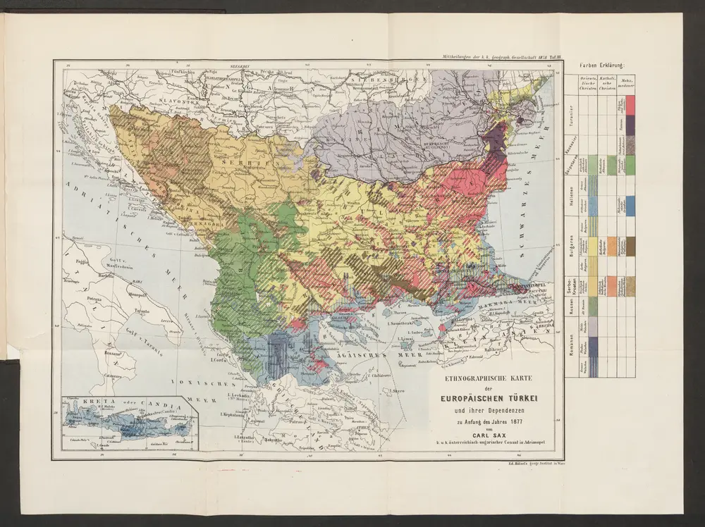
Ethnographische Karte der europäischen Türkei und ihrer Dependenzen zu Anfang des Jahres 1877
1877
Sax, Carl
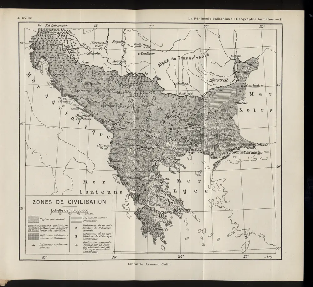
Zones de civilisation
1918
1:6m
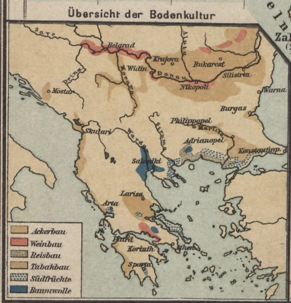
Übersicht der Bodenkultur
1904
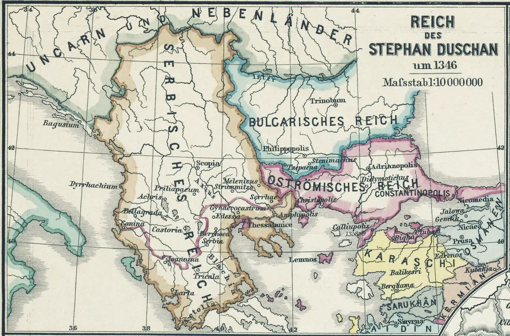
Reich des Stephan Duschan
1355
1:10m
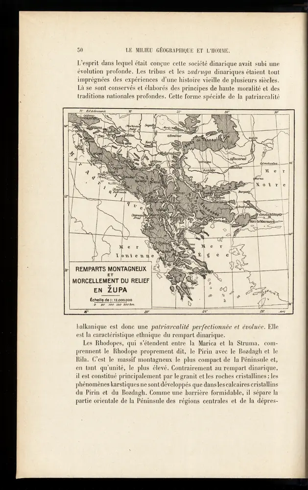
Remparts montagneux et morcellement du relief en župa
1918
1:12m
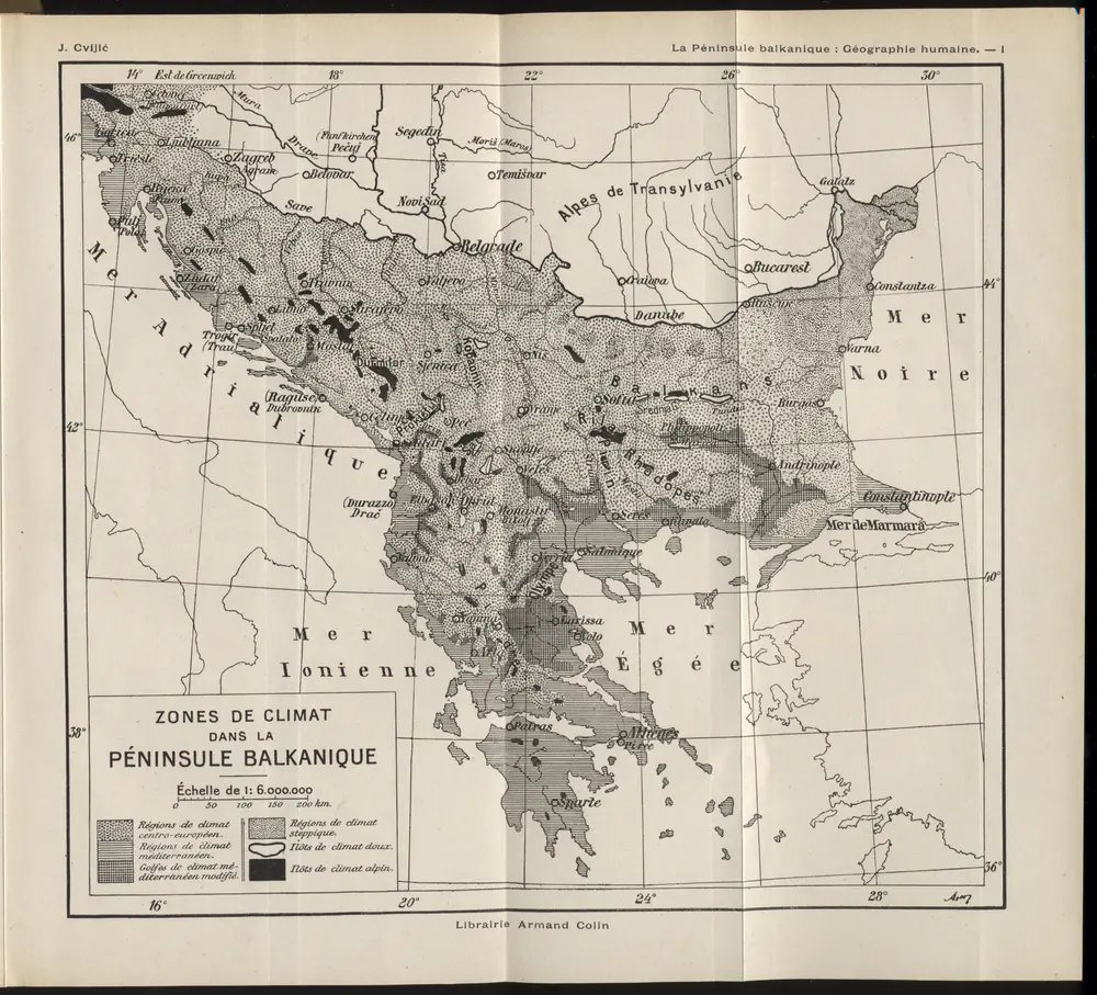
Zones de climat dans la peninsule balkanique
1918
1:6m
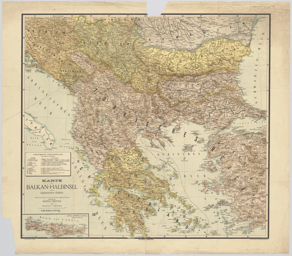
Karte der Balkan-Halbinsel und der angrenzenden Gebiete / nach den neuesten Quellen bearb. von Gustav Freytag
1890
Gustav Freytag
1:2m
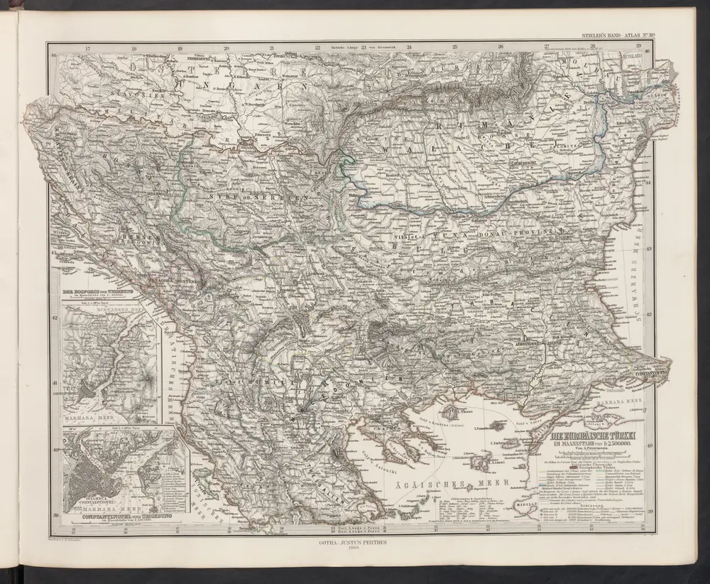
Die Europäische Türkei
1869
Stieler, Adolf
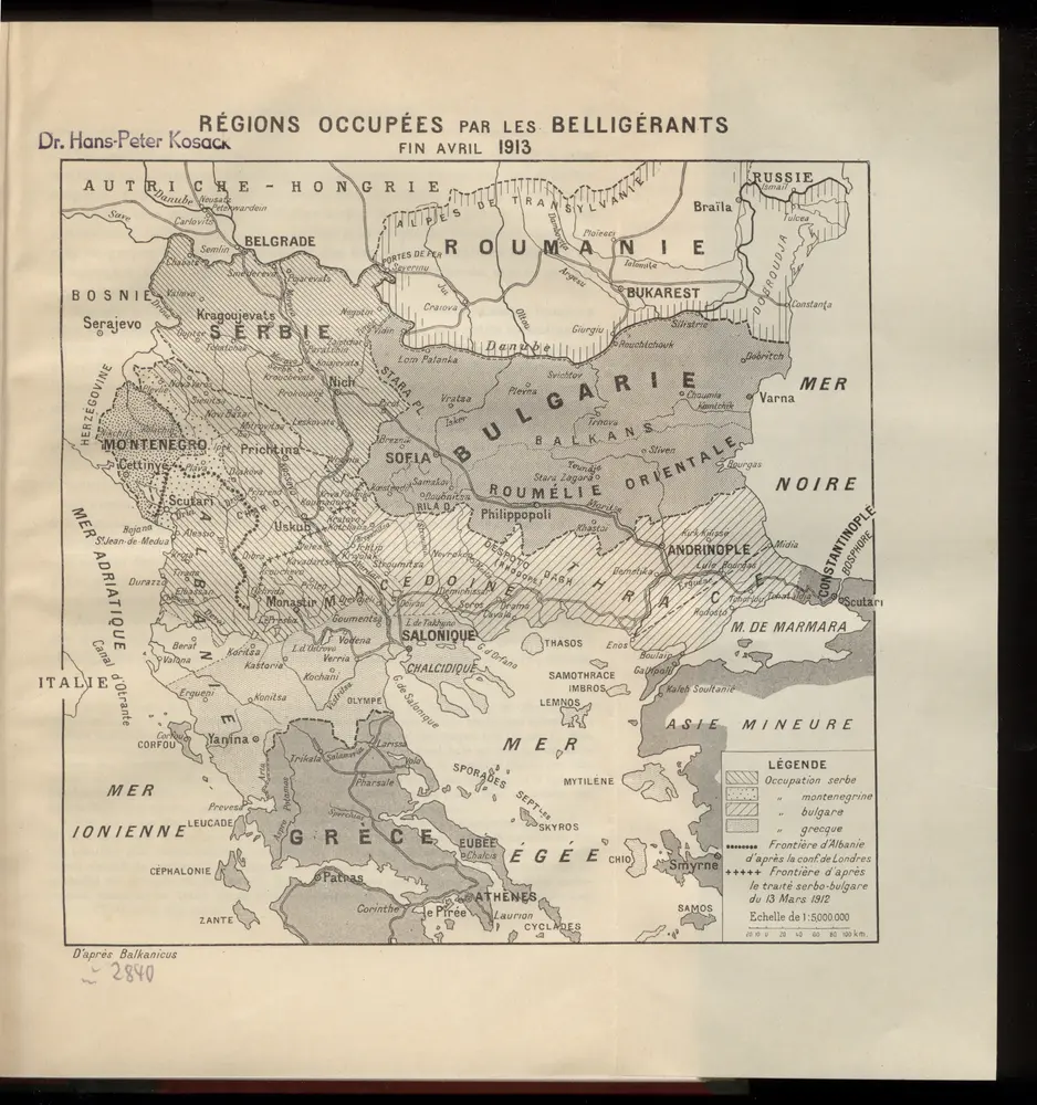
Règions occupèes par les belligèrants fin avril 1913
1913
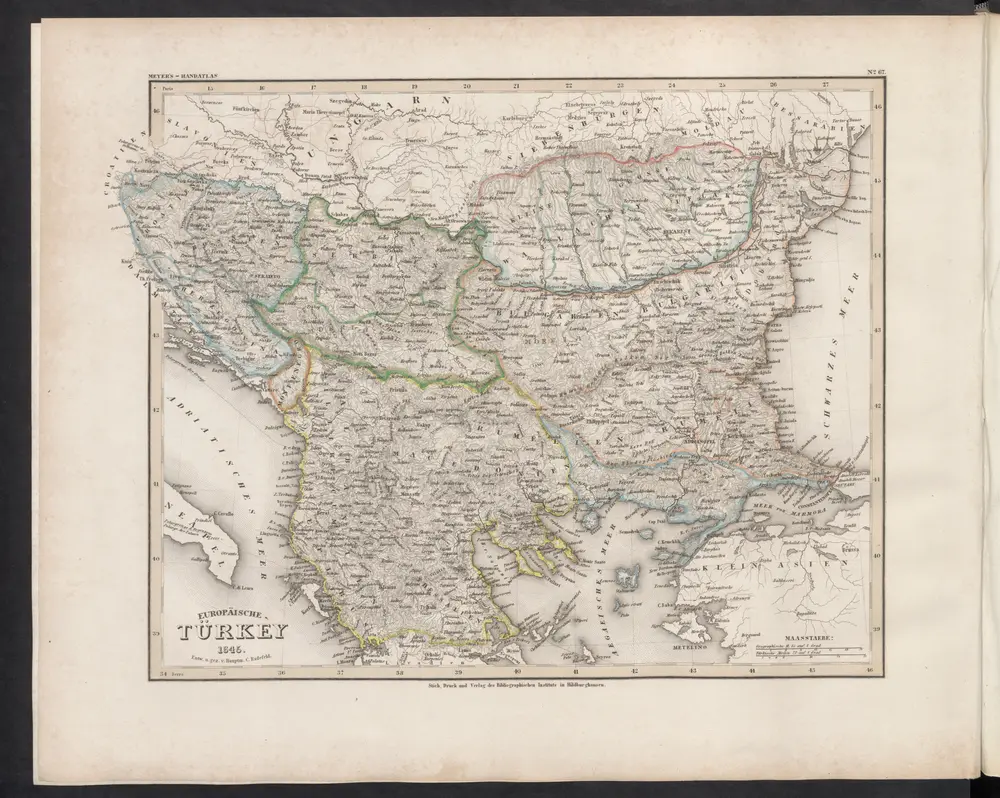
Europäische Türkey
1860
Meyer, J.