编目地图
Verbreitung der Religionen im Anfange von Justinians Regierung
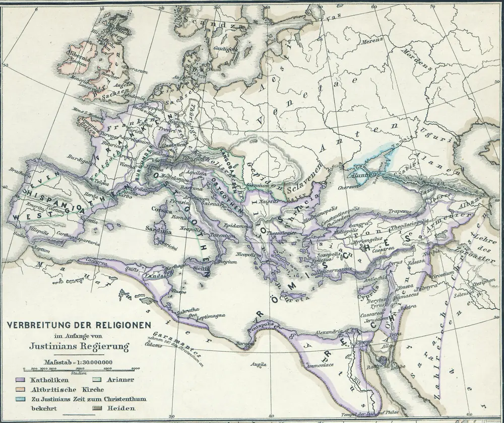

完整标题:Verbreitung der Religionen im Anfange von Justinians Regierung
描述:560
发布日期:1880
物理尺寸:20 x 30 cm
地图比例尺:1:30 000 000
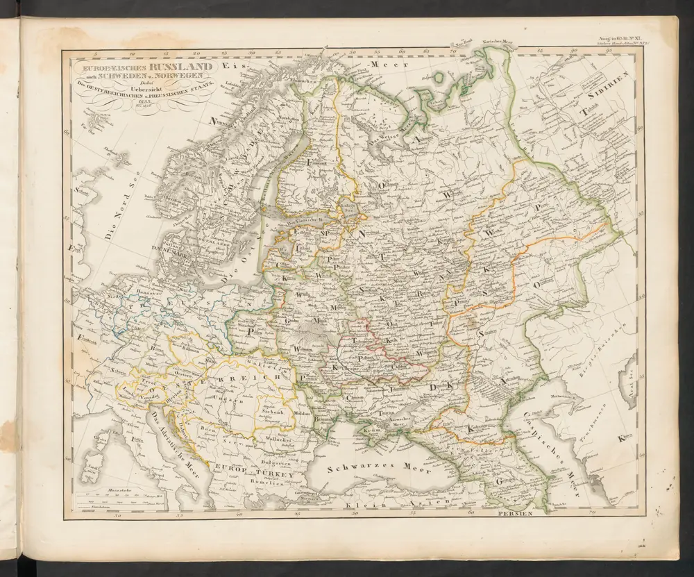
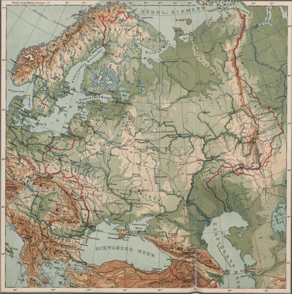
[Europaeisches Russland auch Schweden u. Norwegen]
1845
Stieler, Adolf
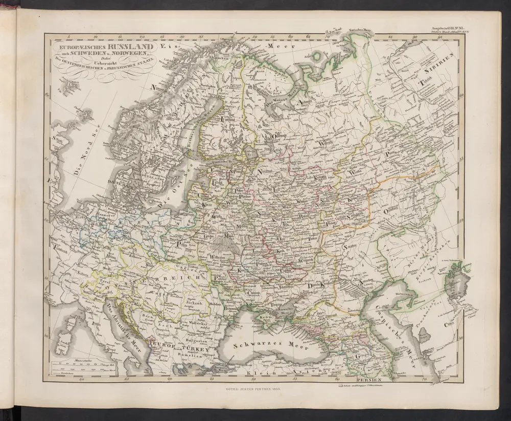
[Europaeisches Russland auch Schweden u. Norwegen, Dabei Uebersicht des Oesterreichischen u. Preussischen Staats]
1854
Stieler, Adolf
n/a
1858
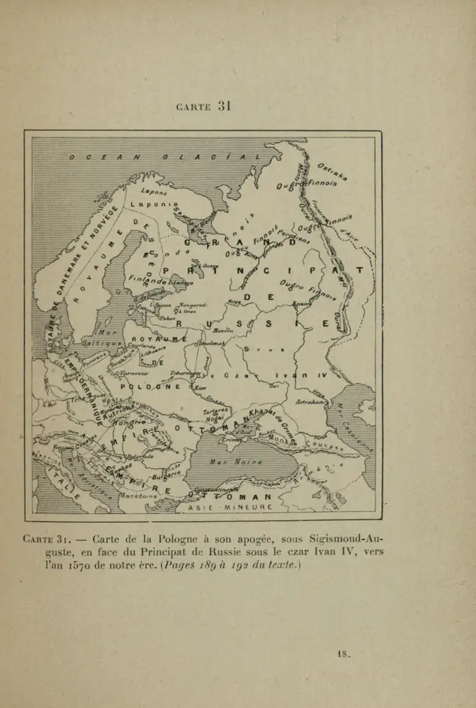
Carte de la Pologne à son apogee, sous Sigismond-Auguste, en face du Principat de Russie sous le czar Ivan IV, vers l’an 1570 de notre ère
1570
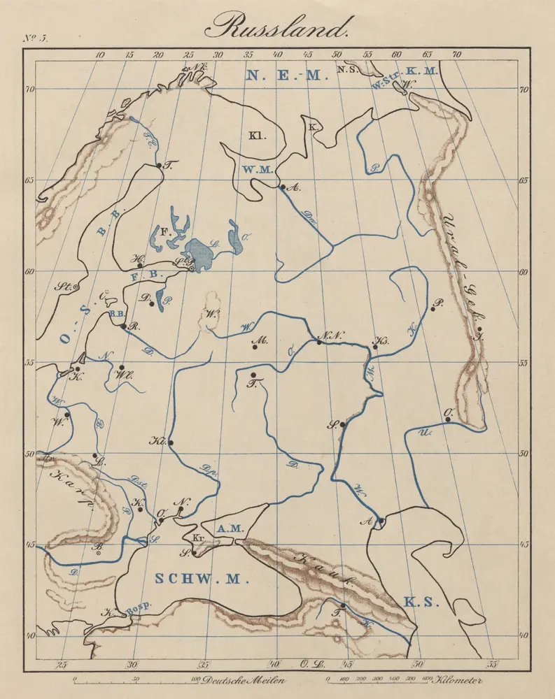
Ruszland
1913
1:12m
Tabvla Rvssiæ / ex autographo, quod delineandum curavit Foedor filius tzaris Boris desumta; et ad f
1644
Fëdor
1:9m
Tabula Russiae ex autographo, quod delineandum curavit Foedor filius Tzaris Bori et ad fluvios Dwina
1641
[Matthäus Merian d. Ältere]
1:1m
地理志略:歐羅巴
1903
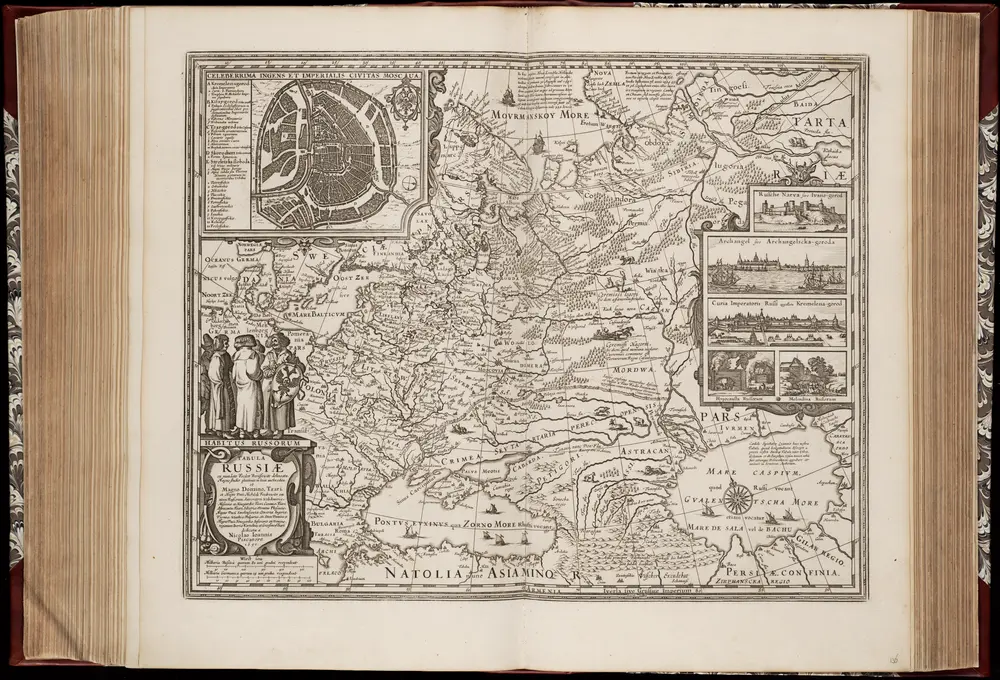
Tabula Russiae ex mandato Foedor Borissovitsj delineata ... Magno domino, Tzari et magno duci Michäeli Foedrowits omnium Russorum autocratori... dedicata a Nicolao Ioannis Piscatore
1651
Fjodor Borissovitsj Godoenov 17e E.; Claes Jansz. Visscher 1586/1587-1652
1:10m
Russland
1900