Maps of Alaska
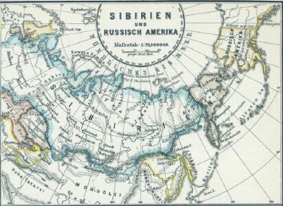
Sibirien und Russisch Amerika
1 : 70000000 Sibirien, Russisch-Amerika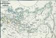
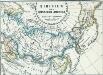
Russisches Eroberungsgebiet in Sibirien XVI. und XVII. Jahrh.
1 : 47000000 Sibirien, Eroberung
Polar-Karte enthaltend: die Lander u. Meere vom Nord-Pol bis 50 degrees N.
1 : 29000000 Stieler, Adolf
North Polar Regions.
1 : 22000000 Rand McNally and Company
3. Terre polari.
1 : 45000000 Touring club italiano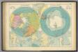
Polar Regions.
1 : 35000000 Philip, George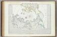
Carta generale del Polo Artico.
1 : 22500000 Marzolla, Benedetto
Map of Alaska / comp. by Alaska Branch
1 : 5000000 United States Geological Survey. Alaskan Branch [Washington, D.C. : U.S. Geological Survey]
River Ice in Relation to Navigation, Average Annual Number of Days with Ice.
U.S. Navy
Ice Chart, Northern Hemisphere, April.
U.S. Navy
The Arctic regions
1 : 14673400 Arktida National Geographic Society
Ice Chart, Northern Hemisphere, October.
U.S. Navy
Northern Regions.
1 : 22176000 Colton, G.W.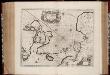
Nova et accvrata Poli Arctici et terrarum circum iacentium descriptio
1 : 17500000 Annotatie: Rechtsboven: IV; Origineel is Blad 148 in atlas factice Amstelodami : apud Ioannem Ianßonium
Die allmaehlige Bildung des Russichen Reiches seit der MItte des XVten Jahrhundert's
1 : 40000000 Russland Expansion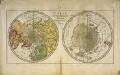
Carte des deux regions polaires
2 Karten auf einem Blatt : Kupferdruck ; Durchmesser je 20 cm Lange; Berndt s.n.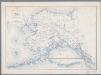
Map of Alaska
1 : 5000000 [Washington, D.C. : United States Department of the Interior, Geological Survey]
Karta predstavljajuščaja čast zapadnago berega Ameriki
1 : 7000000 Aleutské ostrovy (Aljaška) Charitonov, G.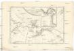
Carte de la côte N.O. del'Amerique et de la côte N.E. de l Asie reconnues en 1778 et 1779
1 : 13700000 Asie východní Bonne, Rigobert André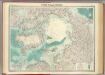
North Polar regions.
1 : 14000000 John Bartholomew and Son
North western America showing the territory ceded by Russia to the United States.
1 : 12100000 United States Coast Survey
North western America showing the territory ceded by Russia to the United States.
1 : 12100000 United States Coast Survey
Canada - West. Pergamon World Atlas.
1 : 10000000 Polish Army Topography Service
Carte Generale de la Russie d'Asie ou Siberie.
1 : 14300000 Vivien de St Martin, L.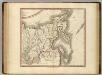
Russian Empire east.
1 : 9400000 Cary, John, ca. 1754-1835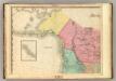
North America, N.W. Sheet..
1 : 7600000 Tanner, Henry S.
Facsimile: Spanish Admiralty World in Mercator (portion).
1 : 15200000 Alaskan Boundary Tribunal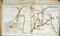
Esquisse d'une carte du cap.te Cook
2 Karten auf 1 Blatt : Kupferdruck ; 19 x 32 cm Cook; Barrington; Engel; Holzhalb s.n.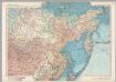
U.S.S.R. - Eastern Siberia and Far East. Pergamon World Atlas.
1 : 10000000 Polish Army Topography Service