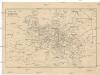
Maps of Metropolitan France

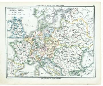
29. Mitteleuropa im Jahre 1650
Mitteleuropa
30. Mitteleuropa nach Beendigung des nordischen Krieges im Jahre 1721
Mitteleuropa, Ostmitteleuropa, Nordischer Krieg <1700-1721>
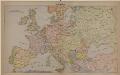
32. Mitteleuropa nach dem Reichsdeputationshauptschluss im Jahre 1803
Mitteleuropa Reichsdeputationshauptschluss
Übersicht des Ländergebiets der Westeuropäischen Grossmächte
1 : 6000000 Evropa západní Justus Perthes
La Germanie à l’époque des invasions des Cimbres et des Teutons à travers l’Europe
Mitteleuropa Germanien Kimbern Teutonen Augustus
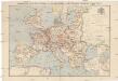
Carte des chemins de fer de l'Europe, uit: Carte des chemins de fer de la Belgique
1 : 370000 [Bruxelles : Ministère des Chemins de Fer, Postes et Télégraphes]
Oorlogskaart van Europa : met vermelding der voornaamste gebeurtenissen van af 28 juni 1914 tot 29 januari 1916 / samengest. en get. door Ph.L. Battefeld
1 : 2600000 Annotatie: Met lijst van: Datums en feiten; Annotatie geografische gegevens: Met schaalstok Ph.L. Battefeld Delft : Hillen's Sigaren en Tabaksfabriek / (Amsterdam : drukkerij Senefelder)
Evropa
1 : 5000000 Evropa V. Neubert
Kriegszusammenhänge V (1788 - 1815)
1 : 20000000 Europa Napoleonische Kriege, Koalitionskriege
Carte genérale et itineraire de l'Europe
1 : 2300000 Evropa Traux, Maximilian de Schwarzenberg, Karel Filip Artaria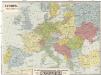
Evropa
1 : 5000000 Evropa
Kriegszusammenhänge III (1700 - 1721)
1 : 20000000 Europa Nordischer Krieg <1700-1721>, Türkenkriege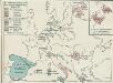
4. Friedensschlüsse nach dem span. Erbfolgekriege 1713/1714. nach d. Nord. Kriege 1719/21. Passarowitz 1718
1 : 30000000 Europa Nystad / Friede, Požarevac / Friede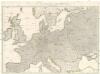
Wege-Karte durch den grösten und wichtigsten Theil Europa's
Evropa Schmidt, Johann Marius Friedrich Kliewer, Heinrich Simon Schropp et Comp.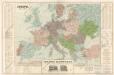
Evropa
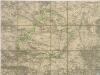
Strassenkarte des Bezirkes Joslowitz
Compagnie Internationale des Wagons-lits et des Grands Express européens
1 : 4500000 Evropa L. Hermann
[Evropa - politická mapa]
1 : 3000000 Evropa Paulík, Antonín Klus, František
Nová mapa vysílacích stanic Evropy
Evropa Hlaváček, Josef Orbis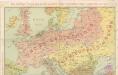
Die Karte von Europa...
Cestovní spoje v Evropě
Evropa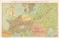
Die Karte von Europa...
Part of Europe.
1 : 7200000 Cornell, S. S. (Sarah S.)
Carte itinéraire de l'Europe indiquant les limites actuelles des etats
1 : 3760000 Evropa Dufour, A. H. Simonneau, Charles Ch.les Simonneau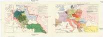
Conseil national des pays Tcheques
Evropa Conseil National des Pays Tcheques
Bez titulu: Povětrnostní mapa Střední Evropy

Mitteleuropa zur Napoleonischen Zeit
Mittel-Europa
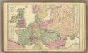
Europa
Carte Routiere et Postale de la France