Cataloged map
Balkan-Uebersichtskarte


Full title:Balkan-Uebersichtskarte
Depicted:1916
Pubdate:1916
Physical Size:20 x 30 cm
Map scale:1:2 250 000
[Bulgarien: Russisch-türkischer Krieg 1877/78]
1878
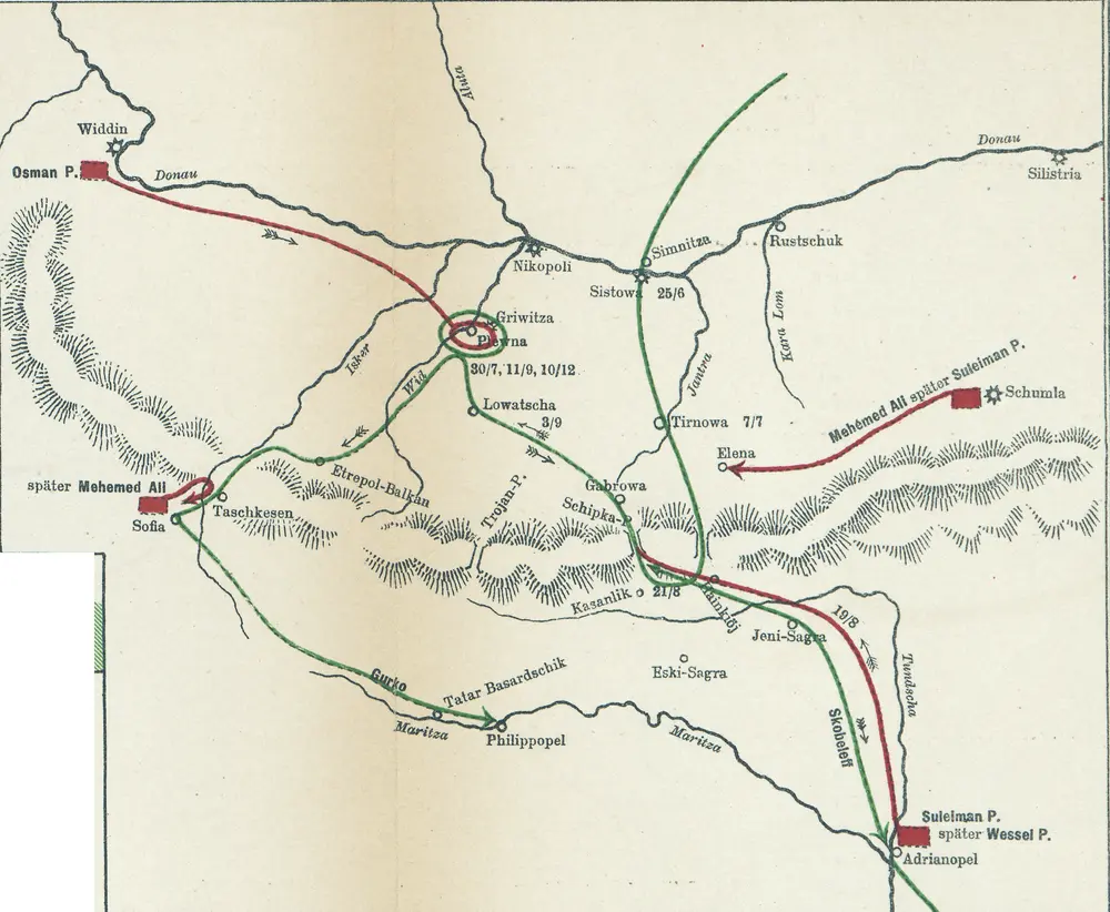
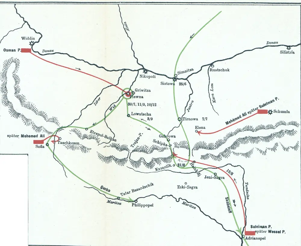
[Bulgarien: Russisch-türkischer Krieg 1877/78]
1878
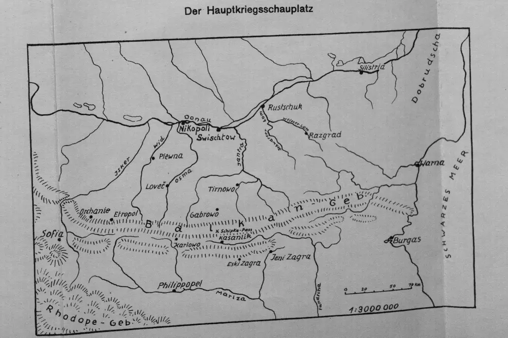
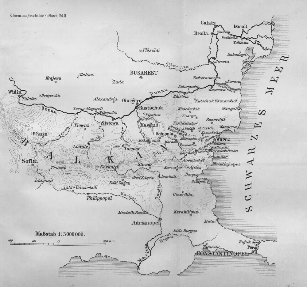
Karten zum russisch-türkischen Krieg 1877-1878. Der Hauptkriegsschauplatz
1878
1:3m
Perechod čerez Balkany v dekabrě 1877 g.
1877
Sofia, Philippopel
1916
K. u. k. Militärgeographisches Institut
1:750k
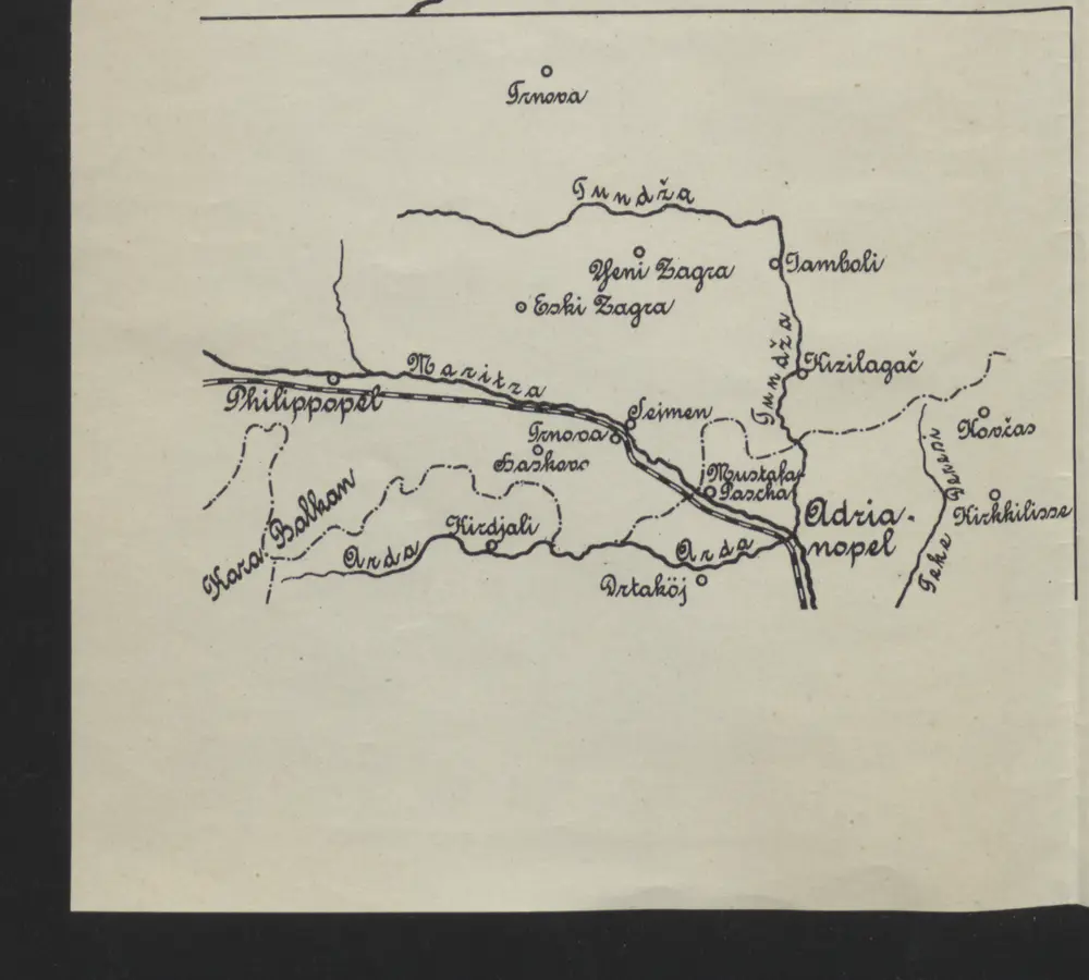
[Philippopel-Adrianopel]
1913
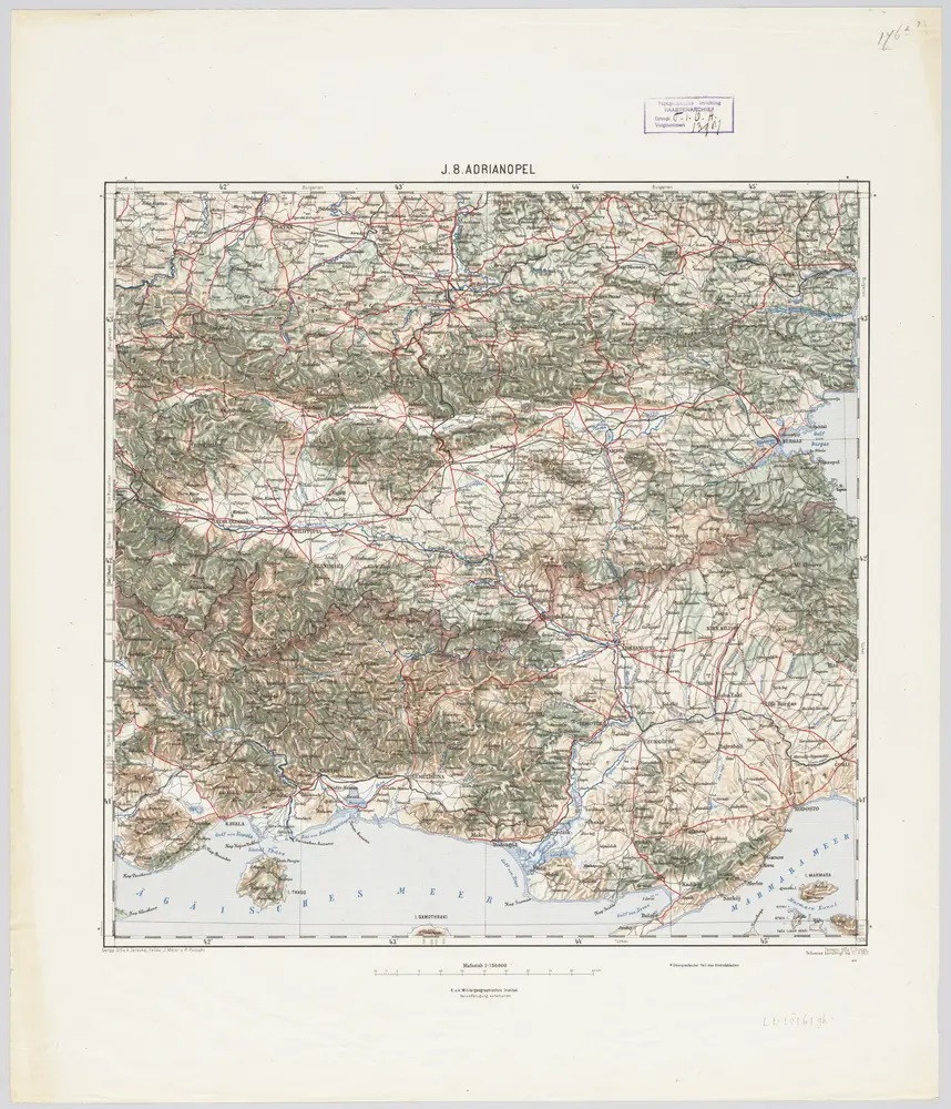
J.8. Adrianopel, uit: [Übersichtskarte von Europa 1:750.000]
1910
Wien : K.u.K. Militärgeographisches Institut
1:750k
[Bulharsko]
1800
Petr
1:800k
[Balkan]
1908
1:3m
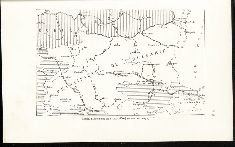
Karta priložena pri San-Stefanskija dogovor, 1878 g.
1878