Mappa catalogata
Winterschlacht in Masuren

Titolo completo:Winterschlacht in Masuren
Anno di illustrazione:1915
Data di pubblicazione:1918
Dimensione fisica:20 x 30 cm
Scala della mappa:1:2 000 000
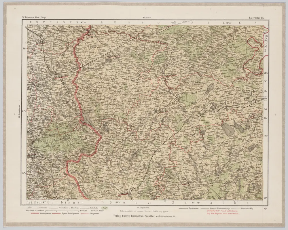
Suwalki 19, uit: Special-Karte von Mittel-Europa / nach amtlichen Quellen bearbeitet von W. Liebenow
1899
Johannes Wilhelm Liebenow 1822-1897
1:300k

Iz istorii kampanii 1914 goda na russkom frontě: načalo vojny i operacii v vostočnoj Prussii : s priloženiem kart i schem na otděl'nych listach, mapa ze strany: [439]
1925
Golovin, Nikolaj Nikolajevič

Iz istorii kampanii 1914 goda na russkom frontě: načalo vojny i operacii v vostočnoj Prussii : s priloženiem kart i schem na otděl'nych listach, mapa ze strany: [440]
1925
Golovin, Nikolaj Nikolajevič
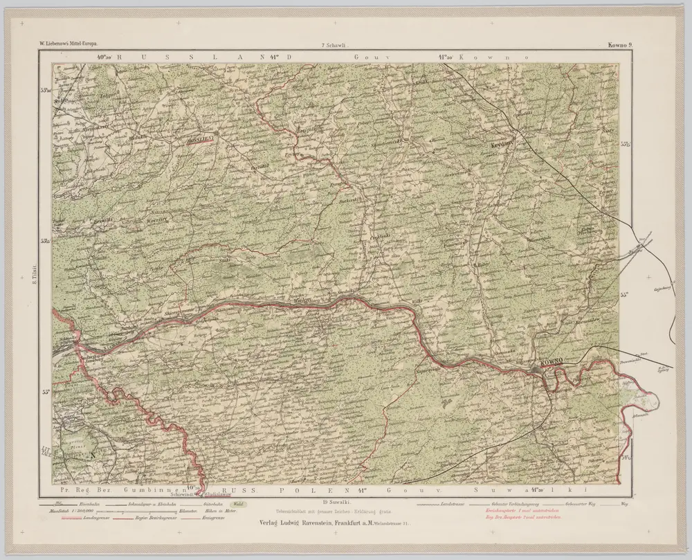
Kowno 9, uit: Special-Karte von Mittel-Europa / nach amtlichen Quellen bearbeitet von W. Liebenow
1899
Johannes Wilhelm Liebenow 1822-1897
1:300k
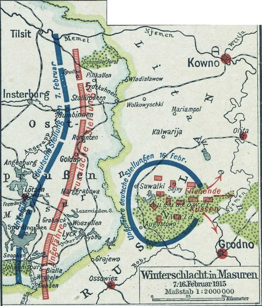
Winterschlacht in Masuren
1915
1:2m
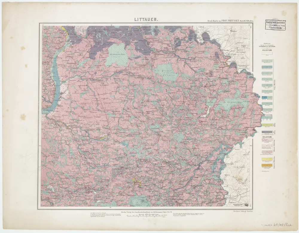
Sect. 9. Pillkallen (Littauen), uit: Geologische Karte der Provinz Preussen
1880
Berlin : Neumann
1:100k

Iz istorii kampanii 1914 goda na russkom frontě: načalo vojny i operacii v vostočnoj Prussii : s priloženiem kart i schem na otděl'nych listach, mapa ze strany: [438]
1925
Golovin, Nikolaj Nikolajevič
Meßtischblatt 16102 : Wehrkirchen, 1936
1936
1:250k
Meßtischblatt 15102 : Gr. Kallweitschen, 1936
1936
1:250k
Meßtischblatt 14102 : Grenzen (Ostpr.), 1936
1936
1:250k