Maps of Czech Republic
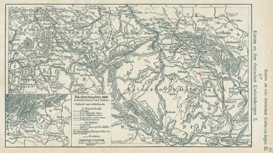
Karten zu den deutschen Einheitskriegen II - Kriegsschauplatz 1866 in Deutschland und Italien
1 : 3000000 Mitteleuropa Deutscher Krieg <1866>
Theatre de la Guerre en Austriche, Baviere, Souabe, le Tirol et le Pays aux Environs
1 : 565000 Mollova mapová sbírka Covens, Johannes Covens, Johannes I
Eigentliche Verzeichnuss des Marches
1 : 950000 Evropa střední Kleinsträttl, Georg Wilhelm Merian
Atlas Topographique et militaire, qui comprend les états de la Couronne de Boheme

Geologische Übersichtskarte des Österreichischen Monarchie
1 : 576000 Rakousko-Uhersko Hauer, Franz Beck'schen Universitäts Buchhandlung (A. Hölder)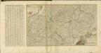

[Süd-Deutsches Bergland]
E. von Sydow's Schul-Atlas in sechs und dreissig Karten Sydow, Emil von bei Justus Perthes
Karte mehrer Eisenbahnen Oesterreichs & Deutschlands
Německo jižní
Karten zur Statistik des Königreiches Böhmen...

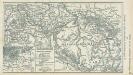
Théatre de la guerre actuelle, en Allemagne, en Pologne et en Turquie. n10, Prague
1 : 900000 Chanlaire, Pierre Grégoire 1758-1817 Paris : chez l'auteur P. G. Chanlaire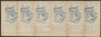
Bohemia Nova Descriptio Tabula XVII. [Karte], in: Claud. Ptolemaeus. Geographia lat. cum mappis [...], S. 407.
1 Karte aus Atlas Münster, Sebastian [und Ptolemaeus, Claudius]
Přehledná mapa meteorologických stanic v Čechách, na Moravě a ve Slezsku

[Österreich-Ungarn, Blatt 1]
Adolf Stieler's Handatlas über alle Theile der Erde und über das Weltgebäude Stieler, Adolf Justus Perthes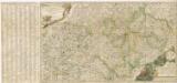
Nova et accurata Descriptio Geographica Totius Regni Bohemiae...

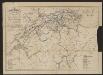
Eisenbahn-Routen-Karte für Böhmen und die angrenzenden Länder
Čechy (Česko)
Das Königreich Böhmen

Čechy
České království
1 : 720000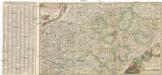
Nova et accurata descriptio geographica totius regni Bohemiae
1 : 731000 Bavorsko (Německo) Lidl, Johann Jakob J.J. Lidl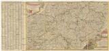
Nova et accurata descriptio geographica totius Regni Bohemiae
1 : 690000 Německo Lidl, Johann Jakob J. J. Lidl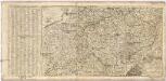
Nova et accurata Descriptio Geographica TOTIUS REGNI BOHEMIAE
1 : 6800000 Německo Lidl, Johann Jakob Joannis Jacobo Lidlii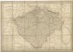
General Post & Strassen Karte des Königreichs Boehmen
Bohemia In Suas Partes Geographicé Distincta. [Karte], in: Gerardi Mercatoris et I. Hondii Newer Atlas, oder, Grosses Weltbuch, Bd. 1, S. 328.
1 Karte aus Atlas Mercator, Gerhard und Hondius, Jodocus Jansson, Jan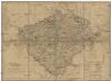
Königreich Böhmen
Česko
Bohemia. [Karte], in: Novus atlas absolutissimus, Bd. 2, S. 241.
1 Karte aus Atlas Janssonius Offizin
Topographische Landkarte von Böhmen

Karte des Königreiches Böhmen
1 : 650000 Česko Raffelsperger, Franz in dem k. k. a. p. Civil-Geograpischen Institut
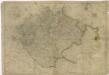
Bohemia

La Royaume de Boheme...