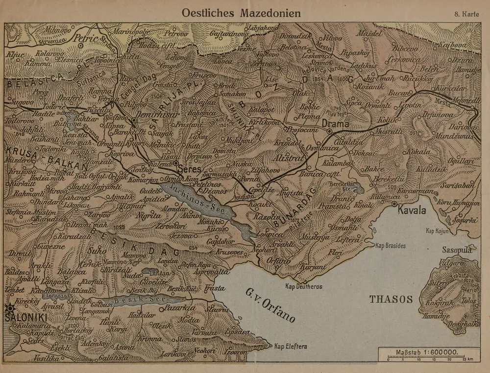
Gecatalogiseerde kaart
Oestliches Mazedonien

Volledige titel:Oestliches Mazedonien
Jaar illustratie:1916
Pubdatum:1916
Fysieke grootte:20 x 30 cm
Schaal kaart:1:600 000
Oestliches Mazedonien
1916
1:600k
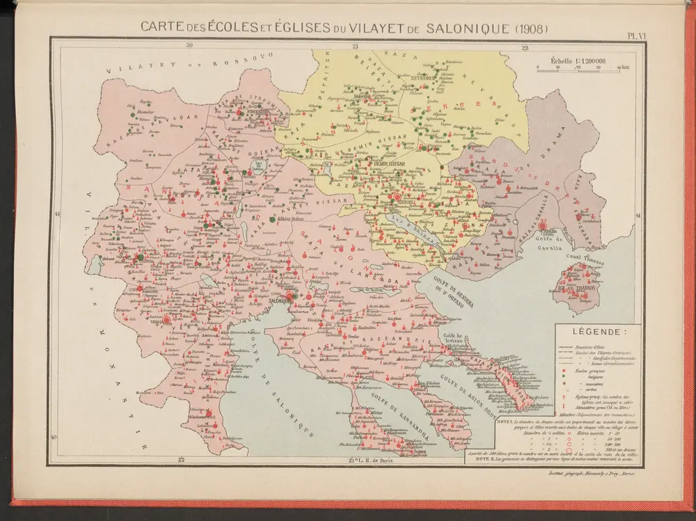
Carte des écoles et églises du vilayet de Salonique (1908)
1908
Kümmerly & Frey
Saloniki, Seres, Xanthi, Kastro, Pharsalos
1917
K. u. k. Militärgeographisches Institut
1:750k
[Romanien]
1790
[Trattner]
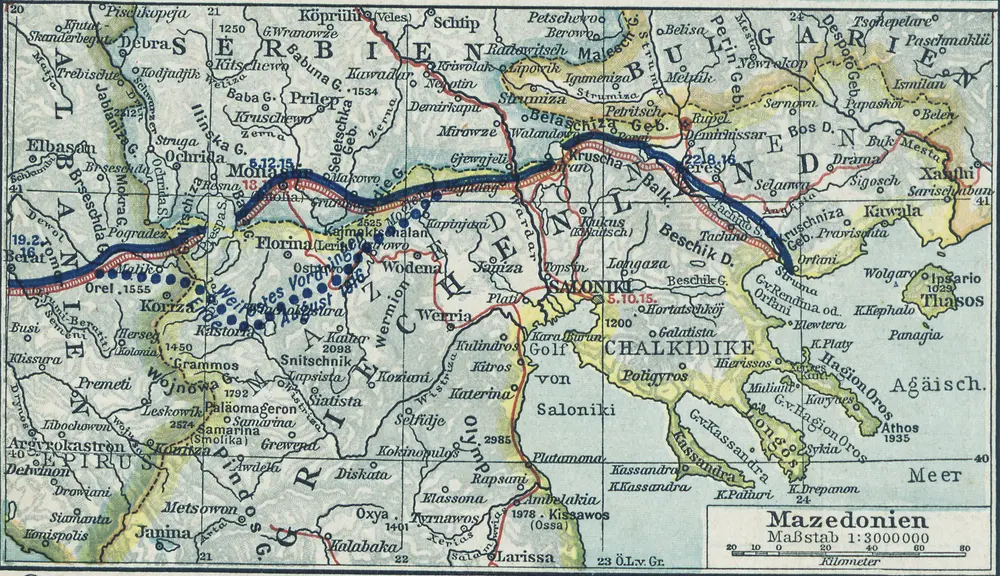
Mazedonien
1916
1:3m
[Mazedonien]
1915
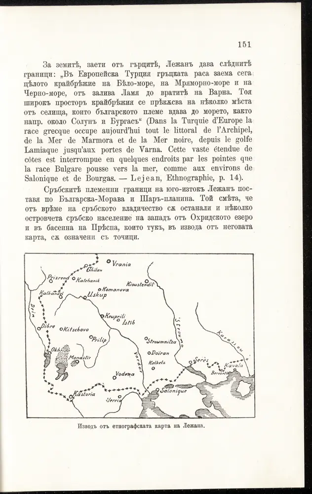
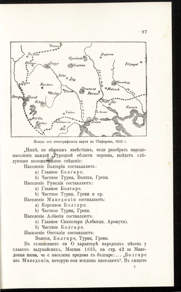
Izvod ot etnografskata karta na Ležana
1915
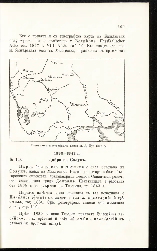
[Bălgarska zemja v Makedonija]
1915
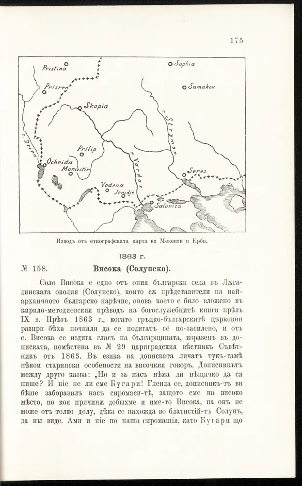
Izvod ot etnografskata karta na Mekenzi i Erbi
1915
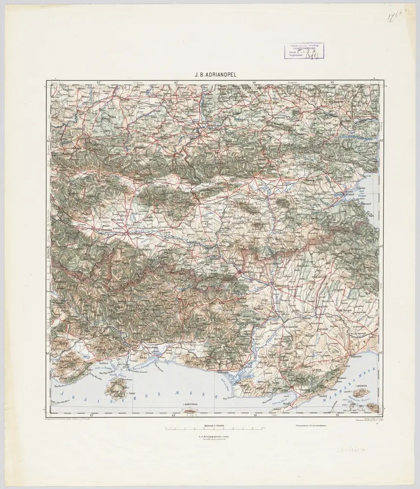
J.8. Adrianopel, uit: [Übersichtskarte von Europa 1:750.000]
1910
Wien : K.u.K. Militärgeographisches Institut
1:750k