Maps of Caraș-Severin

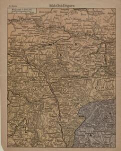
Süd-Ost-Ungarn
1 : 600000 Österreich-Ungarn (Südost), Banat
Krassó - Szörény Vármegye

C. Krassó
Rumänien Komitat Caraşova

Oršava
1 : 200000 Oršava (Rumunsko) Kartografska radionica
Krassova und Teregova.
from Spezialkarte der osterreichisch-ungarischen Monarchie.
Karansebes und Resicabanya.
from Spezialkarte der osterreichisch-ungarischen Monarchie.
Maros-Illye.
from Spezialkarte der osterreichisch-ungarischen Monarchie.
Malomviz
1 : 25000 Kendeffy, Malomvizi
Korosbanya.
from Spezialkarte der osterreichisch-ungarischen Monarchie.
Nada und Soborsin.
from Spezialkarte der osterreichisch-ungarischen Monarchie.
Vulkan Pasz.
from Spezialkarte der osterreichisch-ungarischen Monarchie.
Deva und Szaszvaros.
from Spezialkarte der osterreichisch-ungarischen Monarchie.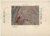
Zone 25, Kol. XXVI, Krassova und Teregova, uit: [Geologische Specialkarte der im Reichsrathe vertretenen Königreiche und Länder der österreichisch-ungarischen Monarchie] / geologische Aufnahmen der königl. ung. Geologischen Anstalt
1 : 75000 Annotatie: Verantwoordelijkheidsvermelding in 1909 veranderd in: Königliche Ungarische Geologische Reichsanstalt; Sommige bladen in het Frans; Annotatie geografische gegevens: Coördinaten gebaseerd op nulmeridiaan van Ferro (Hierro) Königliche Ungarische Geologische Reichsanstalt; Königliche Ungarische Geologische Anstalt Budapest : [Königliche Ungarische Geologische Anstalt]
Lugos
1 : 75000 Lugoj Geripp: A. Deppisch. Terrain: Lieutenant Kuźmin
Facset
1 : 75000 Făget
Krassova und Teregova
1 : 75000 Caraşova, Caraş-Severin Geripp: Offic. Höller u. Offic. M. Jakupec. Terrain: Oblt. G. Brenner u. Lieut. Sied
Maros-Illye
1 : 75000 Ilia (Hunedoara)
Somosréve
1 : 75000 Caraş-Severin Geripp: F. Kohout. Terrain: Feldw. Maschka
Karánsebes und Resicabánya
1 : 75000 Reșița, Caransebeş Geripp: Fwkr. Krainz. Terrain: Hauptm. Pitron u. Oblt. Trica
Kornyareva.; Spezialkarte der osterreichisch-ungarischen Monarchie.
from Spezialkarte der osterreichisch-ungarischen Monarchie. Austro-Hungarian Monarchy. Militärgeographisches Institut.,
Borlova und Klopotiva.; Spezialkarte der osterreichisch-ungarischen Monarchie.
from Spezialkarte der osterreichisch-ungarischen Monarchie. Austro-Hungarian Monarchy. Militärgeographisches Institut.,
Lugos.; Spezialkarte der osterreichisch-ungarischen Monarchie.
from Spezialkarte der osterreichisch-ungarischen Monarchie. Austro-Hungarian Monarchy. Militärgeographisches Institut.,
Ruskberg [Ruszkahegy].; Spezialkarte der osterreichisch-ungarischen Monarchie.
from Spezialkarte der osterreichisch-ungarischen Monarchie. Austro-Hungarian Monarchy. Militärgeographisches Institut.,
Facset.; Spezialkarte der osterreichisch-ungarischen Monarchie.
from Spezialkarte der osterreichisch-ungarischen Monarchie. Austro-Hungarian Monarchy. Militärgeographisches Institut.,
Borló und Klopotiva
1 : 75000 Caraş-Severin Geripp: F. Kohout. Terrain: Oberlt. Sachs
Ruskberg (Ruszkahecy)
1 : 75000 Caraş-Severin Gemeindegebiet Geripp: Assistent Scherling. Terrain: Hptm. Pönisch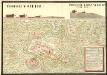
Proiect von Karansebes von dem Herren Obrist Liutin ont von Suly den Kais. Hoffkrigs Rat Hüber geben vnd Approbiret Anno MDCCXL
Mollova mapová sbírka Geyer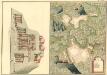
Plan von Bergwerg Racksest, und Bocza
Mollova mapová sbírka Geyer