编目地图
Gebiet um Hermannstadt

完整标题:Gebiet um Hermannstadt
描述:1916
发布日期:1916
物理尺寸:20 x 30 cm
地图比例尺:1:600 000
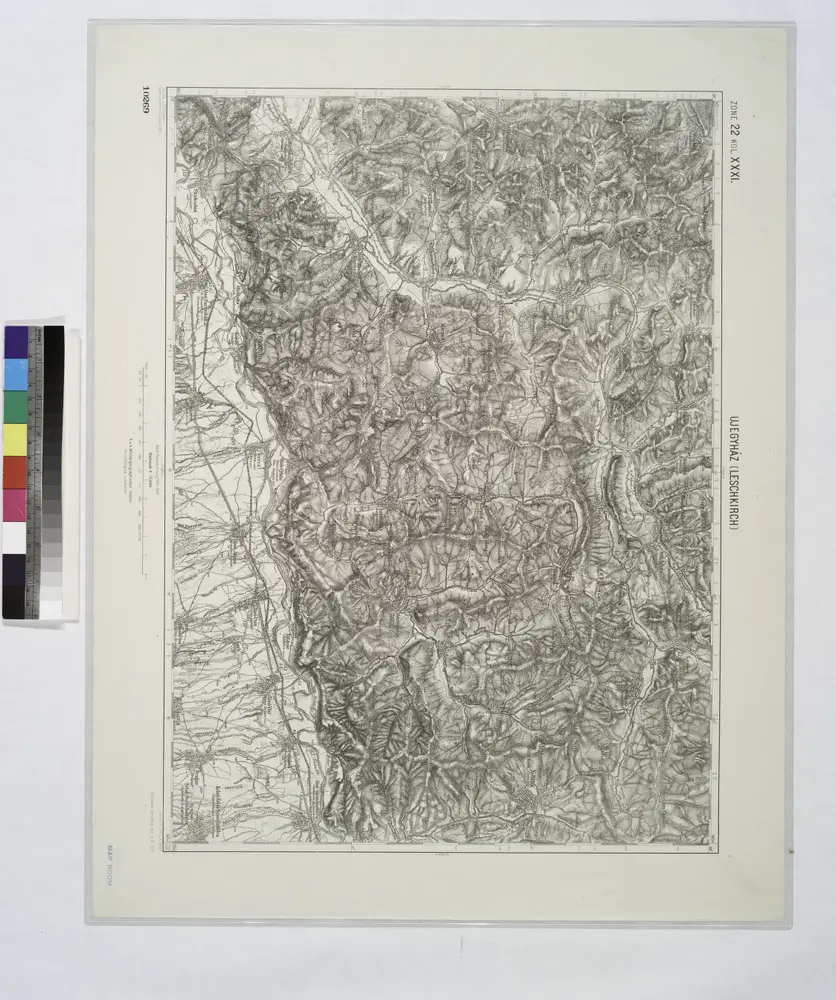
Ujegyhaz [Leschkirch].
1914
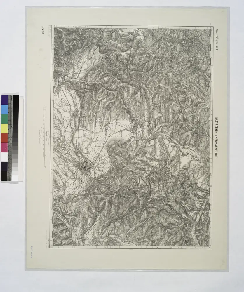
Nagyszeben [Hermannstadt].
1914
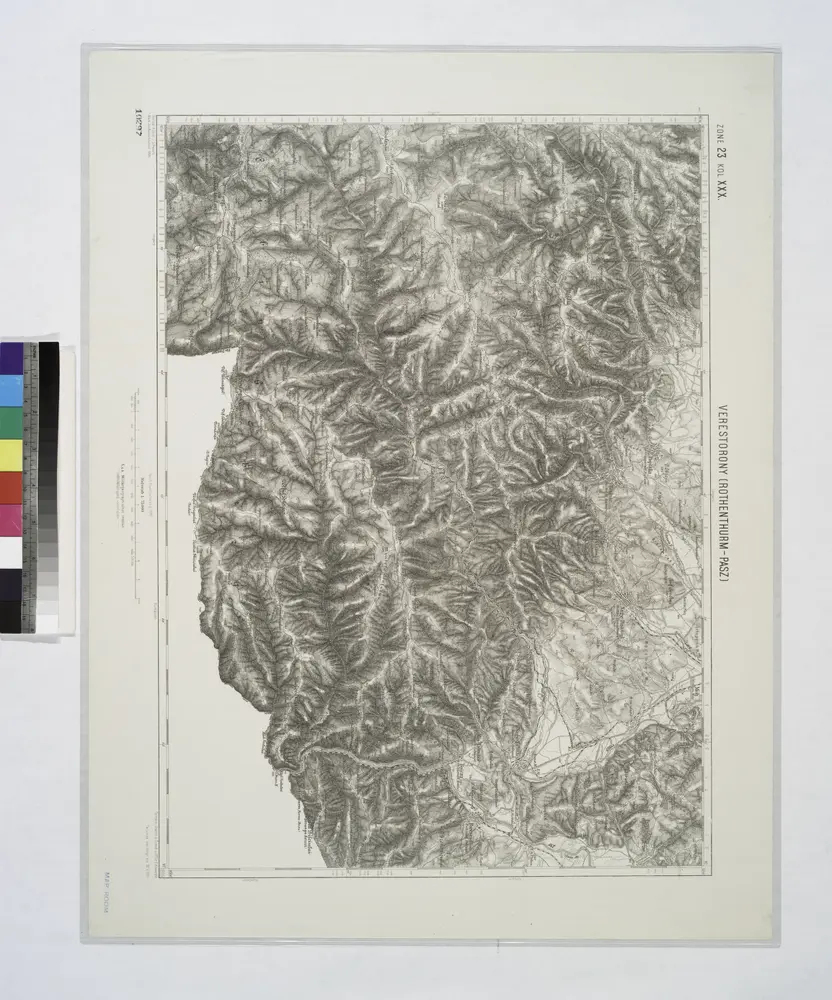
Verestorony [Rothenthurm-Pasz].
1914
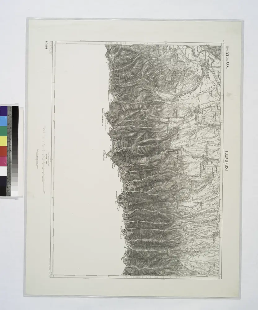
Felek [Freck].
1914
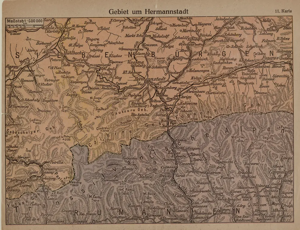
Gebiet um Hermannstadt
1916
1:600k
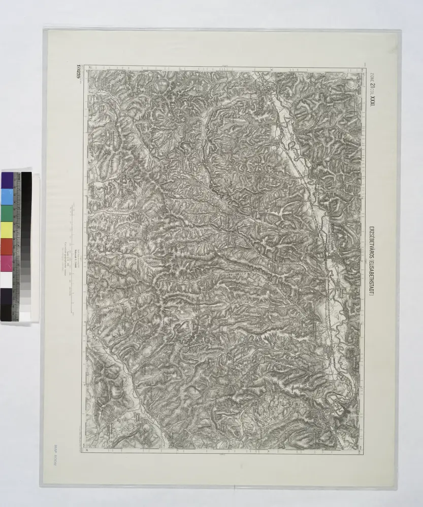
Erzsebetvaros [Elisabethstadt].; Spezialkarte der osterreichisch-ungarischen Monarchie.
1911
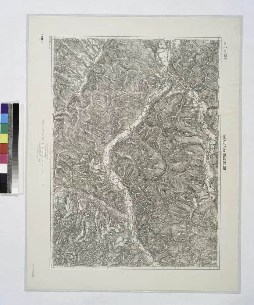
Balazsfalva [Blasendorf].; Spezialkarte der osterreichisch-ungarischen Monarchie.
1910
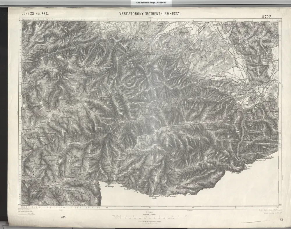
Verestorony (Rothenthurm - Pasz)
1914
Geripp: Assist. J. Schwarz. Terrain: Oberlt. J. Šraub u. Offiz. F. Kowarzik
1:75k
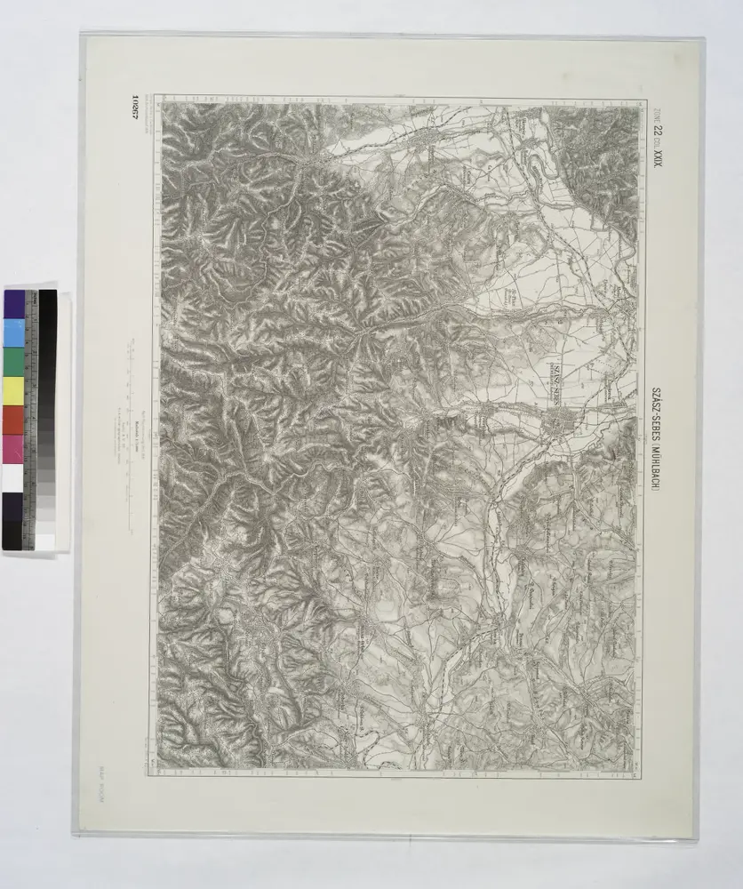
Szasz-Sebes [Muhlbach].
1914
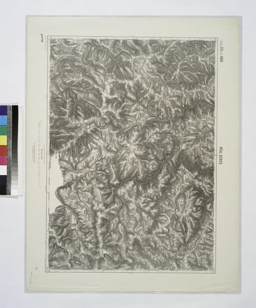
Riul Sebes.
1914