Carte cataloguée
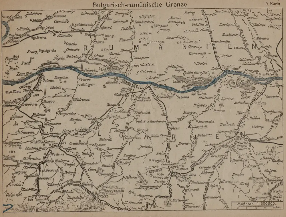
Bulgarisch-rumänische Grenze

Titre complet:Bulgarisch-rumänische Grenze
Année de l'image:1916
Date de publication:1916
Taille physique:20 x 30 cm
Échelle de la carte:1:600 000
Bulgarisch-rumänische Grenze
1916
1:600k
Lambert-Cholesky sheet 2936 (Balta Stejarul)
1939
Serviciul Geografic al Armatei
1:20k
Lambert-Cholesky sheet 3036 (Kozlodui)
1956
Direcția Topografică Militară
1:20k
Lambert-Cholesky sheet 3136 (Bechetu)
1957
Direcția Topografică Militară
1:20k
Lambert-Cholesky sheet 3236 (Ianca)
1956
Direcția Topografică Militară
1:20k
Lambert-Cholesky sheet 3235 (Ostrov)
1930
Serviciul Geografic al Armatei
1:20k
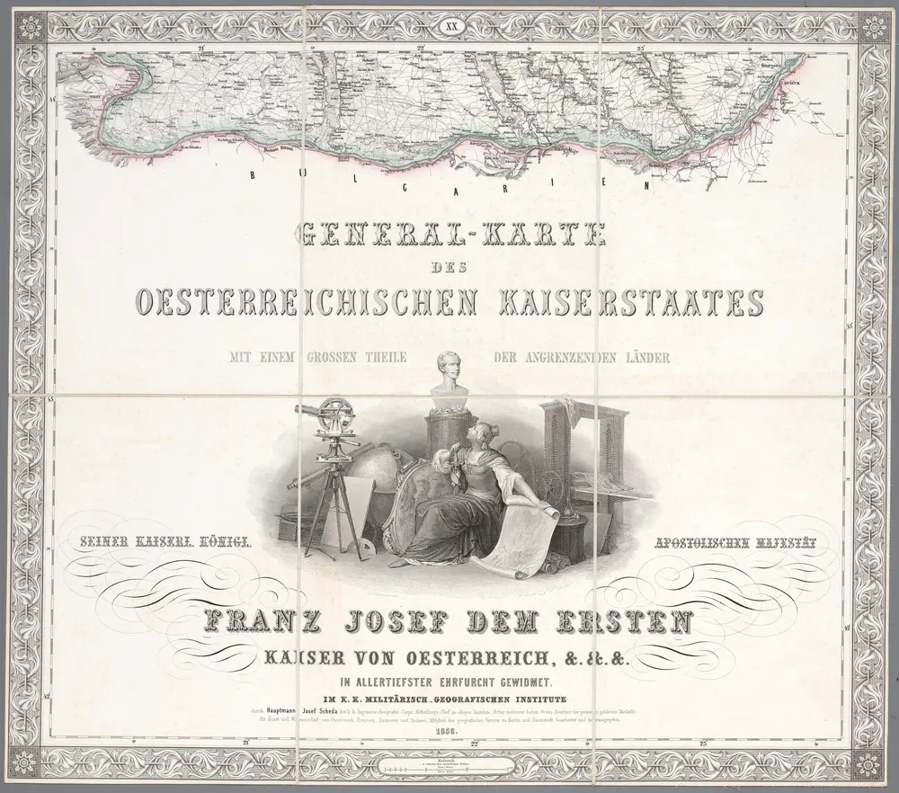
XX, uit: General-Karte des oesterreichischen Kaiserstaates mit einem grossen Theile der angrenzenden Länder / durch Josef Scheda ... bearb. und hrsg
1856
[Wien : K.K. Militärisch-Geografisches Institut]
1:576k
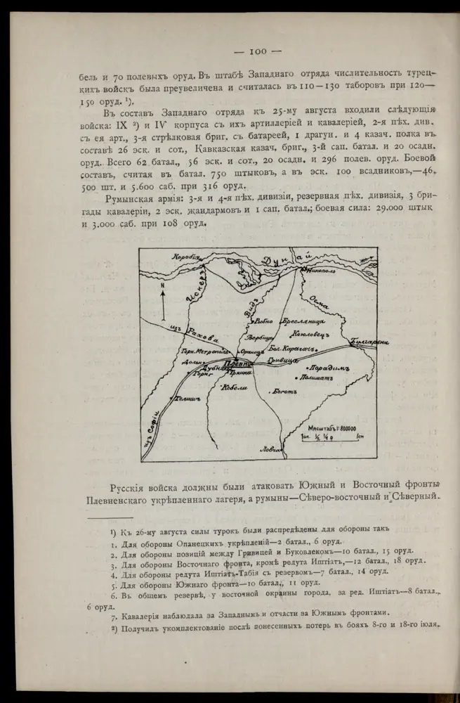
[Pleven]
1877
1:800k
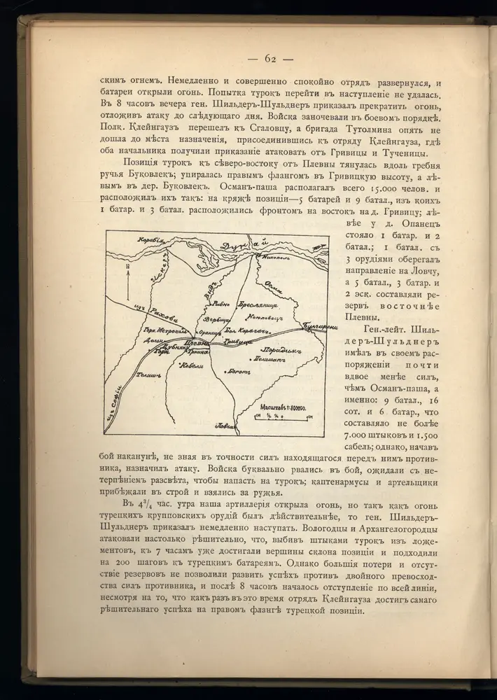
[Pleven]
1877
1:800k
Sofia, Philippopel
1916
K. u. k. Militärgeographisches Institut
1:750k