Cataloged map
Rumänen in Ost-Ungarn 1941

Full title:Rumänen in Ost-Ungarn 1941
Depicted:1941
Pubdate:2018
Physical Size:20 x 30 cm
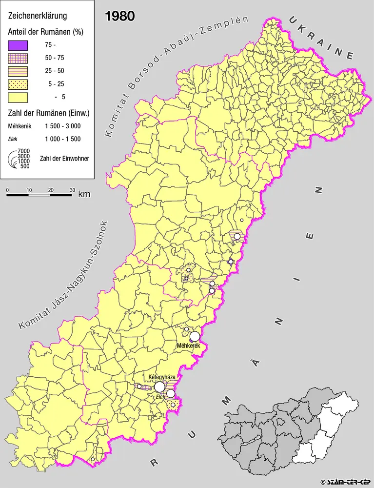
Rumänen in Ost-Ungarn 1980
1980
Bottlik, Zsolt
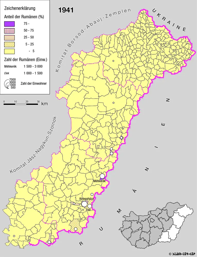
Rumänen in Ost-Ungarn 1941
1941
Bottlik, Zsolt
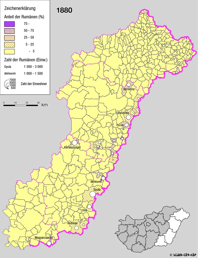
Rumänen in Ost-Ungarn 1880
1880
Bottlik, Zsolt

A rományok aránya és száma Kelet-Magyarországon 1941-ben
1941
Bottlik, Zsolt
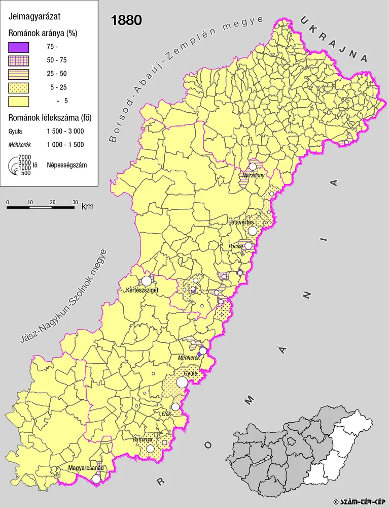
A rományok aránya és száma Kelet-Magyarországon 1880-ban
1880
Bottlik, Zsolt

A rományok aránya és száma Kelet-Magyarországon 1980-ban
1980
Bottlik, Zsolt
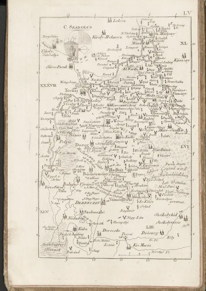
C. Szabolcs
1804
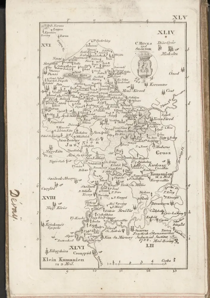
C. Heves und Szólnok
1804
n/a
1804
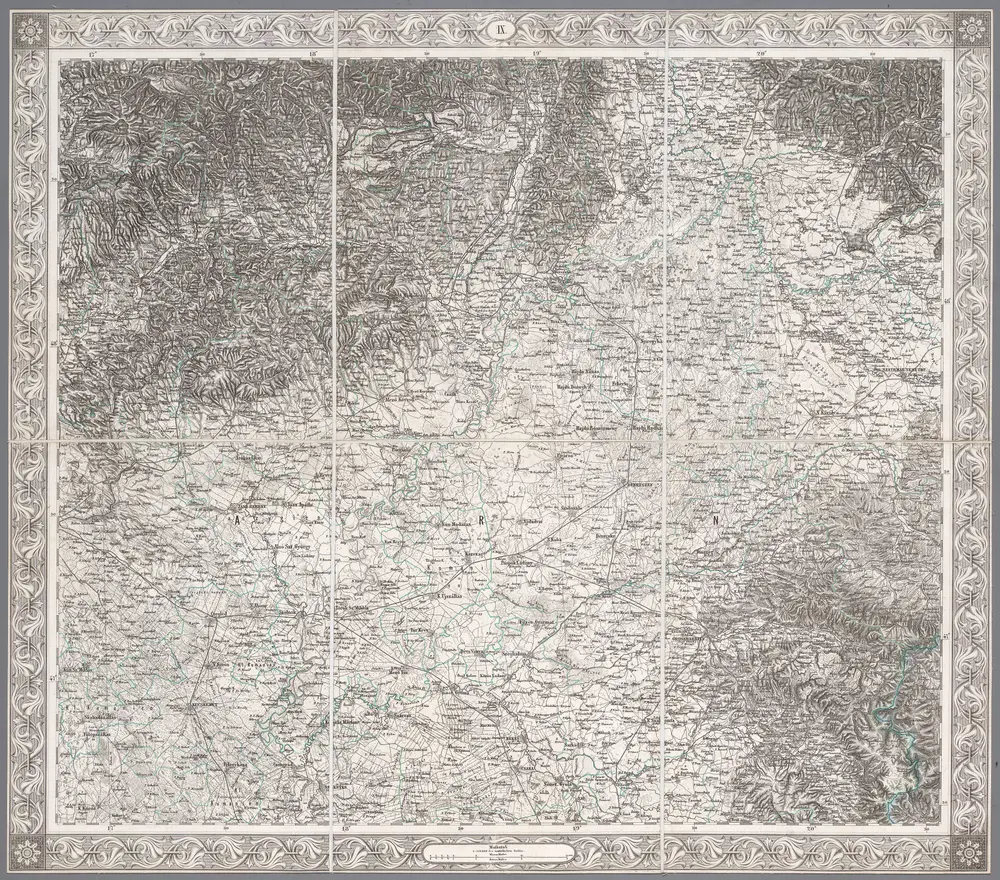
IX, uit: General-Karte des oesterreichischen Kaiserstaates mit einem grossen Theile der angrenzenden Länder / durch Josef Scheda ... bearb. und hrsg
1856
[Wien : K.K. Militärisch-Geografisches Institut]
1:576k