Cataloged map
Republik Moldau 1989. Ethnische Zusammensetzung der Bevölkerung - Bulgaren

Full title:Republik Moldau 1989. Ethnische Zusammensetzung der Bevölkerung - Bulgaren
Depicted:1989
Pubdate:2005
Physical Size:20 x 30 cm
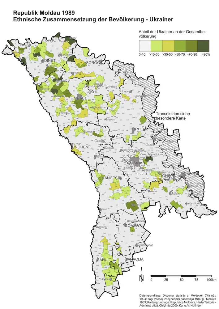
Republik Moldau 1989. Ethnische Zusammensetzung der Bevölkerung - Ukrainer
1989
Hofinger, Veronika

Republik Moldau 1989. Ethnische Zusammensetzung der Bevölkerung - Moldauer (Rumänen)
1989
Hofinger, Veronika
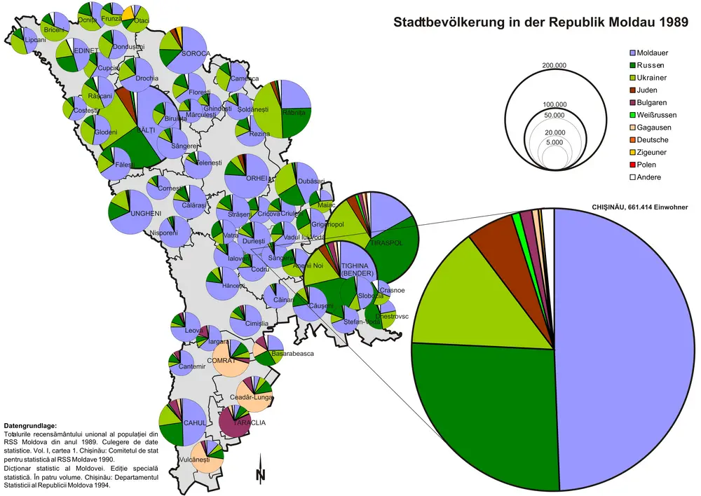
Stadtbevölkerung in der Republik Moldau 1989
1989
Hofinger, Veronika
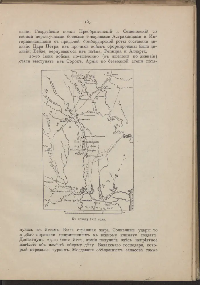
Kʺ pochodu 1711 goda.
1711
Carte de la Roumanie et pays limitrophes. Odessa
1912
France. Service géographique de l'armée
1:500k
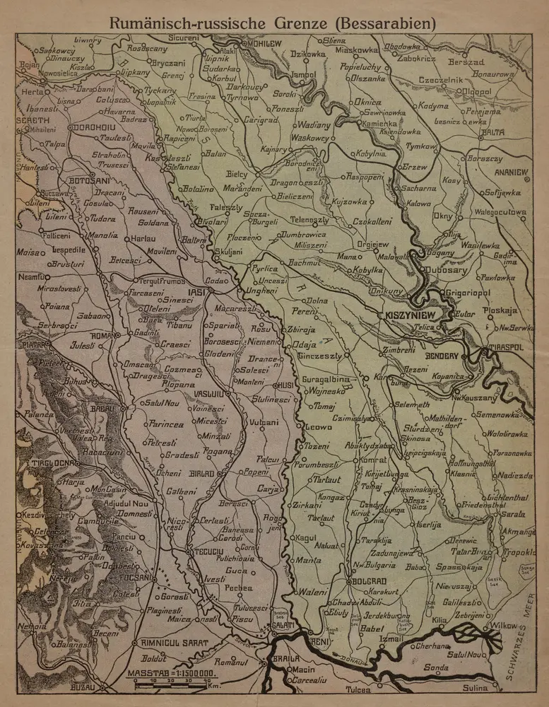
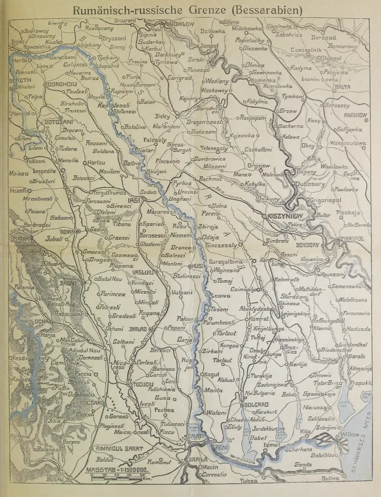
Rumänisch-russische Grenze (Bessarabien)
1916
1:2m
Rumänisch-russische Grenze
1916
1:2m
Bielcy, Kisziniew, Jassi
1917
K. u. k. Militärgeographisches Institut
1:750k
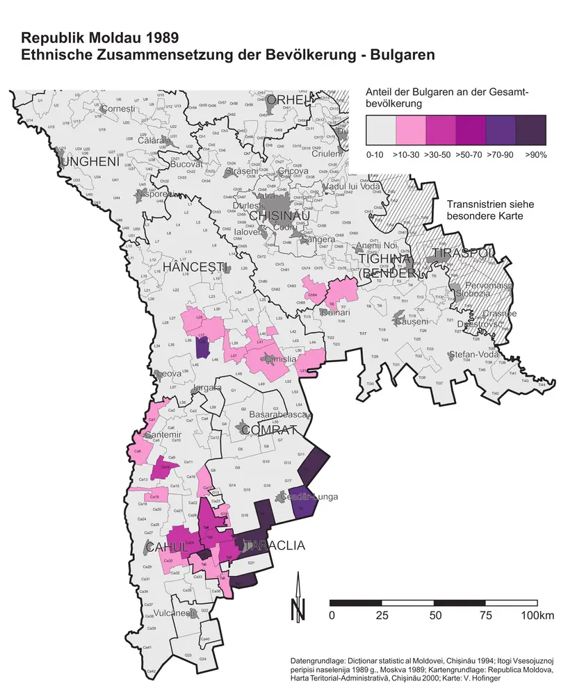
Republik Moldau 1989. Ethnische Zusammensetzung der Bevölkerung - Bulgaren
1989
Hofinger, Veronika
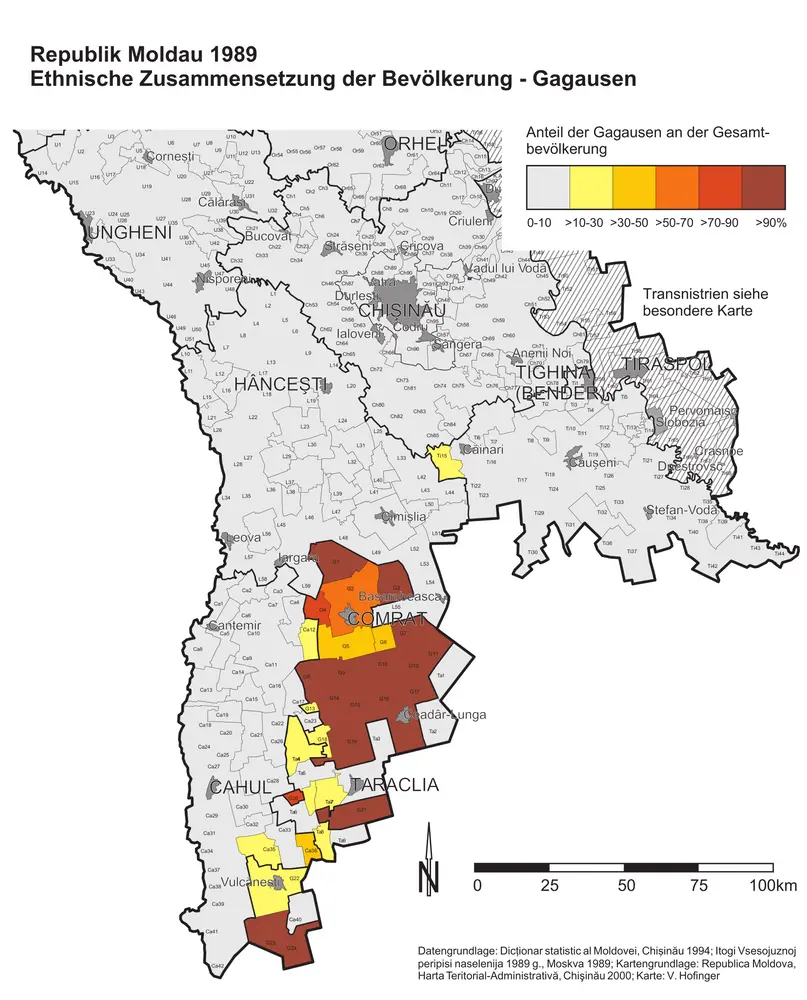
Republik Moldau 1989. Ethnische Zusammensetzung der Bevölkerung - Gagausen
1989
Hofinger, Veronika